Tlayacapan is worth a stop: 5 minutes from Emiliano Zapata (Casahuates), 38km from Popocatépetl.
Tlayacapan is in Morelos, Mexico, with about 8,000 people. You drive on the right here. The nearest town is Emiliano Zapata (Casahuates), about 4 km away.
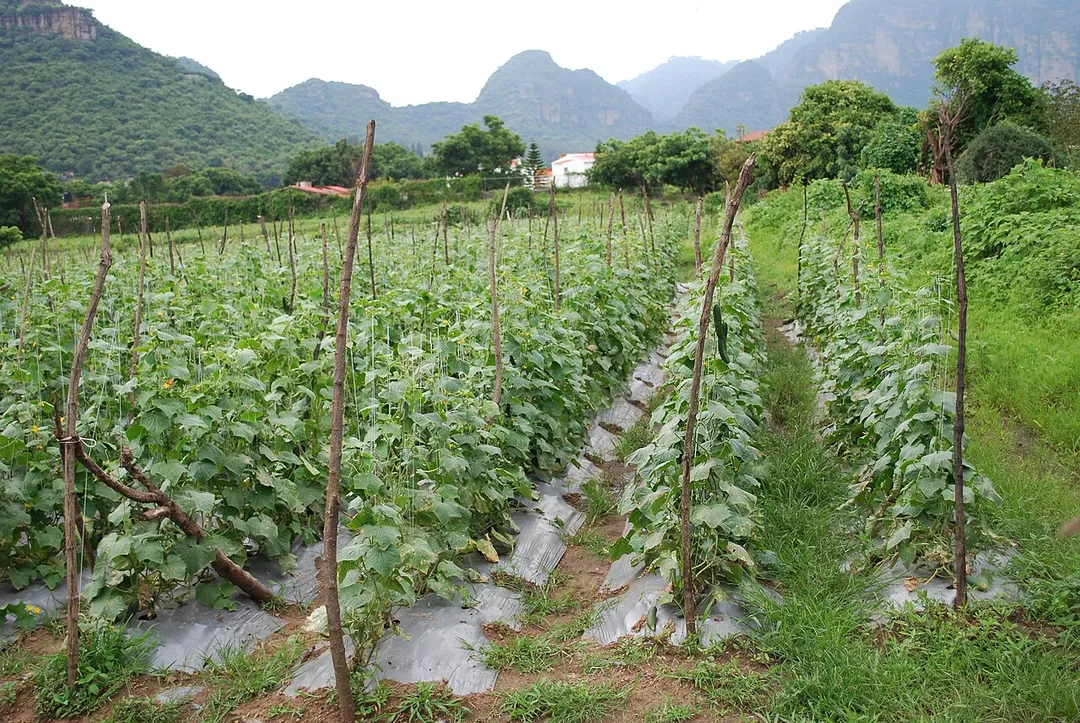
Tlayacapan (Spanish pronunciation: [tlaʝaˈkapan]) is the name of a town and a municipality located in the northeast part of Morelos state in central Mexico. It is located 60 km east from the state capital of Cuernavaca and about 1.5 hours south of Mexico City. It is a rural area, whose way of life has not changedRead more much over the 20th century, with 90% of its population still partially or fully dependent on agriculture. The town has old mansions, houses with red tile roofs and streets paved with stones. Many ravines crisscross the area and are crossed by numerous stone bridges.
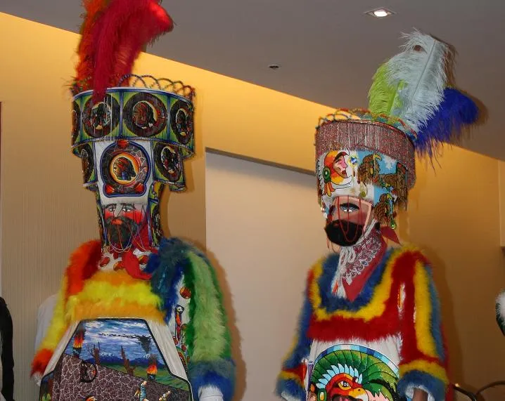
The main landmark is the former monastery of San Juan Bautista, which towers over all the other structures. It was built beginning the 1530s, along with 26 chapels scattered around the original town as part of the "spiritual conquest" of the area. Today, this monastery is part of the Monasteries on the slopes of Popocatépetl, which was made a World Heritage Site in 1994. Culturally, the town is famous for two things: being the origin of the Chinelos dance and the home of the Banda de Tlayacapan band, the most important culturally in the state and nationally recognized.
Tlayacapan was also a popular filming location for many Mexican and American films such as La Valentina, starring María Félix and Eulalio González, and Two Mules for Sister Sara, starring Shirley MacLaine and Clint Eastwood. American rock band The Killers, filmed the music video of their hit song When You Were Young, in 2006.
A Morelos town under sheer volcanic cliffs, with a hilltop 13th-century pyramid to the pulque god reached by a steep hour's climb, a fortress-like Dominican convent, and a market known for exotic ice creams.
13 km · about 25 min drive
landmark
Xochimilco Floating Gardens
A network of ancient Aztec canals and artificial islands where colorful trajinera boats glide past floating gardens and mariachi bands.
36 km · about 40 min drive
mountain pass
Paso de Cortés
The 3,600-m saddle between the volcanoes Popocatépetl and Iztaccíhuatl, reached by a paved mountain road from Amecameca: the route Cortés marched into the Valley of Mexico in 1519.
38 km · about 45 min drive
natural wonder
Popocatépetl
An active 5,426 m stratovolcano southeast of Mexico City, visible from the Puebla highway; the Paso de Cortés road runs on its saddle.
38 km · about 45 min drive
landmark
Six Flags México
Mexico City's premier amusement park with world-class coasters and seasonal events in the south of the city.
45 km · about 50 min drive
museum
Museo Frida Kahlo (Casa Azul)
The vibrant blue house where Frida Kahlo was born, lived, and died, filled with her art, personal objects, and Diego Rivera's collection.
48 km · about 55 min drive
racetrack
Autódromo Hermanos Rodríguez
The Mexico City circuit hosting the Formula 1 Mexican Grand Prix, built around the Foro Sol stadium section.
51 km · about 60 min drive
ancient ruins
Malinalco
Site of the Cuauhcalli, or House of Eagles: one of the very few temples in the Americas carved directly out of solid bedrock, reached by 400 steps up the Hill of the Idols above a quiet colonial town.
54 km · about 60 min drive
Driving roads near Tlayacapan
38 kmPaso de CortésThe 3,600-m saddle between the volcanoes Popocatépetl and Iztaccíhuatl, reached by a paved mountain road from Amecameca: the route Cortés marched into the Valley of Mexico in 1519.
When to drive here
Year-round
Tropical latitude: plan around the wet season rather than temperature.