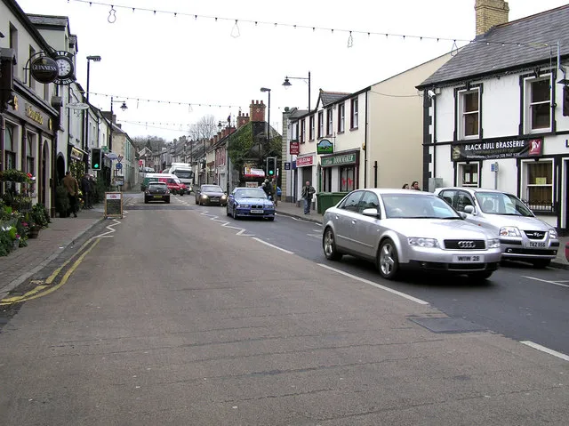
Randalstown is worth a stop: 15 minutes from Antrim, 29km from Lough Neagh.
Randalstown is in Northern Ireland, United Kingdom, with about 5,400 people. You drive on the left here. The nearest town is Antrim, about 7 km away.
Randalstown (Irish: Baile Raghnaill) is a small town and townland in County Antrim, Northern Ireland, between Antrim and Toome. The town, which contains a prominent disused railway viaduct, lies beside Lough Neagh and the Shane's Castle estate. Randalstown is bypassed by the M22 motorway with junctions at both theRead more eastern and western ends of the town. It had a population of 5,151 people in the 2021 census.
A 11.9km loop of Northern Irish country lanes still used for the Ulster Grand Prix motorcycle races, with jumps, stone walls and hedges inches from the racing line. Open public roads the rest of the year.
23 km · about 25 min drive
natural wonder
Lough Neagh
The largest freshwater lake in the British Isles at 392 square kilometres, with a famous eel fishery.
29 km · about 35 min drive
museum
Titanic Belfast
World-leading visitor attraction in a striking angular building on the exact spot where RMS Titanic was designed, built and launched in 1912.
30 km · about 35 min drive
castle
Carrickfergus Castle
One of the best-preserved Norman castles in Ireland, guarding Belfast Lough for over 800 years from its commanding waterfront position.
32 km · about 35 min drive
waterfall
Glenariff Forest Park
The 'Queen of the Glens', with a boardwalk waterfall trail through a wooded gorge above the Antrim coast.
32 km · about 35 min drive
museum
Ulster Transport Museum
Major transport museum at Cultra near Belfast, home to a gull-winged DeLorean DMC-12 built just miles away, Irish-built cars, locomotives and a renowned Titanic exhibition.
34 km · about 40 min drive
historic highway
Craigantlet Hillclimb
A hillclimb on public roads in the hills above Belfast, running since 1946 and closed to traffic only on event days. The narrow climb gives long views over Belfast Lough.
36 km · about 40 min drive
scenic viewpoint
The Gobbins
A dramatic Edwardian cliff-path of bridges and tunnels clinging to the basalt cliffs of Islandmagee.
38 km · about 45 min drive
Driving roads near Randalstown
7 named roads, passes and coastal drives within 60km.
23 kmDundrod CircuitA 11.9km loop of Northern Irish country lanes still used for the Ulster Grand Prix motorcycle races, with jumps, stone walls and hedges inches from the racing line. Open public roads the rest of the year.
36 kmCraigantlet HillclimbA hillclimb on public roads in the hills above Belfast, running since 1946 and closed to traffic only on event days. The narrow climb gives long views over Belfast Lough.
38 kmThe GobbinsA dramatic Edwardian cliff-path of bridges and tunnels clinging to the basalt cliffs of Islandmagee.
38 kmCauseway Coastal Route (A2 Antrim Coast Road)A cliff-edge road cut in the 1830s between Larne and Ballycastle, running under the Glens of Antrim with the Scottish coast in view.
39 kmAntrim Coast RoadA breathtaking coastal drive hugging cliffs and beaches from Larne past the Glens of Antrim toward the Causeway.
43 kmThe Dark HedgesAn eerie tunnel of intertwined beech trees made world-famous as the Kingsroad in Game of Thrones.