
PYRTPlan Your Road Trips
Create TripCommunityMerchandise
PYRTPlan Your Road Trips
Create TripCommunityMerchandise
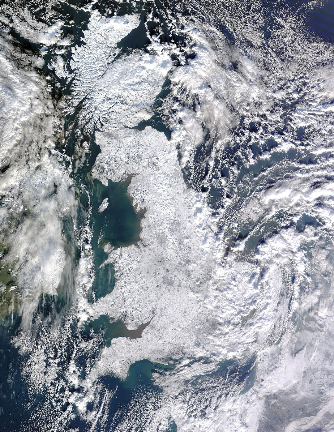
Satellite image of snow-covered Great Britain on 7 January 2010, taken by MODIS on NASA's Terra satellite.
The Palace of Westminster (Houses of Parliament) from the dome on Methodist Central Hall, which is only open to the public once a year on Open House London weekend.
Photographer's notes: Each of the 12 frames (2 columns, 6 rows, landscape) was taken with a Sony A77II camera and Sony 16-50 f/2.8 lens at 50mm. The exposure was F/8, 1/250s, ISO 100. The sun lit up the Houses of Parliament and London Eye for only a few minutes. 

.mw-parser-output .messagebox{margin:4px 0;width:auto;border-collapse:collapse;border:2px solid var(--border-color-progressive,#6485d1);background-color:var(--background-color-neutral-subtle,#fbfcff);color:var(--color-base,#202122);box-sizing:border-box;border-inline-start-width:8px}.mw-parser-output .messagebox.mbox-small{font-size:88%;line-height:1.25em}.mw-parser-output .mbox-warning,.mw-parser-output .mbox-speedy{border:2px solid var(--border-color-error,#b22222);background:var(--background-color-error-subtle,#ffdbdb);border-inline-start-width:8px}.mw-parser-output .mbox-serious,.mw-parser-output .mbox-delete,.mw-parser-output .mbox-stop{border:2px solid var(--border-color-error,#b22222);border-inline-start-width:8px}.mw-parser-output .mbox-issue,.mw-parser-output .mbox-content{border:2px solid #f28500;background:var(--background-color-warning-subtle,#ffe);border-inline-start-width:8px}.mw-parser-output .mbox-query,.mw-parser-output .mbox-style{border:2px solid #f4c430;background:var(--background-color-warning-subtle,#ffe);border-inline-start-width:8px}.mw-parser-output .mbox-shit{border:2px solid #960;border-inline-start-width:8px}.mw-parser-output .mbox-license{border:2px solid #88a;border-inline-start-width:initial}.mw-parser-output .mbox-legal{border:2px solid var(--border-color-notice,#666);background:var(--background-color-base,#fff);border-inline-start-width:8px}.mw-parser-output .mbox-honor{border:2px solid #ca3;background:var(--background-color-warning-subtle,#fcf4db);border-inline-start-width:8px}.mw-parser-output .mbox-growth{border:2px solid #8d4;background:var(--background-color-success-subtle,#d5fdf4);border-inline-start-width:8px}.mw-parser-output .mbox-move{border:2px solid #93c;border-inline-start-width:8px}.mw-parser-output .mbox-protection,.mw-parser-output .mbox-message{border:2px solid var(--border-color-base,#aaa);border-inline-start-width:8px}.mw-parser-output .messagebox .mbox-text{border:none;padding:0.25em 0.9em;width:100%}.mw-parser-output .messagebox .mbox-image{border:none;padding-top:2px;padding-bottom:2px;padding-inline-start:0.9em;padding-inline-end:0;text-align:center}.mw-parser-output .messagebox .mbox-imageright{border:none;padding-top:2px;padding-bottom:2px;padding-inline-start:0;padding-inline-end:0.9em;text-align:center}.mw-parser-output .messagebox .mbox-empty-cell{border:none;padding:0;width:1px}.mw-parser-output .messagebox .mbox-invalid-type{text-align:center}@media(min-width:720px){.mw-parser-output .messagebox{margin:4px 10%}.mw-parser-output .messagebox.mbox-small{clear:right;float:right;margin:4px 0 4px 1em;width:238px}}body.skin--responsive .mw-parser-output table.messagebox img{max-width:none!important}Wikidata has entry Palace of Westminster (Q62408) with data related to this building.
Official portrait of James Cleverly MP, 3:4 crop.
Photo by NASA image by Jeff Schmaltz, MODIS Rapid Response Team, Goddard Space Flight Center.
Destinations
Home›Destinations›Connor
EuropeUnited KingdomNorthern Ireland

Connor

Northern Ireland, United Kingdom · Europe

About Connor

Connor works well as a base: 15 minutes from Randalstown, 30km from Causeway Coastal Route (A2 Antrim Coast Road).

Connor is in Northern Ireland, United Kingdom, with about 1,800 people. You drive on the left here. The nearest town is Randalstown, about 8 km away.

Where to Stay in Connor

Compare prices across Booking.com, Airbnb, Expedia, and more. Select your dates to see availability.

Filter presets

Pick your must-haves once: provider links open pre-filtered. Each filter lists which sites it applies to.

Booking.comExpediaTripAdvisorHotels.comAgodaAirbnb

Compare before you book!

Prices can vary significantly between platforms. We recommend checking at least 2-3 sites to find the best deal for your stay in Connor.

Explore the Area

Discover famous landmarks, scenic roads, and more near Connor.

Loading map...
Open in Google Maps

Frequently Asked Questions

What is there to see near Connor?

Within an hour or so of Connor: Glenariff Forest Park (24 km), Dundrod Circuit (25 km), Carrickfergus Castle (27 km), Titanic Belfast (28 km).

Are there any good drives near Connor?

The nearest famous roads are Dundrod Circuit, Causeway Coastal Route (A2 Antrim Coast Road) and Antrim Coast Road.

Where is Connor?

Connor is in Northern Ireland, United Kingdom, about 8 km from Randalstown.

Road trip

Drive to Connor

Add it as a stop and the planner works out the driving, the nights and what's worth seeing on the way.

Start planning

What's nearby?

Swipe through places to go

Places within a drive of Connor. Keep the ones you like and add them to your trip.

Explore now

Quick Information

Population
1,778
Continent
Europe
Country
United Kingdom
Region
Northern Ireland
Timezone
Europe/London
Coordinates
54.8000, -6.2000

Emergency & Services

Essential numbers in United Kingdom

Police
999
Ambulance
999
Fire
999
Non-emergency police
101
Driving side
left

112 also works. NHS non-emergency medical advice: 111. National Highways breakdown assistance on motorways: 0300 123 5000.

Full driving guide for United Kingdom

Tags

EuropeUnited KingdomNorthern IrelandTown

Worth the detour from Connor

8 notable places within an hour's drive.

waterfall

Glenariff Forest Park

The 'Queen of the Glens', with a boardwalk waterfall trail through a wooded gorge above the Antrim coast.

24 km · about 30 min drive

66 US ROUTE

historic highway

Dundrod Circuit

A 11.9km loop of Northern Irish country lanes still used for the Ulster Grand Prix motorcycle races, with jumps, stone walls and hedges inches from the racing line. Open public roads the rest of the year.

25 km · about 30 min drive

castle

Carrickfergus Castle

One of the best-preserved Norman castles in Ireland, guarding Belfast Lough for over 800 years from its commanding waterfront position.

27 km · about 30 min drive

museum

Titanic Belfast

World-leading visitor attraction in a striking angular building on the exact spot where RMS Titanic was designed, built and launched in 1912.

28 km · about 35 min drive

museum

Ulster Transport Museum

Major transport museum at Cultra near Belfast, home to a gull-winged DeLorean DMC-12 built just miles away, Irish-built cars, locomotives and a renowned Titanic exhibition.

30 km · about 35 min drive

famous road

Causeway Coastal Route (A2 Antrim Coast Road)

A cliff-edge road cut in the 1830s between Larne and Ballycastle, running under the Glens of Antrim with the Scottish coast in view.

30 km · about 35 min drive

scenic viewpoint

The Gobbins

A dramatic Edwardian cliff-path of bridges and tunnels clinging to the basalt cliffs of Islandmagee.

31 km · about 35 min drive

coastal drive

Antrim Coast Road

A breathtaking coastal drive hugging cliffs and beaches from Larne past the Glens of Antrim toward the Causeway.

32 km · about 35 min drive

Driving roads near Connor

7 named roads, passes and coastal drives within 60km.

  • 25 kmDundrod CircuitA 11.9km loop of Northern Irish country lanes still used for the Ulster Grand Prix motorcycle races, with jumps, stone walls and hedges inches from the racing line. Open public roads the rest of the year.
  • 30 kmCauseway Coastal Route (A2 Antrim Coast Road)A cliff-edge road cut in the 1830s between Larne and Ballycastle, running under the Glens of Antrim with the Scottish coast in view.
  • 31 kmThe GobbinsA dramatic Edwardian cliff-path of bridges and tunnels clinging to the basalt cliffs of Islandmagee.
  • 32 kmAntrim Coast RoadA breathtaking coastal drive hugging cliffs and beaches from Larne past the Glens of Antrim toward the Causeway.
  • 33 kmCraigantlet HillclimbA hillclimb on public roads in the hills above Belfast, running since 1946 and closed to traffic only on event days. The narrow climb gives long views over Belfast Lough.
  • 39 kmThe Dark HedgesAn eerie tunnel of intertwined beech trees made world-famous as the Kingsroad in Game of Thrones.

Driving in United Kingdom

Drives on
the left
Petrol
~€1.73/litre
Motorway tolls
None

When to drive here

April to October

Nearby Destinations

Other places to explore near Connor.

Randalstown

🇬🇧 United Kingdom

8 km awayPop. 5,378

Ballymena

🇬🇧 United Kingdom

9 km awayPop. 28,932

Antrim

🇬🇧 United Kingdom

9 km awayPop. 19,661

Broughshane

🇬🇧 United Kingdom

10 km awayPop. 2,581

Ballyclare

🇬🇧 United Kingdom

14 km awayPop. 9,472

Crumlin

🇬🇧 United Kingdom

20 km awayPop. 5,149

Bellaghy

🇬🇧 United Kingdom

20 km awayPop. 1,072

Carnmoney

🇬🇧 United Kingdom

21 km awayPop. 2,775

Plan a trip around Connor

United Kingdom road trip planner

Your trip starts here

Plan a road trip from Connor.

Pick the days, drop in the stops, and share it with whoever's coming.

Start planning
PYRT

The ultimate road trip planning platform. Discover 150,000+ destinations worldwide, plan scenic routes, and create unforgettable adventures.

Inspiration

  • Discover Trips
  • Travel Guides
  • Community

The Product

  • Calendar Planner
  • Integrations
  • How It Works
  • Collaboration Mode
  • Get the App
  • Merchandise: PYRT Supply Co.
  • Become a Creator
  • Trip Marketplace

Plan Your Trip

  • Road Trip Planner
  • Famous Routes
  • Drive Times & Distances
  • Planners by Country
  • Best Road Trip Planner App
  • Discover Road Trips
  • Events
  • Travel Guides
  • How It Works
  • My Trips
  • Community Groups

Company

  • Terms of Service
  • Privacy Policy
  • About PYRT
  • Support
  • Contact Us
  • Sign In
  • Create Account

© 2026 Plan Your Road Trips. All rights reserved.

•[email protected]
Data sources:GeoNames (CC BY 4.0)•Wikimedia Commons (CC BY-SA)•Mapbox•Photography: George Lawrence