PYRTPlan Your Road Trips
Create TripCommunityMerchandise
PYRTPlan Your Road Trips
Create TripCommunityMerchandise
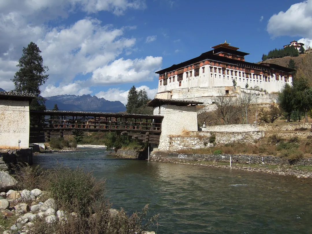
Rinpung Dzong(རིན་སྤུང་རྫོང) in Paro Bhutan with a cantilever bridge over the Paro Chu river in the foreground and the National Museum of Bhutan (Ta Dzong) on the hill in the background.
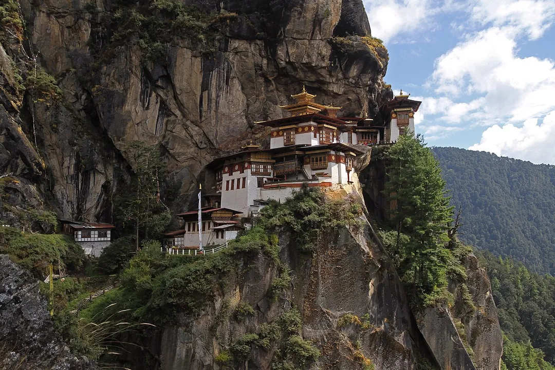
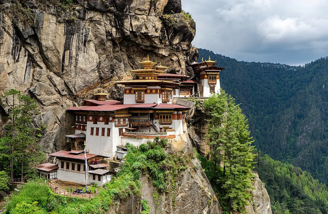
Paro Taktsang - Tigers nest
Paro Taktsang monastery in the upper Paro valley of Bhutan. Also known as the Taktsang Palphug Monastery and the Tiger's Nest, it is located in the cliffside of a mountain, around a cave where Guru Padmasambhava meditated and practiced Vajrayana Buddhism in the early 9th century. It was built in 1692 by 4th Druk Desi Tenzin Rabgey.
Photo by Christopher Fynn
Destinations
Home›Destinations›Paro
AsiaBhutanParo

Paro

Paro, Bhutan · Asia

About Paro

Paro is worth a stop: 25 minutes from Ha, 9km from Chele La.

Paro is in Bhutan, with about 11,000 people. The nearest town is Ha, about 14 km away.

Paro (Dzongkha: སྤ་རོ་) is a town and seat of Paro District, in the Paro Valley of Bhutan. It is a historic town with many sacred sites and historical buildings scattered throughout the area. It is also home to Paro International Airport, Bhutan's sole international airport. Paro Airport is served by Bhutan Airlines

Read more and Drukair.

Read more on Wikipedia

Where to Stay in Paro

Compare prices across Booking.com, Airbnb, Expedia, and more. Select your dates to see availability.

Filter presets

Pick your must-haves once: provider links open pre-filtered. Each filter lists which sites it applies to.

Booking.comExpediaTripAdvisorHotels.comAgodaAirbnb

Compare before you book!

Prices can vary significantly between platforms. We recommend checking at least 2-3 sites to find the best deal for your stay in Paro.

Explore the Area

Discover famous landmarks, scenic roads, and more near Paro.

Loading map...
Open in Google Maps

Frequently Asked Questions

What is there to see near Paro?

Within an hour or so of Paro: Tiger's Nest (Paro Taktsang) (8 km), Tiger's Nest Viewpoint (8 km), Chele La (9 km), Dochula Pass (33 km).

Are there any good drives near Paro?

The nearest famous roads are Chele La, Dochula Pass and Nathu La.

Where is Paro?

Paro is in Paro, Bhutan, about 14 km from Ha.

Road trip

Drive to Paro

Add it as a stop and the planner works out the driving, the nights and what's worth seeing on the way.

Start planning

What's nearby?

Swipe through places to go

Places within a drive of Paro. Keep the ones you like and add them to your trip.

Explore now

Quick Information

Population
11,448
Continent
Asia
Country
Bhutan
Region
Paro
Timezone
Asia/Thimphu
Coordinates
27.4305, 89.4133

Tags

AsiaBhutanParoTown

Worth the detour from Paro

6 notable places within an hour's drive.

landmark

Tiger's Nest (Paro Taktsang)

A sacred Buddhist monastery clinging to a sheer cliff face 900 meters above the Paro Valley floor.

8 km · about 15 min drive

scenic viewpoint

Tiger's Nest Viewpoint

A viewpoint on the trail to Paro Taktsang, looking across a forested gorge at the monastery clinging impossibly to a 3,000-foot cliff face.

8 km · about 15 min drive

mountain pass

Chele La

Bhutan's highest motorable road at 3,988 m, a narrow asphalt climb through hemlock and rhododendron forest between the Paro and Haa valleys, with prayer flags in their thousands at the top.

9 km · about 20 min drive

mountain pass

Dochula Pass

A 3,100 m pass on the Thimphu-Punakha road crowned by 108 memorial chortens. On clear days the roadside terrace unveils a panorama of Bhutan's snowcapped eastern Himalaya.

33 km · about 40 min drive

castle

Punakha Dzong

Bhutan's most beautiful fortress-monastery at the confluence of two rivers, the winter capital of the country's monastic body.

47 km · about 55 min drive

mountain pass

Nathu La

A 4,310 m pass on the India-China border, one of the few open trading posts on the frontier, where you can stand metres from Chinese sentries at the barbed-wire line.

58 km · about 65 min drive

Driving roads near Paro

  • Right hereTiger's Nest ViewpointA viewpoint on the trail to Paro Taktsang, looking across a forested gorge at the monastery clinging impossibly to a 3,000-foot cliff face.
  • Right hereChele LaBhutan's highest motorable road at 3,988 m, a narrow asphalt climb through hemlock and rhododendron forest between the Paro and Haa valleys, with prayer flags in their thousands at the top.
  • 33 kmDochula PassA 3,100 m pass on the Thimphu-Punakha road crowned by 108 memorial chortens. On clear days the roadside terrace unveils a panorama of Bhutan's snowcapped eastern Himalaya.
  • 58 kmNathu LaA 4,310 m pass on the India-China border, one of the few open trading posts on the frontier, where you can stand metres from Chinese sentries at the barbed-wire line.
  • 60 kmNathang ValleyA treeless high plateau at roughly 4,100 m on the Old Silk Route, grazed by yaks and dotted with a handful of houses and a British war memorial from the 1888 Anglo-Tibetan clash.

Nearby Destinations

Other places to explore near Paro.

Ha

🇧🇹 Bhutan

14 km awayPop. 1,449

Thimphu

🇧🇹 Bhutan

23 km awayPop. 98,676

Punākha

🇧🇹 Bhutan

49 km awayPop. 21,500

Jaigaon

🇮🇳 India

65 km awayPop. 158,664

Gangtok

🇮🇳 India

80 km awayPop. 100,286

Rangpo

🇮🇳 India

91 km awayPop. 10,450

Kalimpong, Крукети

🇮🇳 India

103 km away

Gyalshing

🇮🇳 India

115 km awayPop. 4,013

Plan a trip around Paro

Asia road trip planner

Your trip starts here

Plan a road trip from Paro.

Pick the days, drop in the stops, and share it with whoever's coming.

Start planning
PYRT

The ultimate road trip planning platform. Discover 150,000+ destinations worldwide, plan scenic routes, and create unforgettable adventures.

Inspiration

  • Discover Trips
  • Travel Guides
  • Community

The Product

  • Calendar Planner
  • Integrations
  • How It Works
  • Collaboration Mode
  • Get the App
  • Merchandise: PYRT Supply Co.
  • Become a Creator
  • Trip Marketplace

Plan Your Trip

  • Road Trip Planner
  • Famous Routes
  • Drive Times & Distances
  • Planners by Country
  • Best Road Trip Planner App
  • Discover Road Trips
  • Events
  • Travel Guides
  • How It Works
  • My Trips
  • Community Groups

Company

  • Terms of Service
  • Privacy Policy
  • About PYRT
  • Support
  • Contact Us
  • Sign In
  • Create Account

© 2026 Plan Your Road Trips. All rights reserved.

•[email protected]
Data sources:GeoNames (CC BY 4.0)•Wikimedia Commons (CC BY-SA)•Mapbox•Photography: George Lawrence