
mountain pass
Chele La
Bhutan's highest motorable road at 3,988 m, a narrow asphalt climb through hemlock and rhododendron forest between the Paro and Haa valleys, with prayer flags in their thousands at the top.
7 km · about 15 min drive
Haa, Bhutan · Asia
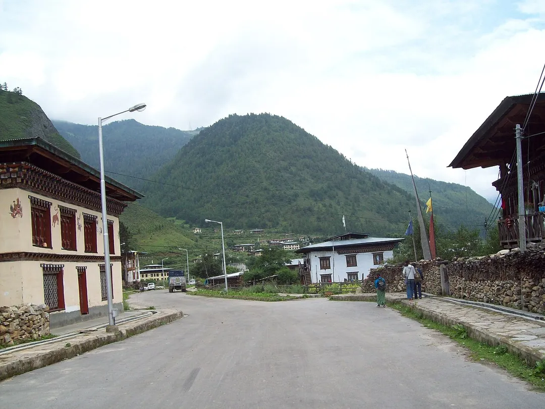
Ha is worth a stop: 25 minutes from Paro, 7km from Chele La.
Ha is in Haa, Bhutan, with about 1,400 people. The nearest town is Paro, about 14 km away.
Ha, also known as Haa or Has, is a Thromde or town, and the seat of Haa District in Bhutan.
Ha is situated in Haa Valley in the west of Bhutan bordering Sikkim. The major economic activity is rice production, yak herding and trade with neighbouring China. Ha accommodates The Indian Military Training Team (also knownRead more
as IMTRAT). IMTRAT is responsible for the training of the personnel of the Royal Bhutan Army (RBA) and the Royal Bodyguard of Bhutan (RBG). It is the oldest training team sent outside India to a friendly-foreign nation. The place has a religious significance as Lhakhang Karpo and other monasteries are situated there.
Compare prices across Booking.com, Airbnb, Expedia, and more. Select your dates to see availability.
Pick your must-haves once: provider links open pre-filtered. Each filter lists which sites it applies to.
Compare before you book!
Prices can vary significantly between platforms. We recommend checking at least 2-3 sites to find the best deal for your stay in Ha.
Discover famous landmarks, scenic roads, and more near Ha.
Within an hour or so of Ha: Chele La (7 km), Tiger's Nest (Paro Taktsang) (14 km), Tiger's Nest Viewpoint (14 km), Nathu La (44 km).
The nearest famous roads are Chele La, Nathu La and Dochula Pass.
Ha is in Haa, Bhutan, about 14 km from Paro.
Road trip
Add it as a stop and the planner works out the driving, the nights and what's worth seeing on the way.
Start planningSwipe through places to go
Places within a drive of Ha. Keep the ones you like and add them to your trip.
7 notable places within an hour's drive.
mountain pass
Bhutan's highest motorable road at 3,988 m, a narrow asphalt climb through hemlock and rhododendron forest between the Paro and Haa valleys, with prayer flags in their thousands at the top.
7 km · about 15 min drive
landmark
A sacred Buddhist monastery clinging to a sheer cliff face 900 meters above the Paro Valley floor.
14 km · about 25 min drive
scenic viewpoint
A viewpoint on the trail to Paro Taktsang, looking across a forested gorge at the monastery clinging impossibly to a 3,000-foot cliff face.
14 km · about 25 min drive
mountain pass
A 4,310 m pass on the India-China border, one of the few open trading posts on the frontier, where you can stand metres from Chinese sentries at the barbed-wire line.
44 km · about 50 min drive
mountain pass
A 3,100 m pass on the Thimphu-Punakha road crowned by 108 memorial chortens. On clear days the roadside terrace unveils a panorama of Bhutan's snowcapped eastern Himalaya.
47 km · about 55 min drive
scenic viewpoint
A treeless high plateau at roughly 4,100 m on the Old Silk Route, grazed by yaks and dotted with a handful of houses and a British war memorial from the 1888 Anglo-Tibetan clash.
47 km · about 55 min drive
photogenic
A 3,415 m balcony above the Old Silk Route where the road from Zuluk unwinds below in a stack of hairpin bends; on clear mornings Kanchenjunga rises straight ahead at sunrise.
51 km · about 60 min drive
Other places to explore near Ha.
Your trip starts here
Pick the days, drop in the stops, and share it with whoever's coming.