PYRTPlan Your Road Trips
Create TripCommunityMerchandise
PYRTPlan Your Road Trips
Create TripCommunityMerchandise
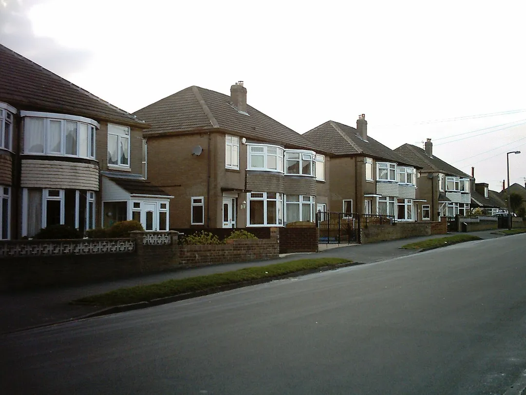
Houses on Kingswear Crescent in Austhorpe, Leeds.  This photograph was taken on the late afternoon of the 1st April 2009.
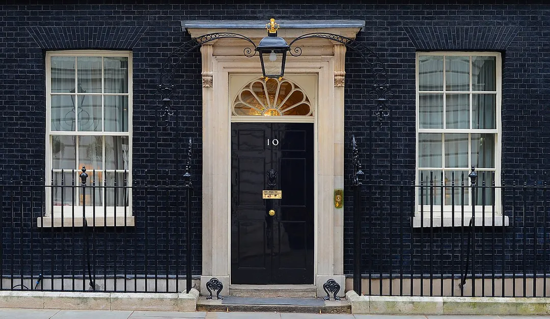
Number 10 Downing Street is the headquarters and London residence of the Prime Minister of the United Kingdom.
Organization: ARMY
Object Name: No10-2013-005-004
Category: MOD
Supplemental Categories: Equipment, Locations
Keywords: No10, 10 Downing Street, Number, 10, Prime, Minister
Country: UK
Only second to the 1611 folio King Jame Bible
Photo by Mtaylor848
Destinations
Home›Destinations›Whittington
EuropeUnited KingdomEngland

Whittington

England, United Kingdom · Europe

About Whittington

Whittington works well as a base: 5 minutes from Oswestry, 29km from B4391 Milltir Gerrig.

Whittington is in England, United Kingdom, with about 1,500 people. You drive on the left here. The nearest town is Oswestry, about 4 km away.

Whittington Castle is a castle in northern Shropshire, England. The castle was originally a motte-and-bailey castle, but this was replaced in the 13th century by one with buildings around a courtyard whose exterior wall was the curtain wall of the inner bailey. As a castle of the Welsh Marches, it was built on the

Read more border of Wales and England very close to the historic fort of Old Oswestry. Whittington Castle resides on a 12-acre (49,000 m2) property in the village of Whittington, in the former district of North Shropshire, in the county of Shropshire in England. It abuts Castle Road. In 2003, a historical and archaeological investigation by Peter Brown and Peter King identified that the outer bailey of the castle had been two elaborate gardens and surrounded by water in the 14th century. This discovery was significant in that it proved the advanced state (as compared to those of the French or Flemish) of English gardening habits. The "lavish" garden was installed by one of the FitzWarin family. The viewing mound in the centre may be the oldest of its type yet discovered in England.

Read more on Wikipedia

Where to Stay in Whittington

Compare prices across Booking.com, Airbnb, Expedia, and more. Select your dates to see availability.

Filter presets

Pick your must-haves once: provider links open pre-filtered. Each filter lists which sites it applies to.

Booking.comExpediaTripAdvisorHotels.comAgodaAirbnb

Compare before you book!

Prices can vary significantly between platforms. We recommend checking at least 2-3 sites to find the best deal for your stay in Whittington.

Explore the Area

Discover famous landmarks, scenic roads, and more near Whittington.

Loading map...
Open in Google Maps

Frequently Asked Questions

What is there to see near Whittington?

Within an hour or so of Whittington: Loton Park (17 km), Horseshoe Pass (21 km), Horseshoe Pass (Bwlch yr Oernant) (21 km), Ponderosa Cafe (22 km).

Are there any good drives near Whittington?

The nearest famous roads are Horseshoe Pass, B4391 Milltir Gerrig and Bwlch y Groes (Pass of the Cross).

Where is Whittington?

Whittington is in England, United Kingdom, about 4 km from Oswestry.

Road trip

Drive to Whittington

Add it as a stop and the planner works out the driving, the nights and what's worth seeing on the way.

Start planning

What's nearby?

Swipe through places to go

Places within a drive of Whittington. Keep the ones you like and add them to your trip.

Explore now

Quick Information

Population
1,481
Continent
Europe
Country
United Kingdom
Region
England
Timezone
Europe/London
Coordinates
52.8732, -3.0030

Emergency & Services

Essential numbers in United Kingdom

Police
999
Ambulance
999
Fire
999
Non-emergency police
101
Driving side
left

112 also works. NHS non-emergency medical advice: 111. National Highways breakdown assistance on motorways: 0300 123 5000.

Full driving guide for United Kingdom

Tags

EuropeUnited KingdomEnglandTown

Worth the detour from Whittington

8 notable places within an hour's drive.

racetrack

Loton Park

A 1,475-yard hillclimb running through the deer park of a Shropshire country estate, twisting between mature trees with the hill's Museum Corner and Fallow bends. One of Britain's most scenic speed venues.

17 km · about 20 min drive

mountain pass

Horseshoe Pass

Sweeping A542 mountain pass curling above Llangollen in a giant horseshoe, climbing to 417m past the Ponderosa Cafe with wide views over the Dee Valley. A classic North Wales driving and biking road.

21 km · about 25 min drive

mountain pass

Horseshoe Pass (Bwlch yr Oernant)

A sweeping 417m moorland pass on the A542 above Llangollen, with the Ponderosa cafe at the top and views to the Berwyns.

21 km · about 25 min drive

cafe

Ponderosa Cafe

A legendary biker stop high on the Horseshoe Pass above Llangollen with panoramic views across the Welsh valleys.

22 km · about 25 min drive

waterfall

Pistyll Rhaeadr

Wales's tallest single-drop waterfall at 73 metres, cascading through a natural rock arch in a remote Berwyn Mountains valley.

25 km · about 30 min drive

famous road

B4391 Milltir Gerrig

A high, empty moorland crossing of the Berwyn range between Bala and Llangynog, all long sightlines and sheep.

29 km · about 35 min drive

landmark

Chester Zoo

The UK's most-visited zoo housing over 35,000 animals across 128 acres with award-winning conservation programs.

40 km · about 45 min drive

famous road

Evo Triangle

Legendary 20-mile loop of the A5, A543 and B4501 across the empty Denbigh Moors, made famous as evo magazine's road-test circuit. Fast, open sightlines past Llyn Brenig make it a pilgrimage for keen drivers.

42 km · about 50 min drive

Driving roads near Whittington

  • 21 kmHorseshoe PassSweeping A542 mountain pass curling above Llangollen in a giant horseshoe, climbing to 417m past the Ponderosa Cafe with wide views over the Dee Valley. A classic North Wales driving and biking road.
  • 21 kmHorseshoe Pass (Bwlch yr Oernant)A sweeping 417m moorland pass on the A542 above Llangollen, with the Ponderosa cafe at the top and views to the Berwyns.
  • 29 kmB4391 Milltir GerrigA high, empty moorland crossing of the Berwyn range between Bala and Llangynog, all long sightlines and sheep.
  • 42 kmEvo TriangleLegendary 20-mile loop of the A5, A543 and B4501 across the empty Denbigh Moors, made famous as evo magazine's road-test circuit. Fast, open sightlines past Llyn Brenig make it a pilgrimage for keen drivers.
  • 42 kmBwlch y Groes (Pass of the Cross)Wales's highest public road at 545m, a 1-in-4 climb from Llanuwchllyn used for pre-war motoring hill-climb tests.
  • 44 kmBwlch y Groes (Hellfire Pass)Wales's highest public road at 545m, a 1-in-4 single-track climb from Llanuwchllyn used for decades as a motoring hill-climb test.
Driving in United Kingdom

Drives on
the left
Petrol
~€1.73/litre
Motorway tolls
None

When to drive here

April to October

Nearby Destinations

Other places to explore near Whittington.

Pant

🇬🇧 United Kingdom

11 km awayPop. 1,998

Ruabon

🇬🇧 United Kingdom

13 km awayPop. 3,091

Rhosllannerchrugog

🇬🇧 United Kingdom

16 km awayPop. 25,362

Wem

🇬🇧 United Kingdom

19 km awayPop. 5,870

Wrexham

🇬🇧 United Kingdom

19 km awayPop. 65,692

Brymbo

🇬🇧 United Kingdom

22 km awayPop. 18,111

Gresford

🇬🇧 United Kingdom

24 km awayPop. 5,010

Bryneglwys

🇬🇧 United Kingdom

25 km away

Plan a trip around Whittington

United Kingdom road trip planner

Your trip starts here

Plan a road trip from Whittington.

Pick the days, drop in the stops, and share it with whoever's coming.

Start planning
PYRT

The ultimate road trip planning platform. Discover 150,000+ destinations worldwide, plan scenic routes, and create unforgettable adventures.

Inspiration

  • Discover Trips
  • Travel Guides
  • Community

The Product

  • Calendar Planner
  • Integrations
  • How It Works
  • Collaboration Mode
  • Get the App
  • Merchandise: PYRT Supply Co.
  • Become a Creator
  • Trip Marketplace

Plan Your Trip

  • Road Trip Planner
  • Famous Routes
  • Drive Times & Distances
  • Planners by Country
  • Best Road Trip Planner App
  • Discover Road Trips
  • Events
  • Travel Guides
  • How It Works
  • My Trips
  • Community Groups

Company

  • Terms of Service
  • Privacy Policy
  • About PYRT
  • Support
  • Contact Us
  • Sign In
  • Create Account

© 2026 Plan Your Road Trips. All rights reserved.

•[email protected]
Data sources:GeoNames (CC BY 4.0)•Wikimedia Commons (CC BY-SA)•Mapbox•Photography: George Lawrence