PYRTPlan Your Road Trips
Create TripCommunityMerchandise
PYRTPlan Your Road Trips
Create TripCommunityMerchandise
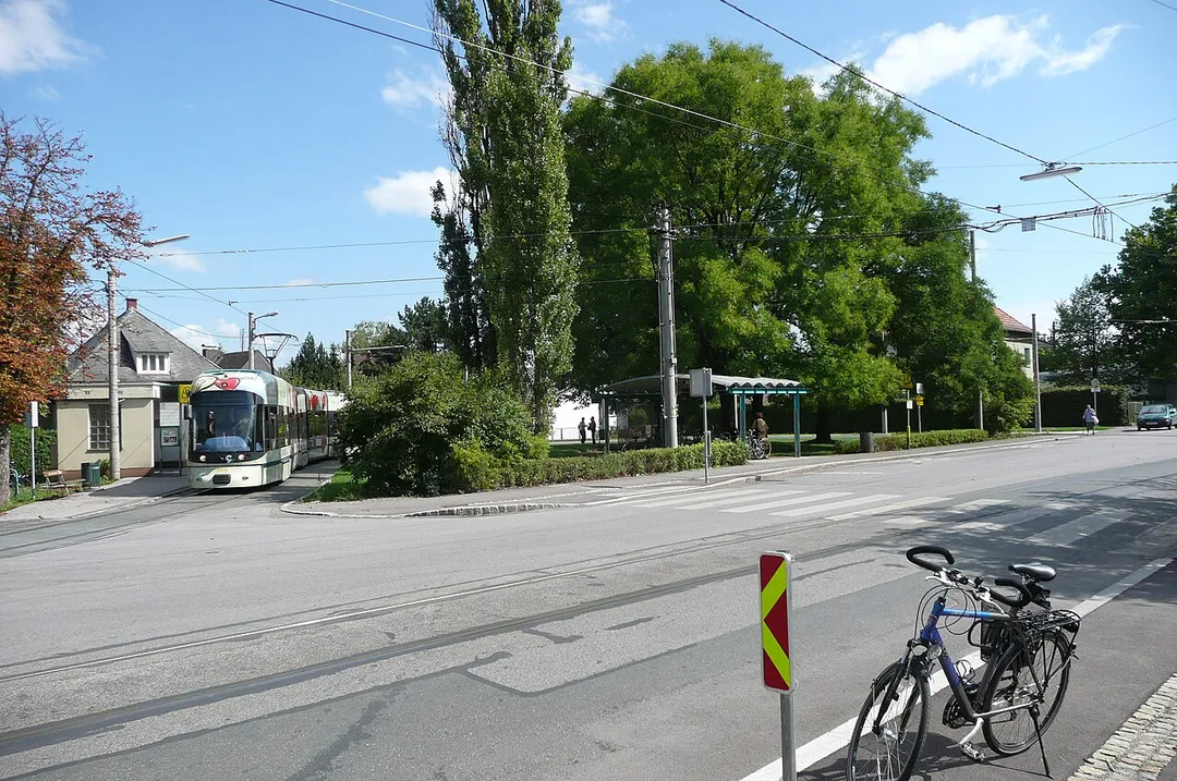
Endhaltestelle der Straßenbahnline 7 der GVB, Graz
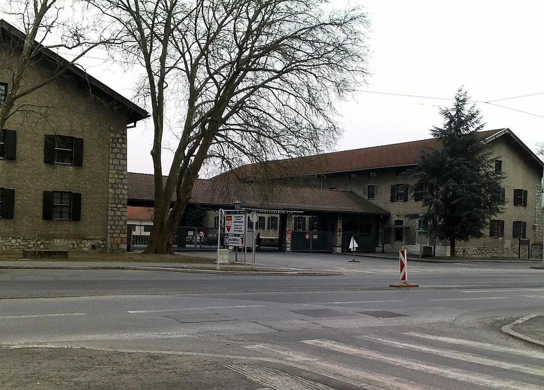
Belgierkaserne in Graz
View from Schlossberg Graz over Graz Art Museum to Wetzelsdorf
Photo by Andreas GARGER
Destinations
Home›Destinations›Wetzelsdorf
EuropeAustriaStyria

Wetzelsdorf

Styria, Austria · Europe

About Wetzelsdorf

Wetzelsdorf is worth a stop: 5 minutes from Lend, 39km from South Styrian Wine Road.

Wetzelsdorf is in Styria, Austria, with about 16,000 people. You drive on the right here. The nearest town is Lend, about 4 km away.

Wetzelsdorf (German: [ˈvεt͡sl̩sˌdɔɐ̯f]) is the 15th city district of Graz, Austria. It is located in the west part of the city between the districts of Eggenberg to the north and Straßgang to the south. About 14,100 people live there in an area of 5.77 km2. The district which originally belonged to Eggenberg developed

Read more along the Austrian Southern Railway and the Alten Poststraße as a commercial area with working class quarters. After the so-called "Anschluß" in 1938 Wetzelsdorf became part of the city of Graz, as other surrounding areas of the city did as well. There are a number of institutions in the district for example the provincial police center of Styria, a provincial school for gardeners, several churches, several military facilities and a Jewish cemetery.

Read more on Wikipedia

Where to Stay in Wetzelsdorf

Compare prices across Booking.com, Airbnb, Expedia, and more. Select your dates to see availability.

Filter presets

Pick your must-haves once: provider links open pre-filtered. Each filter lists which sites it applies to.

Booking.comExpediaTripAdvisorHotels.comAgodaAirbnb

Compare before you book!

Prices can vary significantly between platforms. We recommend checking at least 2-3 sites to find the best deal for your stay in Wetzelsdorf.

Explore the Area

Discover famous landmarks, scenic roads, and more near Wetzelsdorf.

Loading map...
Open in Google Maps

Frequently Asked Questions

What is there to see near Wetzelsdorf?

Within an hour or so of Wetzelsdorf: Johann Puch Museum Graz (3 km), Graz Schlossberg & Clock Tower (4 km), South Styrian Wine Road (39 km), Red Bull Ring (51 km).

Are there any good drives near Wetzelsdorf?

The nearest famous roads are South Styrian Wine Road, Solčava Panoramic Road and Soelk Pass.

Where is Wetzelsdorf?

Wetzelsdorf is in Styria, Austria, about 4 km from Lend.

Road trip

Drive to Wetzelsdorf

Add it as a stop and the planner works out the driving, the nights and what's worth seeing on the way.

Start planning

What's nearby?

Swipe through places to go

Places within a drive of Wetzelsdorf. Keep the ones you like and add them to your trip.

Explore now

Quick Information

Population
15,687
Continent
Europe
Country
Austria
Region
Styria
Timezone
Europe/Vienna
Coordinates
47.0529, 15.3992

Emergency & Services

Essential numbers in Austria

Police
133
Ambulance
144
Fire
122
All emergencies
112
Driving side
right

Motorway vignette required. ÖAMTC roadside assistance: 120.

Full driving guide for Austria

Tags

EuropeAustriaStyriaTown

Worth the detour from Wetzelsdorf

4 notable places within an hour's drive.

museum

Johann Puch Museum Graz

In the last surviving hall of Johann Puch's original factory, some 2,500 exhibits trace Austria's own marque: Puch mopeds and motorcycles, the 500 microcar, and Haflinger and Pinzgauer off-roaders.

3 km · about 5 min drive

landmark

Graz Schlossberg & Clock Tower

A wooded hill in the centre of Graz crowned by the iconic 13th-century clock tower, with the futuristic Kunsthaus 'friendly alien' at its base.

4 km · about 5 min drive

famous road

South Styrian Wine Road

Ribbon roads roll along vine-covered ridges on the Slovenian border between Ehrenhausen, Gamlitz and Leutschach, the 'Austrian Tuscany': dotted with Buschenschank taverns and klapotetz windmills.

39 km · about 45 min drive

racetrack

Red Bull Ring

Short, fast circuit at Spielberg in the Styrian mountains hosting the Austrian Grand Prix, with big elevation changes, alpine views, and a busy calendar of public track days.

51 km · about 60 min drive

Driving roads near Wetzelsdorf

9 named roads, passes and coastal drives within 150km.

  • 39 kmSouth Styrian Wine RoadRibbon roads roll along vine-covered ridges on the Slovenian border between Ehrenhausen, Gamlitz and Leutschach, the 'Austrian Tuscany': dotted with Buschenschank taverns and klapotetz windmills.

Driving in Austria

Drives on
the right
Petrol
~€1.62/litre
Motorway tolls
None
Vignette
Required, around €12.4 for a short-stay sticker

When to drive here

April to October

Nearby Destinations

Other places to explore near Wetzelsdorf.

Eggenberg

🇦🇹 Austria

2 km awayPop. 20,511

Lend

🇦🇹 Austria

4 km awayPop. 31,147

Graz

🇦🇹 Austria

4 km awayPop. 303,270

Jakomini

🇦🇹 Austria

4 km awayPop. 32,912

Sankt Leonhard

🇦🇹 Austria

5 km awayPop. 15,853

Geidorf

🇦🇹 Austria

5 km awayPop. 24,767

Waltendorf

🇦🇹 Austria

5 km awayPop. 11,960

Mariatrost

🇦🇹 Austria

7 km awayPop. 9,631

Plan a trip around Wetzelsdorf

Austria road trip planner

Your trip starts here

Plan a road trip from Wetzelsdorf.

Pick the days, drop in the stops, and share it with whoever's coming.

Start planning
PYRT

The ultimate road trip planning platform. Discover 150,000+ destinations worldwide, plan scenic routes, and create unforgettable adventures.

Inspiration

  • Discover Trips
  • Travel Guides
  • Community

The Product

  • Calendar Planner
  • Integrations
  • How It Works
  • Collaboration Mode
  • Get the App
  • Merchandise: PYRT Supply Co.
  • Become a Creator
  • Trip Marketplace

Plan Your Trip

  • Road Trip Planner
  • Famous Routes
  • Drive Times & Distances
  • Planners by Country
  • Best Road Trip Planner App
  • Discover Road Trips
  • Events
  • Travel Guides
  • How It Works
  • My Trips
  • Community Groups

Company

  • Terms of Service
  • Privacy Policy
  • About PYRT
  • Support
  • Contact Us
  • Sign In
  • Create Account

© 2026 Plan Your Road Trips. All rights reserved.

•[email protected]
Data sources:GeoNames (CC BY 4.0)•Wikimedia Commons (CC BY-SA)•Mapbox•Photography: George Lawrence