

natural wonder
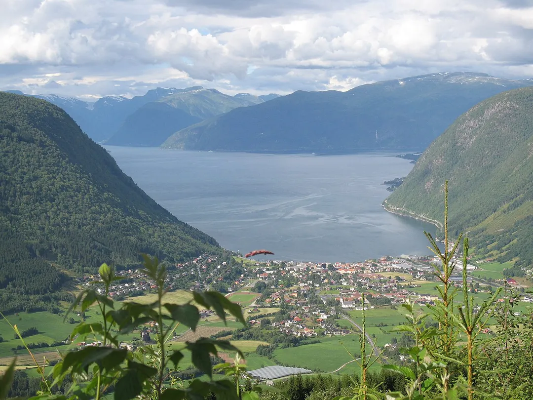
Sognefjorden
Norway's longest and deepest fjord stretching 204 km inland, with the narrow Nærøyfjord branch designated a UNESCO World Heritage site.
4 km · about 10 min drive
Vestland, Norway · Europe
Vikøyri works well as a base: 25 minutes from Balestrand, 4km from Sognefjorden.
Vikøyri is in Vestland, Norway, with about 2,900 people. You drive on the right here. The nearest town is Balestrand, about 14 km away.
Vikøyri is the administrative center of Vik Municipality in Vestland county, Norway. The village is located at the mouth of the Vikja river on the south shore of the Sognefjorden, roughly near the midpoint of Norway's longest fjord. The village lies along Norwegian National Road 13 which leads north to the ferry toRead more
Balestrand and south to the village of Vossevangen. The 1.34-square-kilometre (330-acre) village has a population (2025) of 1,230 and a population density of 918 inhabitants per square kilometre (2,380/sq mi).
Vikøyri sits about 13 kilometres (8.1 mi) south of the village of Balestrand (across the fjord), about 25 kilometres (16 mi) northeast of the village of Arnafjord. To the north and west of Vikøyri lie the villages of Vangsnes, Feios, and Fresvik. Vikøyri is 10 kilometres (6.2 mi) northwest of the Fresvikbreen glacier and about 26 kilometres (16 mi) northeast of the big lake Holskardvatnet.
Vikøyri is the site of one of the Tine cheese factories. It is the only factory in the world that produces gammelost, a unique Norwegian cheese. The village also has the only prison in Sogn og Fjordane. There are also two medieval churches on the south side of the village: Hove Church (built c. 1170) and the Hopperstad Stave Church (built c. 1140). Vik Church is also located in the village, although it is much newer (built in 1877) and it is the main church for the municipality.
Compare prices across Booking.com, Airbnb, Expedia, and more. Select your dates to see availability.
Pick your must-haves once: provider links open pre-filtered. Each filter lists which sites it applies to.
Compare before you book!
Prices can vary significantly between platforms. We recommend checking at least 2-3 sites to find the best deal for your stay in Vikøyri.
Discover famous landmarks, scenic roads, and more near Vikøyri.
Within an hour or so of Vikøyri: Sognefjorden (4 km), Vikafjellet (Fv13) (15 km), Naeroyfjord (27 km), Stalheimskleiva (29 km).
The nearest famous roads are Vikafjellet (Fv13), Stalheimskleiva and Gaularfjellet.
Vikøyri is in Vestland, Norway, about 14 km from Balestrand.
Road trip
Add it as a stop and the planner works out the driving, the nights and what's worth seeing on the way.
Start planningSwipe through places to go
Places within a drive of Vikøyri. Keep the ones you like and add them to your trip.
Essential numbers in Norway
Many toll roads use automatic plate recognition (AutoPASS). Headlights required at all times.
Full driving guide for Norway8 notable places within an hour's drive.
natural wonder
Norway's longest and deepest fjord stretching 204 km inland, with the narrow Nærøyfjord branch designated a UNESCO World Heritage site.
4 km · about 10 min drive
mountain pass
A high, exposed crossing between Voss and the Sognefjord at Vik, frequently shut by winter storms.
15 km · about 25 min drive
natural wonder
A UNESCO-listed fjord barely 250m wide at its narrowest, hemmed by 1,700m peaks and tumbling falls.
27 km · about 30 min drive
historic highway
A breathtakingly steep old hairpin road between two waterfalls in the Naeroy valley near Voss.
29 km · about 35 min drive
scenic viewpoint
Thirteen hairpins at up to 18% drop into the Nærøydalen between two waterfalls; the old road is one-way downhill only.
29 km · about 35 min drive
scenic viewpoint
An angular concrete viewing platform on the Gaularfjellet tourist route, cantilevered over the hairpins below.
30 km · about 35 min drive
mountain pass
A National Tourist Route of hairpins and waterfall viewpoints linking the Sognefjord and Forde.
31 km · about 35 min drive
landmark
Village of about 100 people on the Aurlandsfjord with Norway's smallest stave church in use (c. 1147) and a centuries-old brown goat-cheese tradition. Reachable by road only since 1988.
32 km · about 35 min drive
May to September
Far northern latitude: short daylight hours outside summer make long drives harder.
Other places to explore near Vikøyri.
Your trip starts here
Pick the days, drop in the stops, and share it with whoever's coming.