Federation of B&H, Bosnia and Herzegovina · Europe
About Vareš
Vareš is worth a stop: 25 minutes from Careva Ćuprija, 39km from Vrelo Bosne.
Vareš is in Federation of B&H, Bosnia and Herzegovina, with about 7,200 people. You drive on the right here. The nearest town is Careva Ćuprija, about 14 km away.
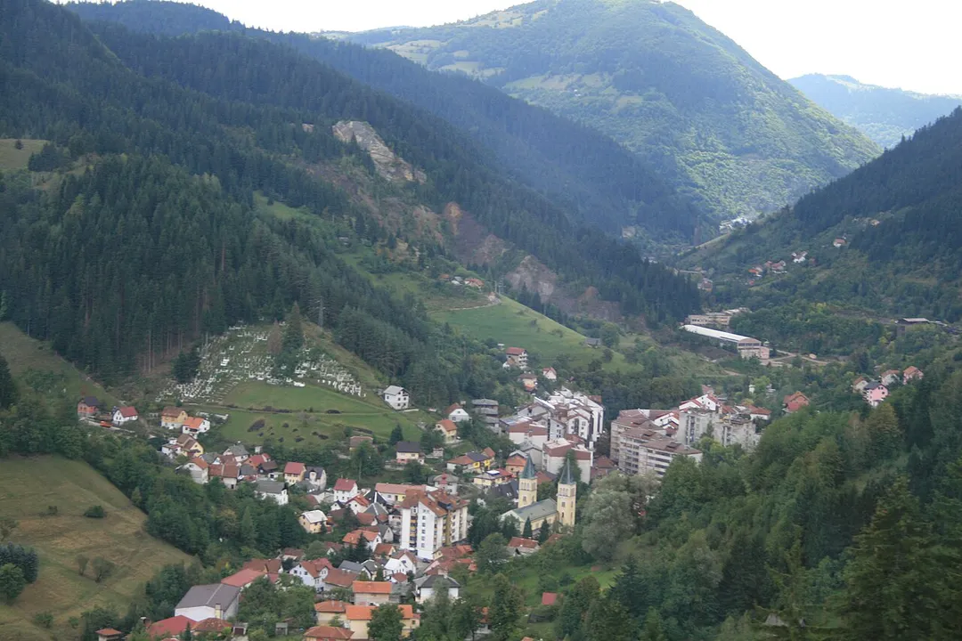
Vareš (Serbian Cyrillic: Вареш) is a town and municipality located in Zenica-Doboj Canton of the Federation of Bosnia and Herzegovina, an entity of Bosnia and Herzegovina. It is situated in central Bosnia and Herzegovina, and is famous for the local mining activities and production of iron. As of 2013, it has aRead more population of 8,892 inhabitants, with 2,917 in the town itself.
A 98 m waterfall, among the highest in the Dinarides: hidden in forest above Nahorevo, a half-hour drive plus walk from central Sarajevo. A beloved local picnic escape that few visitors to the city ever find.
26 km · about 30 min drive
landmark
Baščaršija, Sarajevo
Sarajevo's enchanting Ottoman-era old bazaar quarter where East meets West, filled with copper workshops, mosques, and ćevapi restaurants.
35 km · about 40 min drive
landmark
Latin Bridge
The historic Ottoman bridge where Archduke Franz Ferdinand was assassinated in 1914, triggering the start of World War I.
35 km · about 40 min drive
castle
Vranduk Fortress
A small medieval fortress of the Bosnian kings on a hairpin bend of the Bosna river north of Zenica, with a huddled Ottoman-era village inside its walls. One of the country's most atmospheric and least-visited castles.
37 km · about 40 min drive
museum
Sarajevo Tunnel of Hope
A preserved section of the underground tunnel that served as the only lifeline for besieged Sarajevo during the 1990s war, now a powerful museum.
38 km · about 45 min drive
natural wonder
Vrelo Bosne
A landscaped park at the spring source of the Bosna river below Mount Igman, reached by a tree-lined avenue on Sarajevo's western edge.
39 km · about 45 min drive
natural wonder
Prokoško Lake
A glacial lake at about 1,635 metres on Vranica mountain surrounded by shepherds' huts, reached by a steep unsurfaced road from Fojnica.
52 km · about 60 min drive
landmark
Lukomir
Bosnia's highest permanent village at 1,469 m on the Bjelašnica plateau: stone houses with cherry-shingle roofs, medieval stećci tombstones, and a dramatic view into the 800 m Rakitnica canyon. Gravel road passable in summer.
60 km · about 70 min drive
Driving roads near Vareš
6 named roads, passes and coastal drives within 150km.
64 kmKonjic Old BridgeA graceful six-arch Ottoman stone bridge from 1682 spanning the jade-green Neretva in Konjic, a natural leg-stretch stop on the celebrated Sarajevo-Mostar drive.
72 kmNeretva Canyon Road (M17)Between Jablanica and Mostar the M17 hugs the turquoise Neretva through a deep limestone canyon: the scenic heart of the classic Sarajevo-to-Adriatic drive.
72 kmNeretva Canyon at JablanicaA deep river canyon followed by the M17 between Konjic and Mostar, passing the wartime Bridge on the Neretva museum site.