mountain pass
Rucăr–Bran Pass
Historic corridor road (DN73) between Brașov and Câmpulung, cresting at Fundata (~1,290 m) with pastoral villages, limestone ridges and views of the Bucegi and Piatra Craiului massifs.
21 km · about 25 min drive
Arges, Romania · Europe
Valea Mare Pravăț is worth a stop: 10 minutes from Câmpulung, 30km from Transbucegi (DJ713).
Valea Mare Pravăț is in Arges, Romania, with about 1,900 people. You drive on the right here. The nearest town is Câmpulung, about 4 km away.
Valea Mare-Pravăț is a commune in Argeș County, Muntenia, Romania. It is composed of eight villages: Bilcești, Colnic, Fântânea, Gura Pravăț, Nămăești, Pietroasa, Șelari, and Valea Mare-Pravăț.
The commune is located in the northeastern part of the county, right next to the city of Câmpulung, and 58 km (36 mi) fromRead more
the county seat, Pitești. It lies on the banks of the river Argeșel, at the foot of the Iezer Mountains. The highest point in the commune is Păpușa Peak, at 2,391 m (7,844 ft).
Valea Mare-Pravăț borders Rucăr commune to the northeast, Dragoslavele and Stoenești communes to the east, Mioarele commune to the south, and Câmpulung municipality and Lerești commune to the west.
The commune is crossed by the national road DN73 that connects Câmpulung and Brașov across the Rucăr-Bran Pass. Near Valea Mare-Pravăț, county road DN72A branches off DN73 and leads to the southwest to the city of Târgoviște on the Dâmbovița River valley.
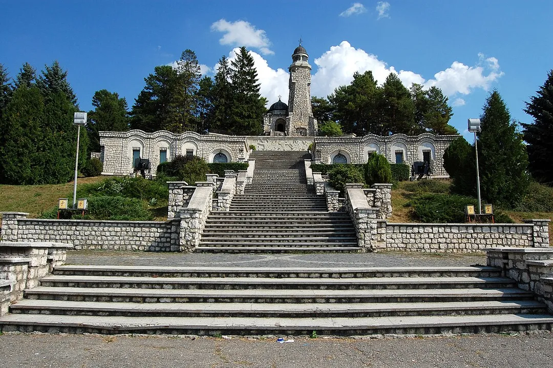
The Mausoleum of the Heroes, also known as the Mateiaș Mausoleum, is a monument dedicated to the soldiers who fought in World War I, during the Romanian Campaign of 1916–1918. It is located on European route E574 (DN73), 11 km (6.8 mi) from Câmpulung on the road to Brașov, on Mateiaș Hill.
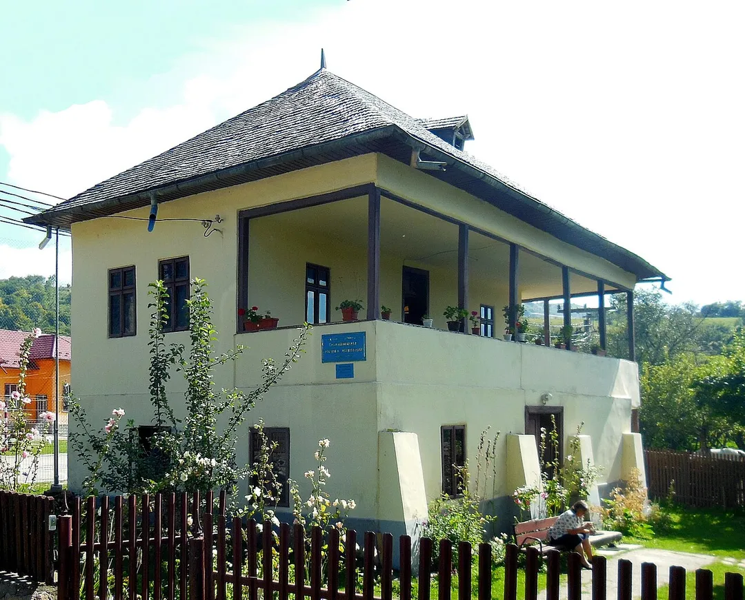
Nămăești hosts the George Topîrceanu Memorial House as well as Nămăești Monastery.
Compare prices across Booking.com, Airbnb, Expedia, and more. Select your dates to see availability.
Pick your must-haves once: provider links open pre-filtered. Each filter lists which sites it applies to.
Compare before you book!
Prices can vary significantly between platforms. We recommend checking at least 2-3 sites to find the best deal for your stay in Valea Mare Pravăț.
Discover famous landmarks, scenic roads, and more near Valea Mare Pravăț.
Within an hour or so of Valea Mare Pravăț: Rucăr–Bran Pass (21 km), Transbucegi (DJ713) (30 km), Transbucegi (32 km), Bucegi Sphinx (32 km).
The nearest famous roads are Rucăr–Bran Pass, Transbucegi (DJ713) and Transfagarasan (DN7C).
Valea Mare Pravăț is in Arges, Romania, about 4 km from Câmpulung.
Road trip
Add it as a stop and the planner works out the driving, the nights and what's worth seeing on the way.
Start planningSwipe through places to go
Places within a drive of Valea Mare Pravăț. Keep the ones you like and add them to your trip.
Essential numbers in Romania
Rovinieta (road tax sticker) required for all national roads.
Full driving guide for Romania8 notable places within an hour's drive.
mountain pass
Historic corridor road (DN73) between Brașov and Câmpulung, cresting at Fundata (~1,290 m) with pastoral villages, limestone ridges and views of the Bucegi and Piatra Craiului massifs.
21 km · about 25 min drive
famous road
A short but dramatic climb from Busteni onto the Bucegi plateau at 2,000m, ending near the Sphinx rock formation.
30 km · about 35 min drive
famous road
Alpine road (DJ713) snaking up the Bucegi Mountains past Bolboci Lake toward the 2,000 m plateau near the Babele rock formations, with sweeping hairpins and dramatic Carpathian views.
32 km · about 35 min drive
photogenic
A wind-carved rock at 2,216 m on the Bucegi plateau that in profile forms a giant human face, beside the mushroom-shaped Babele formations. Reached by cable car from Bușteni or a hike from the Transbucegi road.
32 km · about 35 min drive
castle
A fortress in Transylvania popularly associated with the legend of Count Dracula, perched on a cliff between Wallachia and Transylvania.
33 km · about 40 min drive
castle
A Neo-Renaissance palace in the Carpathian Mountains, one of the most stunning castles in Europe and a former Romanian royal residence.
36 km · about 40 min drive
castle
Vlad the Impaler's real cliff-top fortress, reached by climbing 1,480 steps above the Transfăgărășan.
36 km · about 40 min drive
landmark
A towering 166m arch dam at the southern foot of the Transfăgărășan, topped by the Prometheus statue.
37 km · about 45 min drive
Other places to explore near Valea Mare Pravăț.
Your trip starts here
Pick the days, drop in the stops, and share it with whoever's coming.