
scenic viewpoint
Lake Pukaki Lookout
Roadside lookout on State Highway 8 over the turquoise glacial lake toward Aoraki/Mount Cook, with parking and an information centre.
8 km · about 15 min drive
Canterbury, New Zealand · Oceania
Twizel is worth a stop: 1 hours from Lake Hawea, 32km from Clay Cliffs of Omarama.
Twizel is in Canterbury, New Zealand, with about 1,800 people. You drive on the left here. The nearest town is Lake Hawea, about 77 km away.
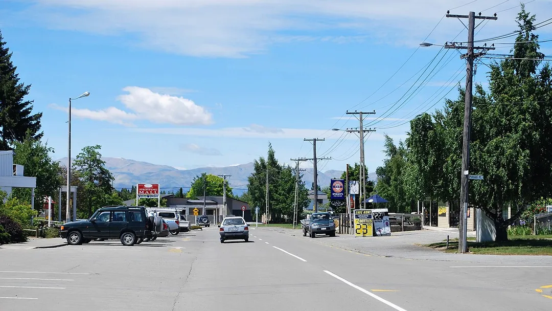
Twizel () is the largest town in the Mackenzie District, in the Canterbury Region of the South Island of New Zealand. The town was founded in 1968 to house construction workers on the Upper Waitaki Hydroelectric Scheme. Today, Twizel is a service and tourist town for visitors to the area. It has a resident populationRead more
of 1,790 (June 2025); during the summer, holidaymakers nearly triple the town's population.
Nearby Lake Ruataniwha supports rowing, sailing and water skiing. Twizel is 37 km (29 minutes drive) east of Lake Ōhau village, 30 km (20 minutes drive) north of Omarama and 60 km (42 minutes drive) south of Lake Tekapo.
Compare prices across Booking.com, Airbnb, Expedia, and more. Select your dates to see availability.
Pick your must-haves once: provider links open pre-filtered. Each filter lists which sites it applies to.
Compare before you book!
Prices can vary significantly between platforms. We recommend checking at least 2-3 sites to find the best deal for your stay in Twizel.
Discover famous landmarks, scenic roads, and more near Twizel.
Within an hour or so of Twizel: Lake Pukaki Lookout (8 km), Lake Pukaki (Laketown views, The Hobbit) (8 km), Clay Cliffs of Omarama (32 km), Church of the Good Shepherd, Lake Tekapo (41 km).
The nearest famous roads are Lindis Pass, Haast Pass and Crown Range Road.
Twizel is in Canterbury, New Zealand, about 77 km from Lake Hawea.
Road trip
Add it as a stop and the planner works out the driving, the nights and what's worth seeing on the way.
Start planningSwipe through places to go
Places within a drive of Twizel. Keep the ones you like and add them to your trip.
Essential numbers in New Zealand
Many rural bridges are single-lane. Give way as signed.
Full driving guide for New Zealand6 notable places within an hour's drive.
scenic viewpoint
Roadside lookout on State Highway 8 over the turquoise glacial lake toward Aoraki/Mount Cook, with parking and an information centre.
8 km · about 15 min drive
film location
The glacial-flour blue lake beneath Aoraki/Mount Cook provided backdrops for Laketown and the road along it is one of New Zealand's finest drives.
8 km · about 15 min drive
natural wonder
Eroded pinnacles and ravines of gravel and silt laid down two million years ago by ancient rivers, cut into badlands by the Ostler Fault. Private land off Henburn Road with an honesty-box fee.
32 km · about 35 min drive
landmark
Stone church built in 1935 on the shore of Lake Tekapo, a short walk from State Highway 8 in a dark-sky reserve.
41 km · about 50 min drive
mountain pass
A 971 m pass on SH8 through rolling tussock-gold hills between the Mackenzie Basin and Central Otago: one of New Zealand's most photographed stretches of high-country road.
52 km · about 60 min drive
national park
Village at the end of State Highway 80 beneath New Zealand's highest peak, the trailhead for the Hooker Valley Track.
58 km · about 65 min drive
5 named roads, passes and coastal drives within 150km.
Other places to explore near Twizel.
Your trip starts here
Pick the days, drop in the stops, and share it with whoever's coming.