

beach
De Panne Beach
Belgium's widest sandy beach, famous for land-yachting and bordering the wild Westhoek dunes near the French border.
13 km · about 25 min drive
Hauts-de-France, France · Europe
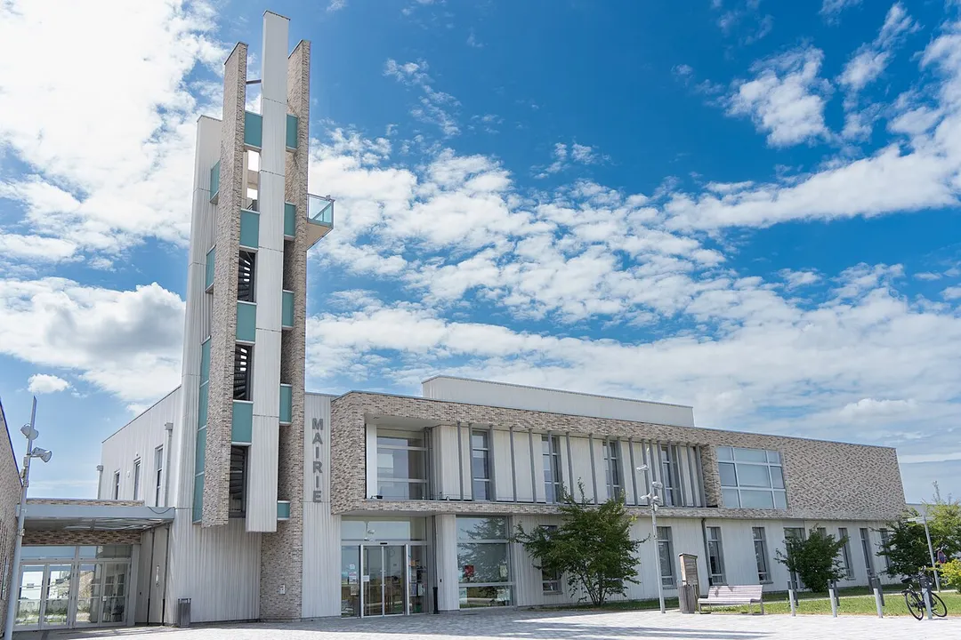
Téteghem is worth a stop: 5 minutes from Coudekerque-Branche, 50km from Koninklijke Baan Coast Road.
Téteghem is in Hauts-de-France, France, with about 7,500 people. You drive on the right here. The nearest town is Coudekerque-Branche, about 4 km away.
Téteghem (French pronunciation: [tetɡɛm]; Dutch and West Flemish: Tetegem) is a former commune in the Nord department, northern France. On 1 January 2016, it was merged into the new commune Téteghem-Coudekerque-Village.
In the Second World War, Téteghem formed part of the perimeter defences during the Battle ofRead more
Dunkirk in 1940.
Compare prices across Booking.com, Airbnb, Expedia, and more. Select your dates to see availability.
Pick your must-haves once: provider links open pre-filtered. Each filter lists which sites it applies to.
Compare before you book!
Prices can vary significantly between platforms. We recommend checking at least 2-3 sites to find the best deal for your stay in Téteghem.
Discover famous landmarks, scenic roads, and more near Téteghem.
Within an hour or so of Téteghem: De Panne Beach (13 km), In de Vrede (24 km), In Flanders Fields Museum (36 km), Menin Gate (36 km).
The nearest famous roads are Koninklijke Baan Coast Road and Brouwersdam.
Téteghem is in Hauts-de-France, France, about 4 km from Coudekerque-Branche.
Road trip
Add it as a stop and the planner works out the driving, the nights and what's worth seeing on the way.
Start planningSwipe through places to go
Places within a drive of Téteghem. Keep the ones you like and add them to your trip.
Essential numbers in France
Carrying a warning triangle and hi-vis vest in your vehicle is mandatory. Motorway emergency phones connect to official breakdown services only.
Full driving guide for France8 notable places within an hour's drive.
beach
Belgium's widest sandy beach, famous for land-yachting and bordering the wild Westhoek dunes near the French border.
13 km · about 25 min drive
cafe
The abbey café opposite Saint-Sixtus monastery in Westvleteren: effectively the only place on earth to reliably drink Westvleteren 12, long rated the world's best beer, at the source with a slab of abbey cheese.
24 km · about 25 min drive
museum
Set in Ypres' rebuilt Cloth Hall, this museum tells the harrowing story of the WWI Western Front trenches.
36 km · about 40 min drive
landmark
A vast memorial arch bearing 54,000 names of the missing, where the Last Post sounds every evening at eight.
36 km · about 40 min drive
coastal drive
The N34 'Royal Road' hugs nearly the whole Belgian coast, sharing its corridor with the world's longest tram line and passing Belle Epoque De Haan, dunes and beach resorts.
50 km · about 60 min drive
scenic viewpoint
Dazzling white chalk cliffs on the Opal Coast with views across the Channel to England on clear days.
52 km · about 60 min drive
landmark
The medieval heart of Bruges, where the climbable Belfry tower looms over a square of stepped-gable guild houses.
58 km · about 65 min drive
film location
The 83m medieval belfry that Ray climbs and falls from in the climax of In Bruges.
58 km · about 65 min drive
April to October
Other places to explore near Téteghem.
Your trip starts here
Pick the days, drop in the stops, and share it with whoever's coming.