natural wonder
Gua Tempurung
Large limestone show cave near Gopeng, Perak, just off the North–South Expressway with guided river passages and parking.
47 km · about 55 min drive
Perak, Malaysia · Asia
Teluk Intan sits on the route: 25 minutes from Cangkat Jong, 47km from Gua Tempurung.
Teluk Intan is in Perak, Malaysia, with about 230,000 people. You drive on the left here. The nearest town is Cangkat Jong, about 12 km away.
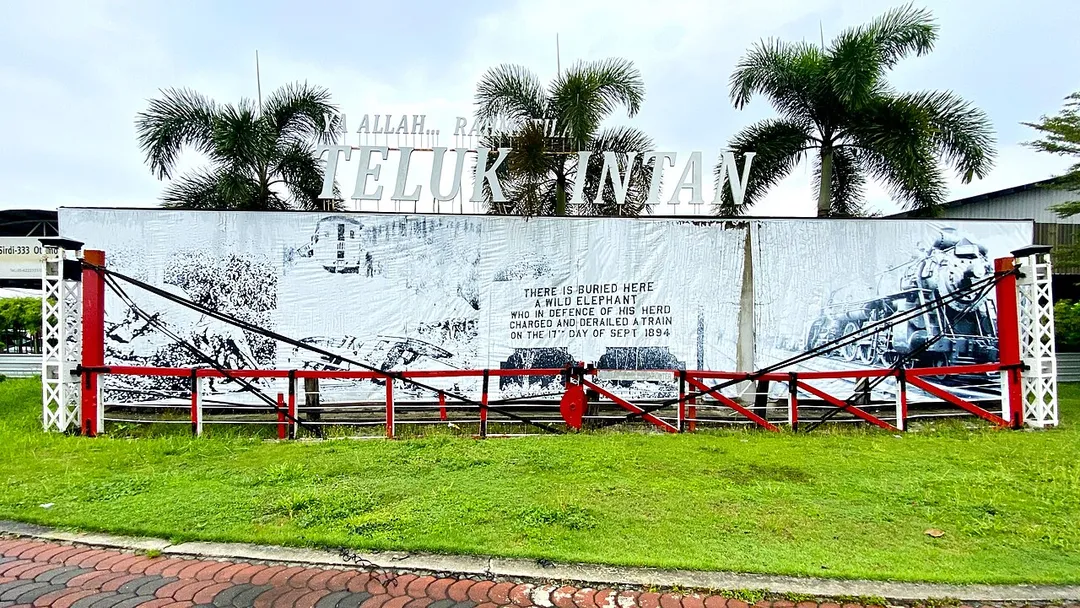
Teluk Intan is a town in Hilir Perak District, Perak, Malaysia. It is the district capital, the largest town in the district and fourth largest town in the state of Perak with an estimated population of around 172,505, more than half of Hilir Perak district's total population (232,900).
In the early days, the town wasRead more
known as Teluk Mak Intan, after a female Mandailing trader. It was here that the Perak rulers held court from 1528 until Kuala Kangsar became the royal town in 1877.
During the British protectorate era, the name was changed to Teluk Anson (Anson Bay), in honour of a British officer and last lieutenant-governor of Penang, Major-General Sir Archibald Edward Harbord Anson, who drew the plan of the modern township in 1882.
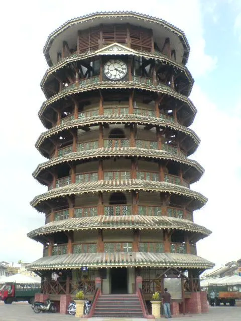
In 1982 during the centenary of the town's establishment, the name was changed again to Teluk Intan (Diamond Bay) by the Sultan of Perak. The Leaning Tower of Teluk Intan is one of the town attractions. The town has a number of colonial buildings and Chinese shophouses together with modern buildings, few shopping complexes and a modern cinema.
Compare prices across Booking.com, Airbnb, Expedia, and more. Select your dates to see availability.
Pick your must-haves once: provider links open pre-filtered. Each filter lists which sites it applies to.
Compare before you book!
Prices can vary significantly between platforms. We recommend checking at least 2-3 sites to find the best deal for your stay in Teluk Intan.
Discover famous landmarks, scenic roads, and more near Teluk Intan.
Within an hour or so of Teluk Intan: Gua Tempurung (47 km), Kellie's Castle (51 km).
The nearest famous roads are Cameron Highlands (Tanah Rata), Genting Highlands and Genting Highlands Road.
Teluk Intan is in Perak, Malaysia, about 12 km from Cangkat Jong.
Road trip
Add it as a stop and the planner works out the driving, the nights and what's worth seeing on the way.
Start planningSwipe through places to go
Places within a drive of Teluk Intan. Keep the ones you like and add them to your trip.
2 notable places within an hour's drive.
natural wonder
Large limestone show cave near Gopeng, Perak, just off the North–South Expressway with guided river passages and parking.
47 km · about 55 min drive
castle
An unfinished Moorish-Scottish mansion begun in 1915 by Scottish planter William Kellie-Smith and abandoned when he died of pneumonia in 1926. Its roofless brick towers and hidden staircases sit beside the Raya River.
51 km · about 60 min drive
Year-round
Tropical latitude: plan around the wet season rather than temperature.
Other places to explore near Teluk Intan.
Your trip starts here
Pick the days, drop in the stops, and share it with whoever's coming.