scenic viewpoint
Tihany Peninsula, Lake Balaton
A lavender-scented peninsula with an abbey perched over Central Europe's largest lake, ringed by a scenic drive.
43 km · about 50 min drive
Tolna County, Hungary · Europe
Tamási sits on the route: 20 minutes from Iregszemcse, 47km from Lake Balaton.
Tamási is in Tolna County, Hungary, with about 9,700 people. You drive on the right here. The nearest town is Iregszemcse, about 10 km away.
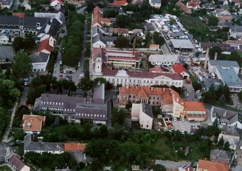
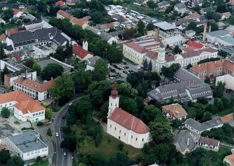
Tamási is a town in Tolna County, Hungary, and is located just 30 kilometers east of Lake Balaton. Tamási is named after St. Thomas and has a population of approximately 9,200 people.
Tamási was founded during the Roman era and primarily focused on agriculture. The town has a history of various conquerors includingRead more
the Turks from 1525 to 1665 and the Austrians from 1848 to 1849. The town has many ruins and the town centre has a Catholic church that was built on the ruins of a temple built during the time of ancient Rome.
The Soviet Army controlled the town from 1945 to 1989 until the Soviet Eastern Bloc fell. Since the dissolution of the Soviet Union, Tamási and Hungary as a whole have been governed as a parliamentary democracy with free elections. Hungary is a member of both NATO and the European Union.
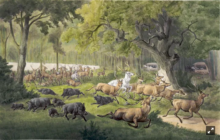
The famous Estherházy family once owned the Gyulaj Forest wild animal preserve, which is one of the area's notable natural features for hunting. During the Communist period of 1945–1989, party officials from Budapest organized large hunting parties and held feasts after the hunt, with photos of these events visible in the host lodge. The preserve covers 7.8 hectares and is home to one of the world's largest populations of fallow deer, called "dám vad. Waterbirds such as ferruginous ducks, Nyroca n. nyroca, and herons (Egretta), as well as predatory birds including hawks (Accipiter sp.), bald eagles, and Heliaeetus leucocephalus, are observed in the nearby Pacsmag Lake area. Bird-watching camps are organized here, led by specialized ornithologists.
Compare prices across Booking.com, Airbnb, Expedia, and more. Select your dates to see availability.
Pick your must-haves once: provider links open pre-filtered. Each filter lists which sites it applies to.
Compare before you book!
Prices can vary significantly between platforms. We recommend checking at least 2-3 sites to find the best deal for your stay in Tamási.
Discover famous landmarks, scenic roads, and more near Tamási.
Within an hour or so of Tamási: Tihany Peninsula, Lake Balaton (43 km), Lake Balaton (47 km), Hegyestű Geological Visitor Site (56 km).
The nearest famous roads are Balaton North Shore Drive (Route 71).
Tamási is in Tolna County, Hungary, about 10 km from Iregszemcse.
Road trip
Add it as a stop and the planner works out the driving, the nights and what's worth seeing on the way.
Start planningSwipe through places to go
Places within a drive of Tamási. Keep the ones you like and add them to your trip.
Essential numbers in Hungary
e-vignette required for motorways. Zero alcohol limit for drivers.
Full driving guide for Hungary3 notable places within an hour's drive.
scenic viewpoint
A lavender-scented peninsula with an abbey perched over Central Europe's largest lake, ringed by a scenic drive.
43 km · about 50 min drive
natural wonder
Central Europe's largest freshwater lake, known as the Hungarian Sea, a beloved summer destination with vineyards and resort towns.
47 km · about 55 min drive
photogenic
A quarried-open basalt volcano near Monoszló above Lake Balaton: a 50 m wall of vertical polygonal columns showing the inside of an 8-million-year-old eruption, with Káli Basin views from the rim.
56 km · about 65 min drive
April to October
Other places to explore near Tamási.
Your trip starts here
Pick the days, drop in the stops, and share it with whoever's coming.