
landmark
Valletta
UNESCO-listed Baroque fortress city built by the Knights of St John, packed with more historic monuments per square metre than any other city.
2 km · about 5 min drive
Tas-Sliema, Malta · Europe
Sliema works well as a base: 3km from Fort St Angelo.
Sliema is in Tas-Sliema, Malta, with about 23,000 people. You drive on the left here.
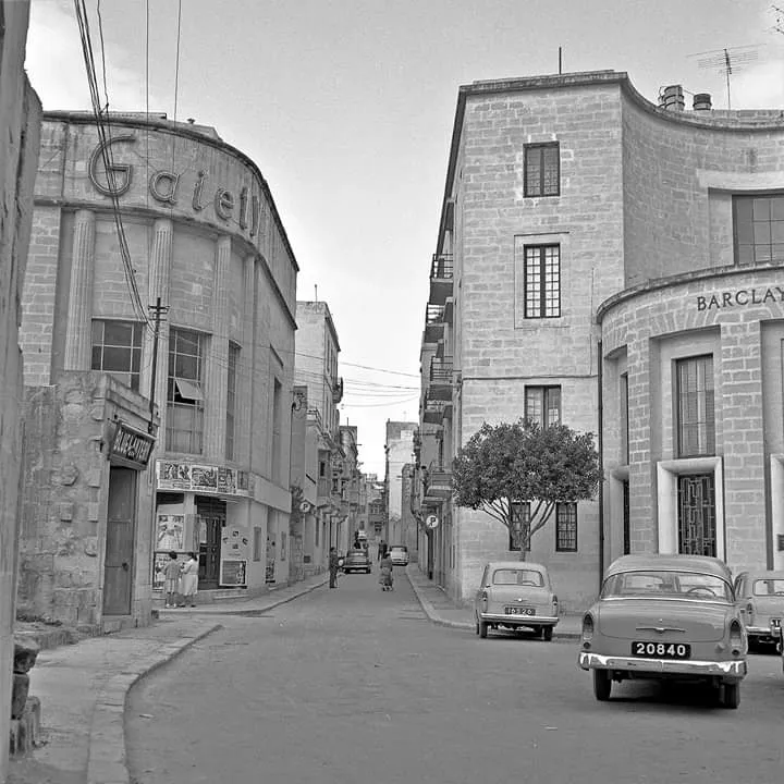
Sliema (Maltese: Tas-Sliema [tɐˈsːlɪːmɐ]) is a town located on the northeast coast of Malta in the Northern Harbour District. It is a major residential and commercial area and a centre for shopping, bars, dining, and café life. It is also the most densely populated town on the island.
Lining the coastline is aRead more
promenade known as the Sliema Front that has become the popular spot for joggers and walkers as well as a prolific meeting place for locals during the summer season. Sliema is also known for its numerous rocky beaches, water sports and hotels. The Strand in Sliema is a popular viewing spot for fireworks displays that take place in August.
Sliema, which means 'peace' or 'comfort', was once a quiet fishing village on the peninsula across Marsamxett Harbour from Valletta and has views of the capital city. The population began to grow in 1853 and the town was declared a parish in 1878. Now Sliema and the coastline up to neighbouring St. Julian's constitute Malta's main coastal resort.
Sliema is considered a desirable place to live and is relatively affluent, with extremely high property prices compared to the national average. Historically, stylish villas and traditional Maltese townhouses lined the streets of Sliema. Sliema has now been ringed with modern apartment blocks, some of which are amongst the tallest buildings in Malta. This has resulted in significant traffic, parking and construction-related noise pollution issues.
Residents of Sliema are stereotypically known for their usage of English as a first language, although this is changing in the 21st century due to demographic shifts. Maltese people from Sliema are referred to as Slimiżi.
Compare prices across Booking.com, Airbnb, Expedia, and more. Select your dates to see availability.
Pick your must-haves once: provider links open pre-filtered. Each filter lists which sites it applies to.
Compare before you book!
Prices can vary significantly between platforms. We recommend checking at least 2-3 sites to find the best deal for your stay in Sliema.
Discover famous landmarks, scenic roads, and more near Sliema.
Within an hour or so of Sliema: Valletta (2 km), St John's Co-Cathedral (2 km), Upper Barrakka Gardens (2 km), Fort St Angelo (3 km).
Sliema is in Tas-Sliema, Malta.
Road trip
Add it as a stop and the planner works out the driving, the nights and what's worth seeing on the way.
Start planningSwipe through places to go
Places within a drive of Sliema. Keep the ones you like and add them to your trip.
8 notable places within an hour's drive.
landmark
UNESCO-listed Baroque fortress city built by the Knights of St John, packed with more historic monuments per square metre than any other city.
2 km · about 5 min drive
cathedral
Baroque cathedral in Valletta built by the Knights of St John, housing Caravaggio's Beheading of Saint John the Baptist.
2 km · about 5 min drive
scenic viewpoint
Terraced garden on Valletta's bastions overlooking the Grand Harbour and Three Cities, with a daily saluting battery firing.
2 km · about 5 min drive
castle
Bastioned fort at the tip of Birgu commanding the Grand Harbour, central to the 1565 Great Siege and now a museum site.
3 km · about 5 min drive
ancient ruins
The world's only known prehistoric underground temple: three levels of chambers carved into living rock around 3300-3000 BC, with red-ochre spirals still on the ceilings. Only 80 visitors a day are admitted; book weeks ahead.
5 km · about 10 min drive
cathedral
Parish church with one of the world's largest unsupported domes (37 m), modelled on the Pantheon and built by villagers between 1833 and 1860. In 1942 a Luftwaffe bomb pierced the dome during Mass and failed to explode: a replica sits in the sacristy.
7 km · about 15 min drive
landmark
Malta's ancient walled capital known as the 'Silent City', with narrow medieval streets and sweeping views over the island.
9 km · about 20 min drive
landmark
Fishing village on Malta's southeast coast lined with painted luzzu boats, known for its Sunday fish market and waterfront restaurants.
9 km · about 15 min drive
Other places to explore near Sliema.
Your trip starts here
Pick the days, drop in the stops, and share it with whoever's coming.