
AfricaSouth AfricaFree State
Senekal
Free State, South Africa · Africa
About Senekal
Senekal sits on the route: 35 minutes from Paul Roux.
Senekal is in Free State, South Africa, with about 40,000 people. You drive on the left here. The nearest town is Paul Roux, about 32 km away.
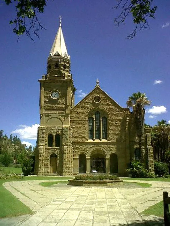
Senekal is a town situated on the banks of the Sand River in the eastern part of the Free State province of South Africa. It was named after Commandant FP Senekal, who led the encroachment of Basotho lands with the Boers under the Orange Free State government. Senekal died in 1865 during a skirmish known as Senekal'sRead more
War.
It is the second largest town in Setsoto Municipality after Ficksburg, the seat of Setsoto. Senekal lies on the N5 national road between Winburg on the west and Bethlehem to the east.
It has two townships, Matwabeng and OR Tambo Section, the latter being the latest, largest and fastest growing.
Where to Stay in Senekal
Compare prices across Booking.com, Airbnb, Expedia, and more. Select your dates to see availability.
Filter presets
Pick your must-haves once: provider links open pre-filtered. Each filter lists which sites it applies to.
Compare before you book!
Prices can vary significantly between platforms. We recommend checking at least 2-3 sites to find the best deal for your stay in Senekal.
Explore the Area
Discover famous landmarks, scenic roads, and more near Senekal.
Loading map...
Frequently Asked Questions
Are there any good drives near Senekal?
The nearest famous roads are Moteng Pass.
Where is Senekal?
Senekal is in Free State, South Africa, about 32 km from Paul Roux.
Road trip
Drive to Senekal
Add it as a stop and the planner works out the driving, the nights and what's worth seeing on the way.
Start planningWhat's nearby?
Swipe through places to go
Places within a drive of Senekal. Keep the ones you like and add them to your trip.
Explore now
Quick Information
- Population
- 39,584
- Continent
- Africa
- Country
- South Africa
- Region
- Free State
- Timezone
- Africa/Johannesburg
- Coordinates
- -28.3197, 27.6208
Emergency & Services
Essential numbers in South Africa
112 works from mobiles. Avoid driving at night in rural areas; keep doors locked in cities.
Full driving guide for South AfricaTags
Nearby Destinations
Other places to explore near Senekal.
Your trip starts here
Plan a road trip from Senekal.
Pick the days, drop in the stops, and share it with whoever's coming.