PYRTPlan Your Road Trips
Create TripCommunityMerchandise
PYRTPlan Your Road Trips
Create TripCommunityMerchandise
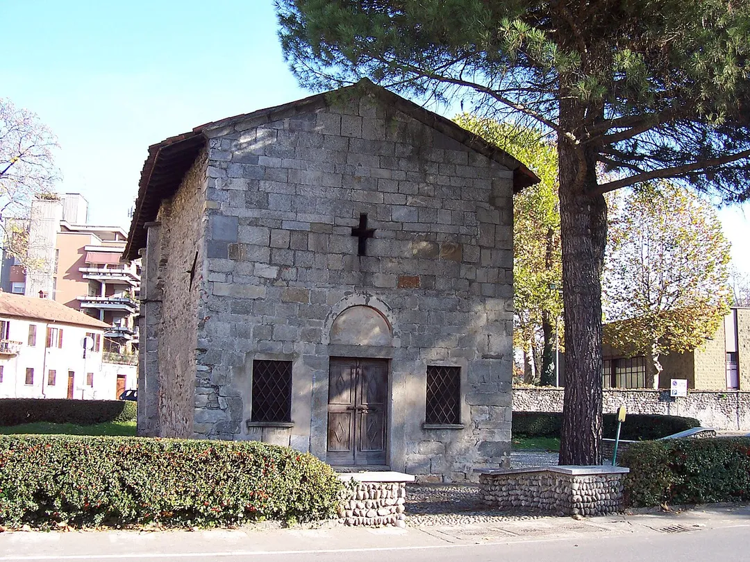
Borgomanero - San Leonardo church

Source photographed by myself
Photographer Pier Luigi Mora
Date 20 November 2005
Camera Data

Camera Kodak CX6330 zoom digital camera
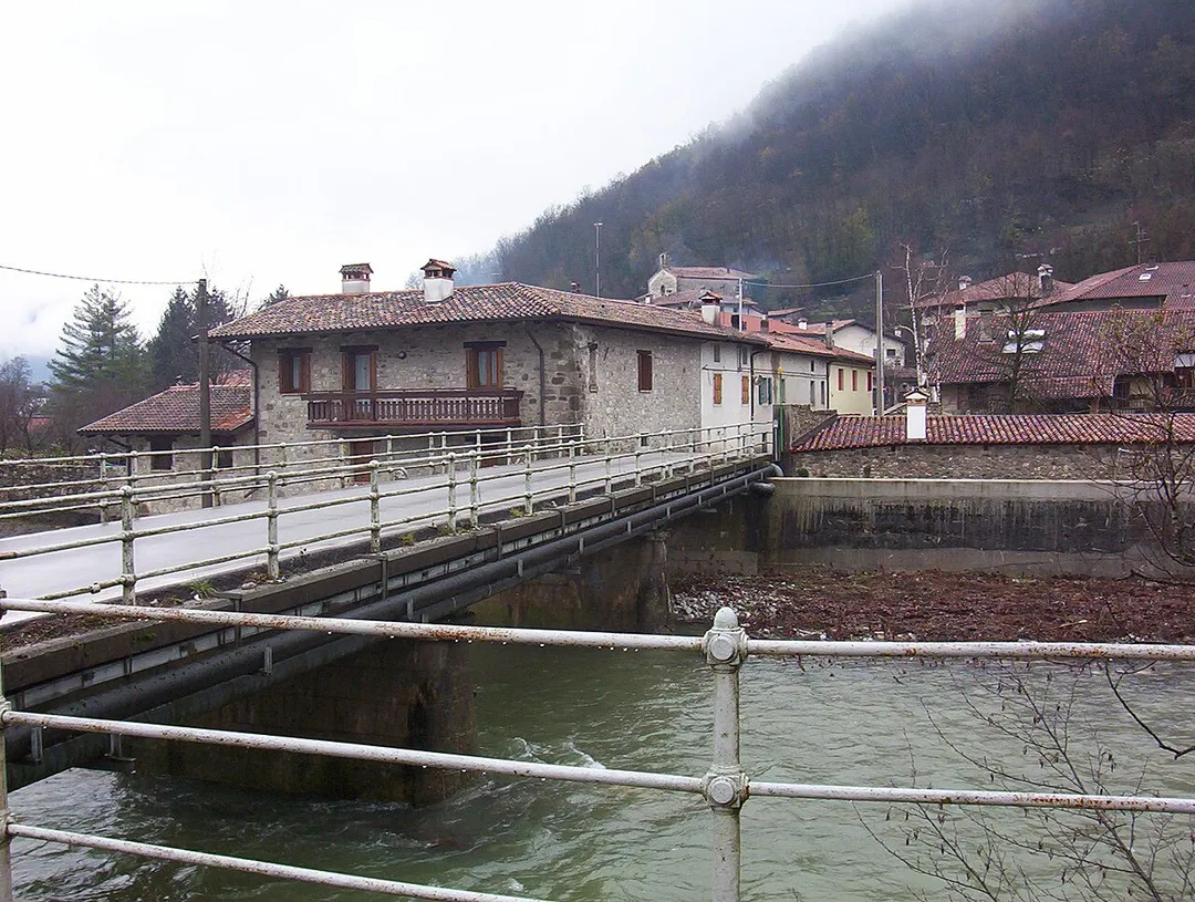
Il ponte sul fiume Cosizza tra Merso di Sopra e Scrutto. Il centro abitato sullo sfondo è Scrutto, una frazione del comune di San Leonardo (UD), Italia. L'immagine è una fotografia scattata da Trevirgola e risale all'autunno 2005.
La chiesa di San Leonardo Abate a San Leonardo, in provincia e arcidiocesi di Udine
Photo by No machine-readable author provided. Zapping assumed (based on copyright claims).
Destinations
Home›Destinations›San Leonardo
EuropeItalyFriuli Venezia Giulia

San Leonardo

Friuli Venezia Giulia, Italy · Europe

About San Leonardo

San Leonardo works well as a base: 5 minutes from Stregna, 18km from Tolmin Gorge.

San Leonardo is in Friuli Venezia Giulia, Italy, with about 113 people. You drive on the right here. The nearest town is Stregna, about 4 km away.

San Leonardo (Slovene: Svet Lienart or Podutana; Friulian: San Lenàrt) is a comune (municipality) in the Regional decentralization entity of Udine in the Italian region of Friuli-Venezia Giulia, located about 60 kilometres (37 mi) northwest of Trieste and about 25 kilometres (16 mi) east of Udine, and borders the

Read more following municipalities: Grimacco, San Pietro al Natisone, Savogna, Stregna, and Prepotto. San Leonardo localities include: Altana-Utana, Camugna-Kamunja, Cemur-Čemur, Cernizza-Čarnica, Cisgne-Čišnje, Clastra-Hlastra, Cosizza-Kosca, Cravero-Kravar, Crostù-Hrastovije, Dolegna-Dolenjane, Grobbia-Grobje, Iainich-Jagnjed, Iesizza-Jesičje, Iessegna-Jesenje, Merso di Sopra-Gorenja Miersa, Merso di Sotto-Dolenja Miersa, Osgnetto-Ošnije, Ovizza-Ovica, Picig-Pičič, Picon-Pikon, Podcravero-Podkravar, Postacco-Puostak, Precot-Prehod, Scrutto-Škrutove, Seuza-Seucè, Ussivizza-Ušiuca, Zabrida-Zabardo, Zamir-Zamier.Municipal hall is located in Merso di Sopra.

Read more on Wikipedia

Where to Stay in San Leonardo

Compare prices across Booking.com, Airbnb, Expedia, and more. Select your dates to see availability.

Filter presets

Pick your must-haves once: provider links open pre-filtered. Each filter lists which sites it applies to.

Booking.comExpediaTripAdvisorHotels.comAgodaAirbnb

Compare before you book!

Prices can vary significantly between platforms. We recommend checking at least 2-3 sites to find the best deal for your stay in San Leonardo.

Explore the Area

Discover famous landmarks, scenic roads, and more near San Leonardo.

Loading map...
Open in Google Maps

Frequently Asked Questions

What is there to see near San Leonardo?

Within an hour or so of San Leonardo: Hiša Franko (14 km), Soča Valley (15 km), Kozjak Waterfall (16 km), Tolmin Gorge (18 km).

Are there any good drives near San Leonardo?

The nearest famous roads are Predil Pass, Mangart Saddle Road and Vršič Pass.

Where is San Leonardo?

San Leonardo is in Friuli Venezia Giulia, Italy, about 4 km from Stregna.

Road trip

Drive to San Leonardo

Add it as a stop and the planner works out the driving, the nights and what's worth seeing on the way.

Start planning

What's nearby?

Swipe through places to go

Places within a drive of San Leonardo. Keep the ones you like and add them to your trip.

Explore now

Quick Information

Population
113
Continent
Europe
Country
Italy
Region
Friuli Venezia Giulia
Timezone
Europe/Rome
Coordinates
46.1191, 13.5308

Emergency & Services

Essential numbers in Italy

Police
113
Ambulance
118
Fire
115
All emergencies
112
Driving side
right

ACI roadside assistance: 803 116. ZTL (limited traffic zones) in city centres are camera-enforced.

Full driving guide for Italy

Tags

EuropeItalyFriuli Venezia GiuliaTown

Worth the detour from San Leonardo

8 notable places within an hour's drive.

restaurant

Hiša Franko

Ana Roš's three-Michelin-star farmhouse restaurant in Staro Selo outside Kobarid, cooking hyper-local Soča Valley ingredients: mountain cheese, river trout, foraged herbs. A pilgrimage-level food detour booked months ahead.

14 km · about 25 min drive

scenic viewpoint

Soča Valley

Valley of the turquoise Soca river below the Julian Alps, followed by a scenic road from Bovec through Kobarid to Tolmin.

15 km · about 25 min drive

waterfall

Kozjak Waterfall

A 15 m waterfall near Kobarid that pours into an underground-feeling amphitheatre chamber, its emerald plunge pool lit by a single opening in the rock. An easy 30-minute walk from the parking by the Soča.

16 km · about 20 min drive

natural wonder

Tolmin Gorge

The lowest and most southerly entry point to Triglav National Park, featuring a dramatic thermal spring emerging from a cave in the gorge wall.

18 km · about 20 min drive

bridge

Solkan Bridge

The world's longest stone railway arch, an 85 m span of hewn limestone blocks: vaults the emerald Soča river just north of Nova Gorica, best admired from the riverside road below.

18 km · about 20 min drive

waterfall

Boka Waterfall

Slovenia's highest waterfall at 106 m, visible from the road near Bovec and best after snowmelt.

23 km · about 25 min drive

waterfall

Savica Waterfall

Majestic 78-metre waterfall plunging from a cave mouth into a turquoise pool at the head of Lake Bohinj in the Julian Alps.

28 km · about 30 min drive

natural wonder

Lake Bohinj

Slovenia's largest natural lake, a tranquil emerald jewel surrounded by mountains within Triglav National Park, quieter and wilder than Bled.

32 km · about 35 min drive

Driving roads near San Leonardo

  • Right hereSoča ValleyValley of the turquoise Soca river below the Julian Alps, followed by a scenic road from Bovec through Kobarid to Tolmin.
  • 18 kmSolkan BridgeThe world's longest stone railway arch, an 85 m span of hewn limestone blocks: vaults the emerald Soča river just north of Nova Gorica, best admired from the riverside road below.
  • 33 kmPredil PassA 1,156 m pass on the Slovenian-Italian border above Bovec, guarded by the ruined Predil fortress; its sweeping curves pair perfectly with the nearby Mangart and Vršič roads on a Julian Alps loop.
  • 36 kmMangart Saddle RoadSlovenia's highest-reaching road at 2055m, a narrow single-track shelf road with no guardrails climbing to a dramatic saddle beneath the Mangart peak.
  • 37 kmMangart SaddleThe end of Slovenia's highest road at 2,072 m, a narrow single-track climb with tunnels cut through rock spurs and a huge Julian Alps view.
  • 39 kmVršič PassSlovenia's highest pass at 1611m with 50 numbered cobblestone hairpins, built by Russian POWs in WWI and now a popular Julian Alps motorcycle route.
Driving in Italy

Drives on
the right
Petrol
~€1.82/litre
Motorway tolls
~€8.50/100km

When to drive here

April to October

Nearby Destinations

Other places to explore near San Leonardo.

Merso di Sopra

🇮🇹 Italy

1 km awayPop. 380

San Pietro al Natisone

🇮🇹 Italy

4 km awayPop. 1,445

Savogna

🇮🇹 Italy

4 km awayPop. 198

Clodig

🇮🇹 Italy

6 km awayPop. 60

Pulfero

🇮🇹 Italy

7 km awayPop. 112

Torreano

🇮🇹 Italy

8 km awayPop. 939

Cividale del Friuli

🇮🇹 Italy

9 km awayPop. 9,290

Kanal

🇸🇮 Slovenia

9 km awayPop. 1,269

Plan a trip around San Leonardo

Italy road trip planner

Your trip starts here

Plan a road trip from San Leonardo.

Pick the days, drop in the stops, and share it with whoever's coming.

Start planning
PYRT

The ultimate road trip planning platform. Discover 150,000+ destinations worldwide, plan scenic routes, and create unforgettable adventures.

Inspiration

  • Discover Trips
  • Travel Guides
  • Community

The Product

  • Calendar Planner
  • Integrations
  • How It Works
  • Collaboration Mode
  • Get the App
  • Merchandise: PYRT Supply Co.
  • Become a Creator
  • Trip Marketplace

Plan Your Trip

  • Road Trip Planner
  • Famous Routes
  • Drive Times & Distances
  • Planners by Country
  • Best Road Trip Planner App
  • Discover Road Trips
  • Events
  • Travel Guides
  • How It Works
  • My Trips
  • Community Groups

Company

  • Terms of Service
  • Privacy Policy
  • About PYRT
  • Support
  • Contact Us
  • Sign In
  • Create Account

© 2026 Plan Your Road Trips. All rights reserved.

•[email protected]
Data sources:GeoNames (CC BY 4.0)•Wikimedia Commons (CC BY-SA)•Mapbox•Photography: George Lawrence