PYRTPlan Your Road Trips
Create TripCommunityMerchandise
PYRTPlan Your Road Trips
Create TripCommunityMerchandise
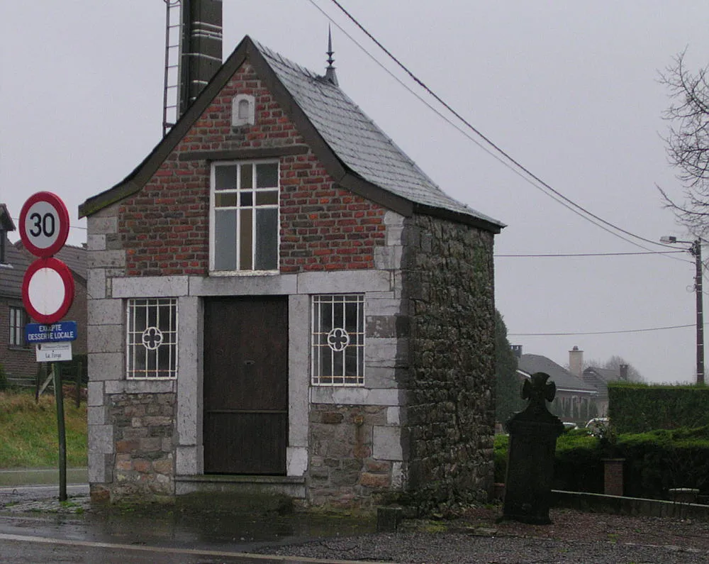
chapel of Christ the Savior between Thimister and Elsaute
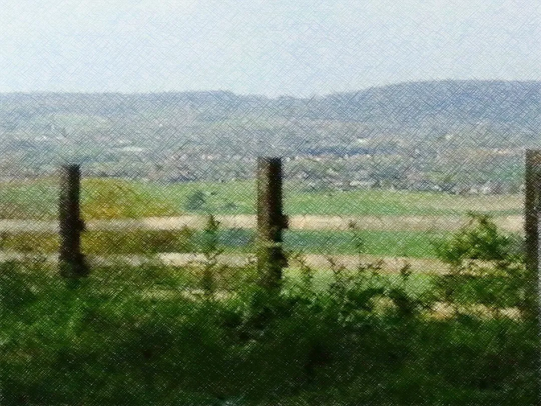
Les collines du coté de Dergneau
Parc naturel du Pays des Collines, Frasnes-lez-Anvaing (Belgique)
Photo by Norbert Schnitzler
Destinations
Home›Destinations›Saint-Sauveur
EuropeBelgiumWallonia

Saint-Sauveur

Wallonia, Belgium · Europe

About Saint-Sauveur

Saint-Sauveur is worth a stop: 5 minutes from Anvaing, 47km from Hallerbos.

Saint-Sauveur is in Wallonia, Belgium, with about 1,800 people. You drive on the right here. The nearest town is Anvaing, about 4 km away.

Where to Stay in Saint-Sauveur

Compare prices across Booking.com, Airbnb, Expedia, and more. Select your dates to see availability.

Filter presets

Pick your must-haves once: provider links open pre-filtered. Each filter lists which sites it applies to.

Booking.comExpediaTripAdvisorHotels.comAgodaAirbnb

Compare before you book!

Prices can vary significantly between platforms. We recommend checking at least 2-3 sites to find the best deal for your stay in Saint-Sauveur.

Explore the Area

Discover famous landmarks, scenic roads, and more near Saint-Sauveur.

Loading map...
Open in Google Maps

Frequently Asked Questions

What is there to see near Saint-Sauveur?

Within an hour or so of Saint-Sauveur: Pairi Daiza (24 km), Vieux Lille (38 km), Ghent (40 km), Gravensteen (40 km).

Are there any good drives near Saint-Sauveur?

The nearest famous roads are Koninklijke Baan Coast Road, Chimay Street Circuit and Brouwersdam.

Where is Saint-Sauveur?

Saint-Sauveur is in Wallonia, Belgium, about 4 km from Anvaing.

Road trip

Drive to Saint-Sauveur

Add it as a stop and the planner works out the driving, the nights and what's worth seeing on the way.

Start planning

What's nearby?

Swipe through places to go

Places within a drive of Saint-Sauveur. Keep the ones you like and add them to your trip.

Explore now

Quick Information

Population
1,843
Continent
Europe
Country
Belgium
Region
Wallonia
Timezone
Europe/Brussels
Coordinates
50.7060, 3.5978

Emergency & Services

Essential numbers in Belgium

Police
101
Ambulance
112
Fire
112
All emergencies
112
Driving side
right
Full driving guide for Belgium

Tags

EuropeBelgiumWalloniaTown

Worth the detour from Saint-Sauveur

8 notable places within an hour's drive.

landmark

Pairi Daiza

Belgium's most-visited attraction: a 75-hectare animal park built around a former Cistercian abbey in Hainaut, with full-scale Chinese, Indonesian and Middle Kingdom gardens housing giant pandas, gorillas and elephants.

24 km · about 30 min drive

landmark

Vieux Lille

Lively old quarter of Flemish brick gables and grand squares, the cultural capital of the French north.

38 km · about 45 min drive

landmark

Ghent

Vibrant medieval Flemish city with stunning canal-side architecture, the Gravensteen castle, and the famous Ghent Altarpiece.

40 km · about 45 min drive

castle

Gravensteen

A grim moated stone castle of the Counts of Flanders rising straight from the canals in the centre of Ghent.

40 km · about 45 min drive

cathedral

Saint Bavo's Cathedral Ghent

This Gothic cathedral guards the Van Eyck brothers' luminous Ghent Altarpiece, a landmark of European painting.

40 km · about 45 min drive

landmark

Strépy-Thieu Boat Lift

A colossal 73 m boat elevator on the Canal du Centre, among the tallest in the world, hoisting entire barges in a concrete cathedral visible for miles across Hainaut.

44 km · about 50 min drive

landmark

Canal du Centre Hydraulic Boat Lifts

Four UNESCO-listed 19th-century hydraulic boat lifts near La Louvière, still standing on the old Canal du Centre.

46 km · about 55 min drive

natural wonder

Hallerbos

The 'Blue Forest' near Halle carpets itself with millions of wild bluebells under beech trees each spring.

47 km · about 55 min drive

Driving roads near Saint-Sauveur

  • 74 kmKoninklijke Baan Coast RoadThe N34 'Royal Road' hugs nearly the whole Belgian coast, sharing its corridor with the world's longest tram line and passing Belle Epoque De Haan, dunes and beach resorts.
  • 75 kmWestern Scheldt TunnelAt 6.6 km the longest road tunnel in the Netherlands, diving under the busy Western Scheldt shipping lane to link Zeeland with Zeelandic Flanders since 2003.
  • 75 kmWesterscheldetunnelTolled 6.6-kilometre road tunnel under the Western Scheldt linking Zeelandic Flanders to Zuid-Beveland, replacing two ferries.
Driving in Belgium

Drives on
the right
Petrol
~€1.74/litre
Motorway tolls
None

When to drive here

April to October

Nearby Destinations

Other places to explore near Saint-Sauveur.

Dergneau

🇧🇪 Belgium

2 km awayPop. 1,031

Anvaing

🇧🇪 Belgium

4 km awayPop. 1,187

Ronse

🇧🇪 Belgium

4 km awayPop. 24,204

Frasnes-lez-Buissenal

🇧🇪 Belgium

5 km awayPop. 10,936

Ellezelles

🇧🇪 Belgium

7 km awayPop. 5,566

Flobecq

🇧🇪 Belgium

11 km awayPop. 3,142

Leuze

🇧🇪 Belgium

12 km awayPop. 7,095

Schorisse

🇧🇪 Belgium

12 km awayPop. 1,602

Plan a trip around Saint-Sauveur

Europe road trip planner

Your trip starts here

Plan a road trip from Saint-Sauveur.

Pick the days, drop in the stops, and share it with whoever's coming.

Start planning
PYRT

The ultimate road trip planning platform. Discover 150,000+ destinations worldwide, plan scenic routes, and create unforgettable adventures.

Inspiration

  • Discover Trips
  • Travel Guides
  • Community

The Product

  • Calendar Planner
  • Integrations
  • How It Works
  • Collaboration Mode
  • Get the App
  • Merchandise: PYRT Supply Co.
  • Become a Creator
  • Trip Marketplace

Plan Your Trip

  • Road Trip Planner
  • Famous Routes
  • Drive Times & Distances
  • Planners by Country
  • Best Road Trip Planner App
  • Discover Road Trips
  • Events
  • Travel Guides
  • How It Works
  • My Trips
  • Community Groups

Company

  • Terms of Service
  • Privacy Policy
  • About PYRT
  • Support
  • Contact Us
  • Sign In
  • Create Account

© 2026 Plan Your Road Trips. All rights reserved.

•[email protected]
Data sources:GeoNames (CC BY 4.0)•Wikimedia Commons (CC BY-SA)•Mapbox•Photography: George Lawrence