

landmark
Bentley Factory Tour
Exclusive guided tours of Bentley's Crewe factory where master craftspeople build the world's finest luxury cars.
13 km · about 25 min drive
England, United Kingdom · Europe
Rode Heath works well as a base: 10 minutes from Kidsgrove, 19km from A54 Congleton to Buxton.
Rode Heath is in England, United Kingdom, with about 2,000 people. You drive on the left here. The nearest town is Kidsgrove, about 5 km away.
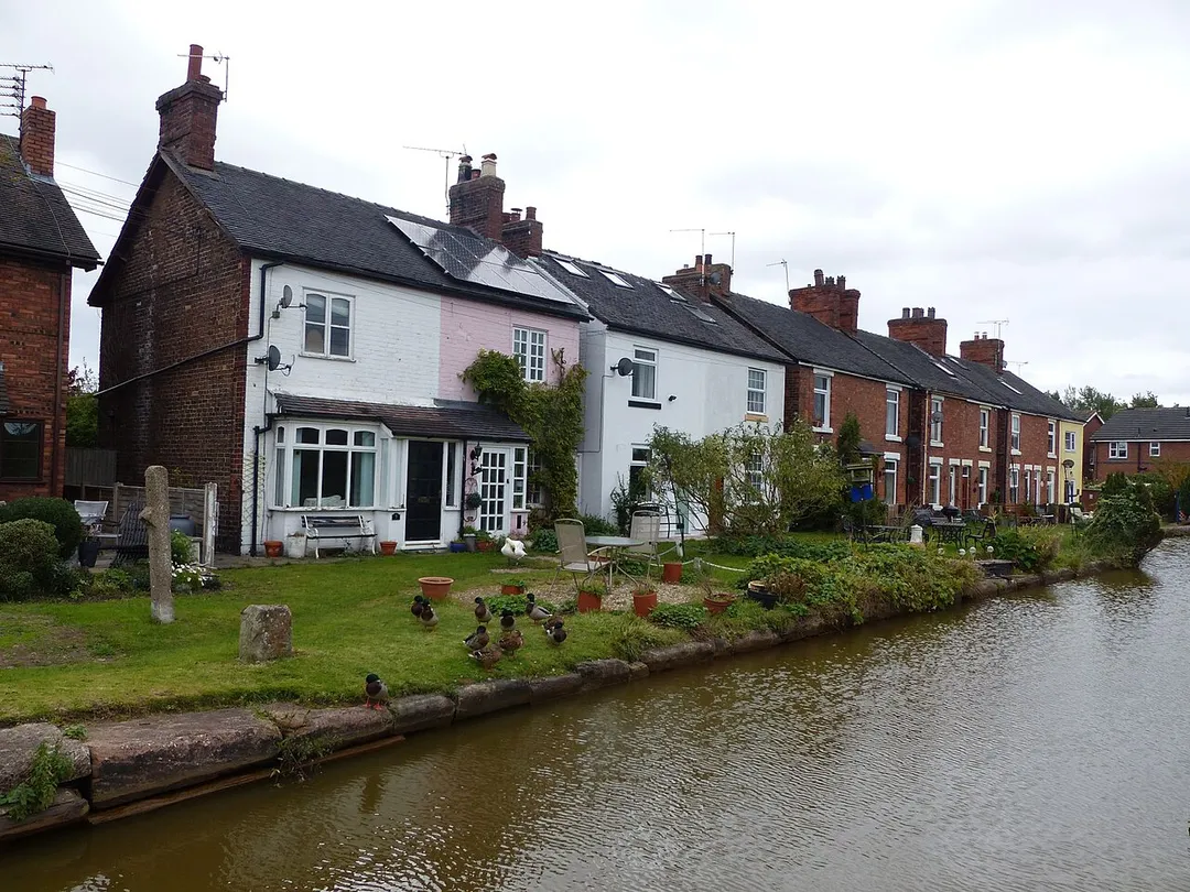
Rode Heath is a small village in the civil parish of Odd Rode, near Alsager and within the unitary authority of Cheshire East and the ceremonial county of Cheshire, England. According to the 2001 census, Rode Heath had a population of 2,150. In the 2011 census the figure had dropped to 2,019 and a 2016 estimate putRead more
the population at 1,943. The village was previously two villages, Rode Heath and Thurlwood. Since extensive housing developments in Thurlwood the two are known simply as Rode Heath.
The Trent and Mersey Canal runs through Rode Heath. The village has one pub (with a second pub to re-open in April 2026), a primary school, post office, shop and Chinese takeaway. There are two churches: the Church of the Good Shepherd, one of the three churches that make up the Parish of Odd Rode, and the Rhema Mission Church (Rode Heath Chapel). Close by is Rode Hall, the gardens of which are a tourist attraction. The current owner of Rode Hall is Lady Wilbraham.
The village has a number of gentle walks along the canal and through the countryside, popular with dog walkers.
Compare prices across Booking.com, Airbnb, Expedia, and more. Select your dates to see availability.
Pick your must-haves once: provider links open pre-filtered. Each filter lists which sites it applies to.
Compare before you book!
Prices can vary significantly between platforms. We recommend checking at least 2-3 sites to find the best deal for your stay in Rode Heath.
Discover famous landmarks, scenic roads, and more near Rode Heath.
Within an hour or so of Rode Heath: Bentley Factory Tour (13 km), A54 Congleton to Buxton (19 km), Lud's Church (20 km), The Roaches (20 km).
The nearest famous roads are A54 Congleton to Buxton, A537 Cat and Fiddle Summit and Goyt Valley road, Peak District.
Rode Heath is in England, United Kingdom, about 5 km from Kidsgrove.
Road trip
Add it as a stop and the planner works out the driving, the nights and what's worth seeing on the way.
Start planningSwipe through places to go
Places within a drive of Rode Heath. Keep the ones you like and add them to your trip.
Essential numbers in United Kingdom
112 also works. NHS non-emergency medical advice: 111. National Highways breakdown assistance on motorways: 0300 123 5000.
Full driving guide for United Kingdom8 notable places within an hour's drive.
landmark
Exclusive guided tours of Bentley's Crewe factory where master craftspeople build the world's finest luxury cars.
13 km · about 25 min drive
famous road
A fast moorland alternative to the Cat and Fiddle, rolling over the Peak District's western edge past Danebridge and the Cheshire border.
19 km · about 20 min drive
natural wonder
Deep mossy chasm hidden in Back Forest above the Dane Valley, 18m deep and cool even in summer. Lollards held secret services here, and scholars identify it as the Green Chapel of Sir Gawain and the Green Knight.
20 km · about 25 min drive
natural wonder
A serrated gritstone ridge on the Staffordshire moorlands, with Doxey Pool, Lud's Church nearby and a long climbing history.
20 km · about 25 min drive
racetrack
A picturesque Cheshire circuit winding through parkland with dramatic elevation changes, a favourite of British club and national racing.
23 km · about 25 min drive
cafe
A historic pub near the summit of the A537 Cat and Fiddle Road between Buxton and Macclesfield, once named Britain's most dangerous road and a famous biking destination.
24 km · about 30 min drive
scenic viewpoint
A high-altitude viewpoint on the A537 between Macclesfield and Buxton, one of England's highest roads with expansive moorland vistas.
24 km · about 30 min drive
mountain pass
The 515 m high point of the A537 between Buxton and Macclesfield, long one of Britain's most notorious motorcycling roads.
24 km · about 30 min drive
8 named roads, passes and coastal drives within 60km.
April to October
Other places to explore near Rode Heath.
Your trip starts here
Pick the days, drop in the stops, and share it with whoever's coming.