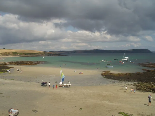
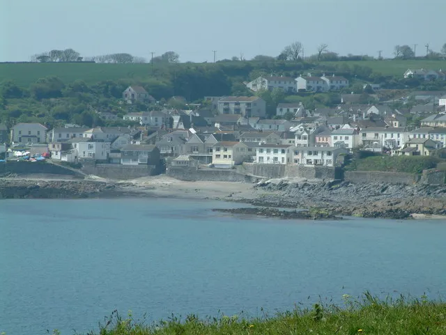
Portscatho works well as a base: 15 minutes from Falmouth, 24km from Wheal Coates.
Portscatho is in England, United Kingdom, with about 1,500 people. You drive on the left here. The nearest town is Falmouth, about 7 km away.
Portscatho (Cornish: Porthskathow) is a coastal village on the Roseland Peninsula in Cornwall, England, United Kingdom. The village adjoins Gerrans (the villages have almost merged into one but retain their identities) on the east side of the peninsula, about seven miles (11 km) south-southeast of Truro. It has anRead more estimated population of 1,500 people.
Portscatho lies within the Cornwall Area of Outstanding Natural Beauty (AONB).
The name Portscatho comes from the Cornish language words porth, meaning 'harbour' or 'cove', and skathow, meaning 'boats'.
Portscatho is also known for the creation of the "portbomb", which combines ruby port with energy drink and is taken as a shot.
Off-grid beach shack above Porthcurnick Beach on the Roseland Peninsula, cooking over fire for a queue that snakes along the coast path. Its summer feast nights sell out in minutes; a 500m walk from the car park.
1 km · about 5 min drive
landmark
St Mawes
A sheltered sailing village on the Roseland peninsula, guarded by Henry VIII's clover-leaf artillery fort.
4 km · about 5 min drive
landmark
The Lost Gardens of Heligan
A Victorian estate garden abandoned after the First World War and restored from the 1990s, with jungle valley and productive gardens.
17 km · about 20 min drive
scenic viewpoint
St Agnes Head
A cliff-top headland on Cornwall's north coast with ruined engine houses of the tin mining World Heritage Site along the shore.
24 km · about 30 min drive
ancient ruins
Wheal Coates
A ruined tin mine engine house perched on the cliff at St Agnes, one of Cornwall's most photographed industrial landmarks.
24 km · about 25 min drive
landmark
Eden Project
Spectacular complex of enormous biome domes nestled in a former clay pit, housing the world's largest indoor rainforest.
26 km · about 30 min drive
beach
Holywell Bay
A wide dune-backed surfing beach with the Gull Rocks offshore, used as a filming location for Poldark.
27 km · about 30 min drive
scenic viewpoint
Lizard Point
The most southerly point of mainland Britain, with dramatic serpentine rock formations and a historic lighthouse.
29 km · about 35 min drive
Driving roads near Portscatho
24 kmSt Agnes HeadA cliff-top headland on Cornwall's north coast with ruined engine houses of the tin mining World Heritage Site along the shore.
29 kmLizard PointThe most southerly point of mainland Britain, with dramatic serpentine rock formations and a historic lighthouse.
35 kmBedruthan StepsGiant rock stacks marching across a wild sandy beach below towering cliffs on the rugged north Cornwall coast.
36 kmPark HeadA National Trust headland just north of Bedruthan Steps with wide views over the stacks and the Atlantic.
42 kmB3306 St Ives to Land's EndA narrow granite-walled road along Cornwall's wild north-west coast past Zennor and Pendeen, slow but stunning.
47 kmThe RumpsA twin-headed promontory near Polzeath ringed by Iron Age ramparts, with a fine short walk from Pentire Point.