Pontlliw works well as a base: 10 minutes from Morriston, 21km from Black Mountain Pass (A4069).
Pontlliw is in Wales, United Kingdom, with about 1,600 people. You drive on the left here. The nearest town is Morriston, about 6 km away.
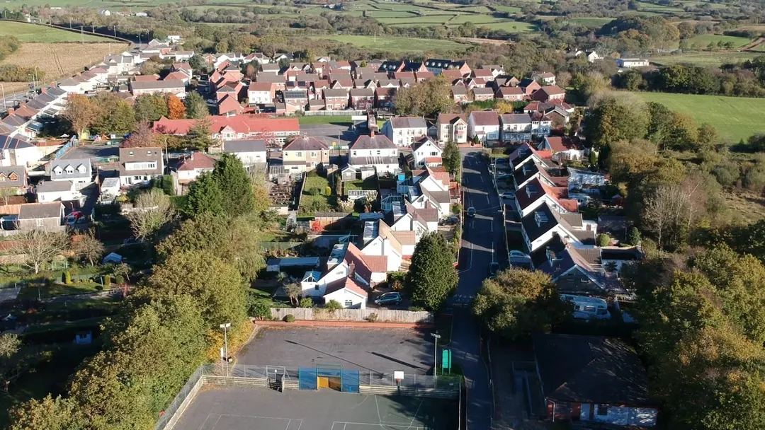
Pontlliw (Welsh spelling: Pont-lliw) is a village in the community of Pontlliw and Tircoed, part of the City and County of Swansea in Wales. The village is located near Pontarddulais, off Junction 47 of the M4 motorway.
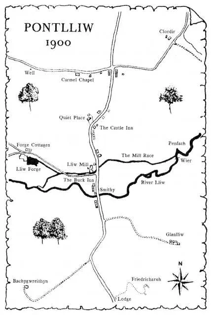
The name of the village comes from the Welsh word for bridge (pont) and the name of the River LliwRead more which runs through the village.
The Pontlliw and Tircoed community has an elected community council and has a population of 2,075. The village itself had a population of around 1,645 in 2011.
Pontlliw has a primary school, as well as a number of small businesses such as a newsagent, Post Office, a restaurant and public house – The Buck and an Indian restaurant – Rasoi.
Pontlliw has one active chapel, Carmel Baptist, which runs activities throughout the week in both Welsh and English.
The village also is home to Pontarddulais Golf Club – which lies within the boundaries of Pontlliw despite its name featuring neighbouring village Pontarddulais. The 9-hole course opened in the 1990s under the name Allt y Graban.
Pontlliw Village Hall is regularly used to stage theatrical performances and concerts as well as classes run by local groups.
Triple limestone peaks guard a sweep of sand where Pennard Pill meanders to the sea on the Gower: repeatedly voted among Britain's best beaches yet reached only on foot past a ruined castle. View from Pennard cliffs is the classic.
15 km · about 30 min drive
famous road
Black Mountain Pass (A4069)
Top Gear's favourite British road, a smooth, empty ribbon of hairpins and open bends over the western Brecon Beacons between Llangadog and Brynamman.
21 km · about 25 min drive
waterfall
Melincourt Falls
An 24m fall in the Neath Valley painted by Turner in 1795, reached by a short riverside path.
21 km · about 25 min drive
racetrack
Pembrey Circuit
Wales's national motorsport centre on the Carmarthenshire coast, a fast former-airfield circuit once used by F1 teams including McLaren and Williams for secret testing.
22 km · about 25 min drive
beach
Rhossili Bay
A sweeping three-mile beach on the Gower Peninsula with dramatic cliff views, Worm's Head promontory, and powerful surf.
24 km · about 25 min drive
waterfall
Henrhyd Falls
At 27m the highest waterfall in south Wales, and the Batcave entrance in The Dark Knight Rises; reached by a steep wooded path.
26 km · about 30 min drive
natural wonder
Worm's Head, Rhossili
A serpentine tidal island at the tip of Gower, crossable over a rock causeway for about two and a half hours either side of low tide.
26 km · about 30 min drive
natural wonder
Llyn y Fan Fach
A glacial corrie lake under the escarpment of the Black Mountain, home to the legend of the Lady of the Lake and the Physicians of Myddfai.
29 km · about 35 min drive
Driving roads near Pontlliw
21 kmBlack Mountain Pass (A4069)Top Gear's favourite British road, a smooth, empty ribbon of hairpins and open bends over the western Brecon Beacons between Llangadog and Brynamman.
44 kmCorn DuPen y Fan's twin summit at 873m, with a Bronze Age cairn and the finest view over the Beacons' north escarpment.
45 kmPen y FanThe highest peak in southern Britain at 886 metres, the flat-topped summit of the Brecon Beacons offering sweeping views across Wales.
53 kmCountisbury HillA long 1-in-4 climb on the A39 out of Lynmouth onto Exmoor, with sweeping views over the Bristol Channel.
59 kmAbergwesyn Pass (Devil's Staircase)Remote 16-mile single-track mountain road from Abergwesyn to Tregaron over the Cambrian Desert, its Devil's Staircase section stacking hairpins at 20%+ gradients. One of the emptiest drives in Britain. No fuel, little signal.
60 kmPorlock HillBritain's steepest A-road, where the A39 climbs out of Porlock onto Exmoor at gradients up to 1-in-4 with two severe hairpins. A scenic Victorian toll road offers a gentler coastal alternative.