
PYRTPlan Your Road Trips
Create TripCommunityMerchandise
PYRTPlan Your Road Trips
Create TripCommunityMerchandise
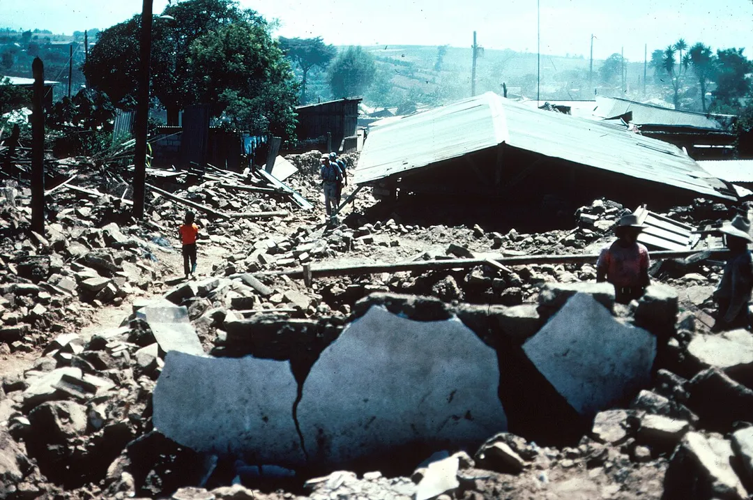
Photo of Patzicía
"Guatemala Earthquake 1976. Typical street view in Patzicia, showing adobe block rubble which is all that remains of the houses that formerly lined this street. The adobe block buildings had very little resistance to horizontal forces and most of them were completely destroyed. Collapse of the heavy adobe walls, roof tiles and beams caused most of the casualties. Many of the adobe blocks are still intact but the mortar between the blocks failed during the seismic shaking. 1976. Slide 43, U.S. Geological Survey Open-File Report 77-165."

Note: this was from the earthquake of 4 February, 1976.
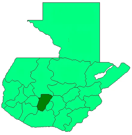
Coat of Patcicia
Photo by No machine-readable author provided. Danny~commonswiki assumed (based on copyright claims).
Destinations
Home›Destinations›Patzicía
North AmericaGuatemalaChimaltenango

Patzicía

Chimaltenango, Guatemala · North America

About Patzicía

Patzicía is worth a stop: 10 minutes from Zaragoza, 28km from Lake Atitlan.

Patzicía is in Chimaltenango, Guatemala, with about 21,000 people. The nearest town is Zaragoza, about 4 km away.

Patzicía (Spanish pronunciation: [patsiˈsi.a]) is a city and a municipality in the Chimaltenango department of Guatemala. It covers an area of approximately 69.86 km2 (26.97 sq mi). As per 2023 estimates, it has a population of about 41,571 inhabitants.

Read more on Wikipedia

Where to Stay in Patzicía

Compare prices across Booking.com, Airbnb, Expedia, and more. Select your dates to see availability.

Filter presets

Pick your must-haves once: provider links open pre-filtered. Each filter lists which sites it applies to.

Booking.comExpediaTripAdvisorHotels.comAgodaAirbnb

Compare before you book!

Prices can vary significantly between platforms. We recommend checking at least 2-3 sites to find the best deal for your stay in Patzicía.

Explore the Area

Discover famous landmarks, scenic roads, and more near Patzicía.

Loading map...
Open in Google Maps

Frequently Asked Questions

What is there to see near Patzicía?

Within an hour or so of Patzicía: Acatenango (16 km), Antigua Guatemala (22 km), Lake Atitlan (28 km), San Pedro La Laguna (38 km).

Are there any good drives near Patzicía?

The nearest famous roads are Ruta de las Flores.

Where is Patzicía?

Patzicía is in Chimaltenango, Guatemala, about 4 km from Zaragoza.

Road trip

Drive to Patzicía

Add it as a stop and the planner works out the driving, the nights and what's worth seeing on the way.

Start planning

What's nearby?

Swipe through places to go

Places within a drive of Patzicía. Keep the ones you like and add them to your trip.

Explore now

Quick Information

Population
21,249
Continent
North America
Country
Guatemala
Region
Chimaltenango
Timezone
America/Guatemala
Coordinates
14.6319, -90.9266

Tags

North AmericaGuatemalaChimaltenangoTown

Worth the detour from Patzicía

6 notable places within an hour's drive.

scenic viewpoint

Acatenango

A 3,976 m stratovolcano near Antigua climbed overnight so hikers can camp on the ridge and watch neighbouring Volcán de Fuego erupt through the night: one of the most reliable live-eruption views on earth.

16 km · about 30 min drive

landmark

Antigua Guatemala

A UNESCO colonial city framed by volcanoes, filled with cobblestone streets, pastel-colored buildings, and stunning ruined churches.

22 km · about 25 min drive

natural wonder

Lake Atitlan

A breathtaking volcanic lake surrounded by three towering volcanoes and traditional Mayan villages, often called the most beautiful lake in the world.

28 km · about 35 min drive

landmark

San Pedro La Laguna

A backpacker and artist hub on Lake Atitlán's shores beneath San Pedro Volcano, known for Spanish schools and Tz'utujil Maya culture.

38 km · about 45 min drive

landmark

Chichicastenango Market

Central America's largest indigenous market held every Thursday and Sunday, overflowing with textiles, masks, flowers, and Maya rituals.

40 km · about 45 min drive

natural wonder

Pacaya Volcano

An active volcano near Antigua Guatemala where hikers can roast marshmallows on volcanic vents and see glowing lava flows.

45 km · about 50 min drive

Driving roads near Patzicía

  • 16 kmAcatenangoA 3,976 m stratovolcano near Antigua climbed overnight so hikers can camp on the ridge and watch neighbouring Volcán de Fuego erupt through the night: one of the most reliable live-eruption views on earth.

When to drive here

Year-round

Tropical latitude: plan around the wet season rather than temperature.

Nearby Destinations

Other places to explore near Patzicía.

Santa Cruz Balanyá

🇬🇹 Guatemala

6 km awayPop. 7,825

Acatenango

🇬🇹 Guatemala

9 km awayPop. 12,136

San Andrés Itzapa

🇬🇹 Guatemala

9 km awayPop. 24,992

Chimaltenango

🇬🇹 Guatemala

12 km awayPop. 96,985

Comalapa

🇬🇹 Guatemala

13 km awayPop. 32,312

Yepocapa

🇬🇹 Guatemala

15 km awayPop. 34,948

Tecpán Guatemala

🇬🇹 Guatemala

16 km awayPop. 34,519

Santa Apolonia

🇬🇹 Guatemala

18 km awayPop. 2,396

Plan a trip around Patzicía

North America road trip planner

Your trip starts here

Plan a road trip from Patzicía.

Pick the days, drop in the stops, and share it with whoever's coming.

Start planning
PYRT

The ultimate road trip planning platform. Discover 150,000+ destinations worldwide, plan scenic routes, and create unforgettable adventures.

Inspiration

  • Discover Trips
  • Travel Guides
  • Community

The Product

  • Calendar Planner
  • Integrations
  • How It Works
  • Collaboration Mode
  • Get the App
  • Merchandise: PYRT Supply Co.
  • Become a Creator
  • Trip Marketplace

Plan Your Trip

  • Road Trip Planner
  • Famous Routes
  • Drive Times & Distances
  • Planners by Country
  • Best Road Trip Planner App
  • Discover Road Trips
  • Events
  • Travel Guides
  • How It Works
  • My Trips
  • Community Groups

Company

  • Terms of Service
  • Privacy Policy
  • About PYRT
  • Support
  • Contact Us
  • Sign In
  • Create Account

© 2026 Plan Your Road Trips. All rights reserved.

•[email protected]
Data sources:GeoNames (CC BY 4.0)•Wikimedia Commons (CC BY-SA)•Mapbox•Photography: George Lawrence