
natural wonder
El Boquerón Crater
The 1.5-km-wide crater of San Salvador Volcano, reached by a scenic road climbing from the capital to 1,800 m: peer into the perfect cinder cone left by the 1917 eruption.
18 km · about 20 min drive
San Salvador Department, El Salvador · North America
Panchimalco is worth a stop: 10 minutes from Rosario de Mora, 18km from El Boquerón Crater.
Panchimalco is in San Salvador Department, El Salvador, with about 6,800 people. The nearest town is Rosario de Mora, about 5 km away.
Panchimalco is a town in the San Salvador department of El Salvador.
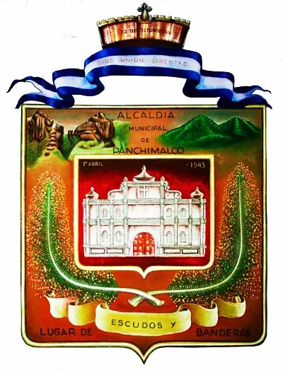
Panchimalco ("The Place of Flags and Shields," from the Nahuatl, "Pantli," meaning banner or flag; "Chimalli," meaning shield or herald, and "co," place) Its 35,000 inhabitants, sometimes called "Panchos," are descendants of Nahua Indians fleeing theRead more
Spanish takeover of San Salvador during the 16th century, into areas originally inhabited by Mayan and Nahuatl peoples.
Compare prices across Booking.com, Airbnb, Expedia, and more. Select your dates to see availability.
Pick your must-haves once: provider links open pre-filtered. Each filter lists which sites it applies to.
Compare before you book!
Prices can vary significantly between platforms. We recommend checking at least 2-3 sites to find the best deal for your stay in Panchimalco.
Discover famous landmarks, scenic roads, and more near Panchimalco.
Within an hour or so of Panchimalco: El Boquerón Crater (18 km), El Tunco (26 km), Joya de Cerén (30 km), Suchitoto (39 km).
The nearest famous roads are Ruta de las Flores.
Panchimalco is in San Salvador Department, El Salvador, about 5 km from Rosario de Mora.
Road trip
Add it as a stop and the planner works out the driving, the nights and what's worth seeing on the way.
Start planningSwipe through places to go
Places within a drive of Panchimalco. Keep the ones you like and add them to your trip.
6 notable places within an hour's drive.
natural wonder
The 1.5-km-wide crater of San Salvador Volcano, reached by a scenic road climbing from the capital to 1,800 m: peer into the perfect cinder cone left by the 1917 eruption.
18 km · about 20 min drive
beach
El Salvador's top surf beach with a distinctive pig-shaped rock formation, vibrant nightlife, and consistent Pacific waves.
26 km · about 30 min drive
ancient ruins
A UNESCO site known as the Pompeii of the Americas, a Maya farming village preserved under volcanic ash from the 6th century.
30 km · about 35 min drive
landmark
El Salvador's best-preserved colonial town: cobbled streets and a white timber-columned church above Lake Suchitlán, a reservoir that draws huge flocks of migratory birds each winter.
39 km · about 45 min drive
natural wonder
A stunning volcanic crater lake in western El Salvador with turquoise water, surrounded by forested hills and lakeside restaurants.
48 km · about 55 min drive
scenic viewpoint
El Salvador's highest volcano, whose nested craters hold a sulphurous turquoise lake. A two-hour guided hike from Cerro Verde car park ends on a rim looking down at the acid lake and across to Izalco and Lake Coatepeque.
55 km · about 65 min drive
Year-round
Tropical latitude: plan around the wet season rather than temperature.
Other places to explore near Panchimalco.
Your trip starts here
Pick the days, drop in the stops, and share it with whoever's coming.