

waterfall
Low Force, Teesdale
A set of broad falls on the Tees above Bowlees, crossed by the Wynch Bridge, an early chain suspension footbridge.
2 km · about 5 min drive
England, United Kingdom · Europe
Newbiggin works well as a base: 10 minutes from Mickleton, 19km from A689 Alston to Stanhope (Weardale).
Newbiggin is in England, United Kingdom. You drive on the left here. The nearest town is Mickleton, about 7 km away.
Newbiggin is a village and civil parish in County Durham, England. At the 2011 census the parish had a population of 146. It is situated on the north side of Teesdale, opposite Holwick. An influx of Derbyshire lead miners into the area in the late 18th century may have brought the name from Biggin. The village isRead more
within the North Pennines Area of Outstanding Natural Beauty (AONB).
The village of Newbiggin is up the River Tees from the incredible High Force, one of England's most impressive waterfalls. The hamlet of Bowlees is close by, as is the landfrom of Coldberry Gutter.
Newbiggin was formerly a township in the parish of Middleton-in-Teesdale, but in 1866 became a separate civil parish.
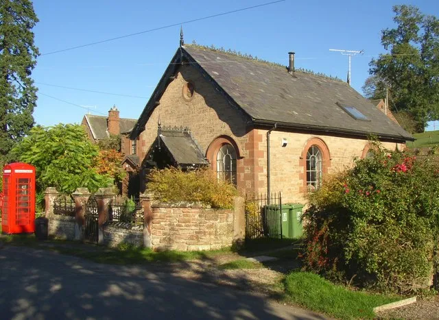
A Methodist chapel was built in the village in 1760. It is now a holiday let known as Newbiggin Chapel. For many years it was said to be one of the oldest Methodist chapel in continuous use. It is a Grade II listed building.
In February 2022 Robert Hooper, a local farmer, was cleared of dangerous driving and criminal damage, after using a telehandler with forks, to remove a parked car from a lane outside his farm, flipping it and pushing it on its side.
Compare prices across Booking.com, Airbnb, Expedia, and more. Select your dates to see availability.
Pick your must-haves once: provider links open pre-filtered. Each filter lists which sites it applies to.
Compare before you book!
Prices can vary significantly between platforms. We recommend checking at least 2-3 sites to find the best deal for your stay in Newbiggin.
Discover famous landmarks, scenic roads, and more near Newbiggin.
Within an hour or so of Newbiggin: Low Force, Teesdale (2 km), High Force Waterfall (3 km), High Force (3 km), High Cup Nick (18 km).
The nearest famous roads are A689 Alston to Stanhope (Weardale), Hartside Pass (A686) and B6270 Swaledale.
Newbiggin is in England, United Kingdom, about 7 km from Mickleton.
Road trip
Add it as a stop and the planner works out the driving, the nights and what's worth seeing on the way.
Start planningSwipe through places to go
Places within a drive of Newbiggin. Keep the ones you like and add them to your trip.
Essential numbers in United Kingdom
112 also works. NHS non-emergency medical advice: 111. National Highways breakdown assistance on motorways: 0300 123 5000.
Full driving guide for United Kingdom8 notable places within an hour's drive.
waterfall
A set of broad falls on the Tees above Bowlees, crossed by the Wynch Bridge, an early chain suspension footbridge.
2 km · about 5 min drive
waterfall
England's largest waterfall by volume, plunging 21 metres over the Whin Sill escarpment in a cloud of spray in Upper Teesdale.
3 km · about 5 min drive
waterfall
A 21m waterfall where the Tees drops over the Whin Sill dolerite, one of England's most powerful falls.
3 km · about 5 min drive
scenic viewpoint
A perfect U-shaped glacial valley in the North Pennines rimmed by dolerite columns, reached by a walk from Dufton.
18 km · about 20 min drive
famous road
A remote high Pennine road over Killhope with wide moorland views and almost no traffic; England's highest market town at one end.
19 km · about 20 min drive
cafe
Britain's highest pub at 1,732 feet in the Yorkshire Dales, a remote and atmospheric destination for drivers and walkers braving the wild moorland roads.
21 km · about 25 min drive
famous road
Voted one of Britain's best drives - a sweeping climb to 580m out of the Eden Valley with a panorama to the Lake District and the Solway.
28 km · about 30 min drive
famous road
The narrow dale road from Richmond to Nateby past Gunnerside and Keld, drystone walls and barns the whole way.
29 km · about 35 min drive
8 named roads, passes and coastal drives within 60km.
April to October
Other places to explore near Newbiggin.
Your trip starts here
Pick the days, drop in the stops, and share it with whoever's coming.