PYRTPlan Your Road Trips
Create TripCommunityMerchandise
PYRTPlan Your Road Trips
Create TripCommunityMerchandise
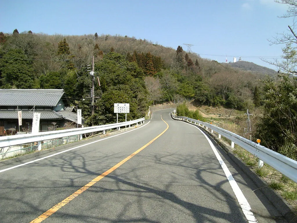
信貴生駒スカイライン、暗峠付近
The Tsugaru Iwaki Skyline is a toll road in northern Japan, which partially ascends Mount Iwaki stratovolcano, and is notable for its steep gradient and 69 hairpin turns. The road ascends 806 meters over an average gradient of 8.66%, with some sections going up to 10%. The Tsugaru Iwaki Skyline has been considered one of the most dangerous mountain roads in the world. (Wikipedia) The image was acquired May 26, 2015, and is located at 40.6 degrees north, 140.3 degrees east.
A snow-covered Quebec City skyline in fog.
Photo by User:Kansai explorer
Destinations
Home›Destinations›Nakatsu
AsiaJapanOita

Nakatsu

Oita, Japan · Asia

About Nakatsu

Nakatsu is worth a stop: 10 minutes from Buzen, 40km from Beppu Hells (Jigoku Meguri).

Nakatsu is in Oita, Japan, with about 85,000 people. You drive on the left here. The nearest town is Buzen, about 6 km away.

Nakatsu (中津市, Nakatsu-shi) is a city on the northern border of Ōita Prefecture in Kyushu, Japan. As of 31 October 2023, the city had an estimated population of 82,301 in 41,222 households, and a population density of 96 persons per km2. The total area of the city is 491.53 km2 (189.78 sq mi).

Read more on Wikipedia

Where to Stay in Nakatsu

Compare prices across Booking.com, Airbnb, Expedia, and more. Select your dates to see availability.

Filter presets

Pick your must-haves once: provider links open pre-filtered. Each filter lists which sites it applies to.

Booking.comExpediaTripAdvisorHotels.comAgodaAirbnb

Compare before you book!

Prices can vary significantly between platforms. We recommend checking at least 2-3 sites to find the best deal for your stay in Nakatsu.

Explore the Area

Discover famous landmarks, scenic roads, and more near Nakatsu.

Loading map...
Open in Google Maps

Frequently Asked Questions

What is there to see near Nakatsu?

Within an hour or so of Nakatsu: Aonodōmon (11 km), Beppu Hells (Jigoku Meguri) (40 km), Kawachi Wisteria Garden (45 km), Tsuetate Onsen (48 km).

Where is Nakatsu?

Nakatsu is in Oita, Japan, about 6 km from Buzen.

Road trip

Drive to Nakatsu

Add it as a stop and the planner works out the driving, the nights and what's worth seeing on the way.

Start planning

What's nearby?

Swipe through places to go

Places within a drive of Nakatsu. Keep the ones you like and add them to your trip.

Explore now

Quick Information

Population
84,701
Continent
Asia
Country
Japan
Region
Oita
Timezone
Asia/Tokyo
Coordinates
33.5981, 131.1883

Emergency & Services

Essential numbers in Japan

Police
110
Ambulance
119
Fire
119
Driving side
left

Japan Helpline (24h English assistance): 0570-000-911. An International Driving Permit (1949 convention) is required to drive.

Full driving guide for Japan

Tags

AsiaJapanOitaTown

Worth the detour from Nakatsu

6 notable places within an hour's drive.

tunnel

Aonodōmon

A tunnel hand-cut through a cliff on the Yamakuni River, begun by the monk Zenkai in 1735 and reputedly dug over three decades to spare travellers a lethal chain path. Sections of the original chiselled bore survive alongside the road.

11 km · about 20 min drive

natural wonder

Beppu Hells (Jigoku Meguri)

A collection of spectacular hot spring vents in Beppu producing steaming pools of vivid blue, red, and milky-white water.

40 km · about 45 min drive

photogenic

Kawachi Wisteria Garden

A private hillside garden near Kitakyushu with two long tunnels of trained wisteria in some twenty colours, flowering for a few weeks in late April and early May. Entry is by advance dated ticket.

45 km · about 50 min drive

landmark

Tsuetate Onsen

A narrow ravine village straddling the Kumamoto–Oita border where steam vents rise between old wooden inns and footbridges. In spring hundreds of carp streamers are strung across the gorge.

48 km · about 55 min drive

waterfall

Nabegataki Falls

A broad, low curtain of water falling from an overhanging ledge, allowing visitors to walk along a path behind the entire span of the fall. A short descent from the car park in northern Kumamoto.

53 km · about 60 min drive

landmark

Kurokawa Onsen

A hot-spring village in the Aso highlands that banned neon and concrete facades, so wooden inns and stone-walled riverside baths dominate. A single wooden pass grants entry to three open-air baths of your choice.

58 km · about 65 min drive

Driving roads near Nakatsu

  • Right hereAonodōmonA tunnel hand-cut through a cliff on the Yamakuni River, begun by the monk Zenkai in 1735 and reputedly dug over three decades to spare travellers a lethal chain path. Sections of the original chiselled bore survive alongside the road.

Nearby Destinations

Other places to explore near Nakatsu.

Yoshitomi

🇯🇵 Japan

1 km awayPop. 6,875

Buzen

🇯🇵 Japan

6 km awayPop. 26,886

Harai

🇯🇵 Japan

9 km awayPop. 7,251

Tsukawaki

🇯🇵 Japan

36 km awayPop. 18,371

Tagawa

🇯🇵 Japan

36 km awayPop. 51,608

Hita

🇯🇵 Japan

38 km awayPop. 64,874

Ube

🇯🇵 Japan

39 km awayPop. 173,733

Hiji

🇯🇵 Japan

41 km awayPop. 28,524

Plan a trip around Nakatsu

Asia road trip planner

Your trip starts here

Plan a road trip from Nakatsu.

Pick the days, drop in the stops, and share it with whoever's coming.

Start planning
PYRT

The ultimate road trip planning platform. Discover 150,000+ destinations worldwide, plan scenic routes, and create unforgettable adventures.

Inspiration

  • Discover Trips
  • Travel Guides
  • Community

The Product

  • Calendar Planner
  • Integrations
  • How It Works
  • Collaboration Mode
  • Get the App
  • Merchandise: PYRT Supply Co.
  • Become a Creator
  • Trip Marketplace

Plan Your Trip

  • Road Trip Planner
  • Famous Routes
  • Drive Times & Distances
  • Planners by Country
  • Best Road Trip Planner App
  • Discover Road Trips
  • Events
  • Travel Guides
  • How It Works
  • My Trips
  • Community Groups

Company

  • Terms of Service
  • Privacy Policy
  • About PYRT
  • Support
  • Contact Us
  • Sign In
  • Create Account

© 2026 Plan Your Road Trips. All rights reserved.

•[email protected]
Data sources:GeoNames (CC BY 4.0)•Wikimedia Commons (CC BY-SA)•Mapbox•Photography: George Lawrence