
mountain pass
Macquarie Pass
A twisting rainforest climb on the Illawarra Highway, hauling drivers 400 m up the escarpment between Albion Park and the Southern Highlands through 100-plus curves.
21 km · about 25 min drive
New South Wales, Australia · Oceania
Mount Kembla works well as a base: 5 minutes from Unanderra, 21km from Macquarie Pass.
Mount Kembla is in New South Wales, Australia, with about 1,000 people. You drive on the left here. The nearest town is Unanderra, about 4 km away.
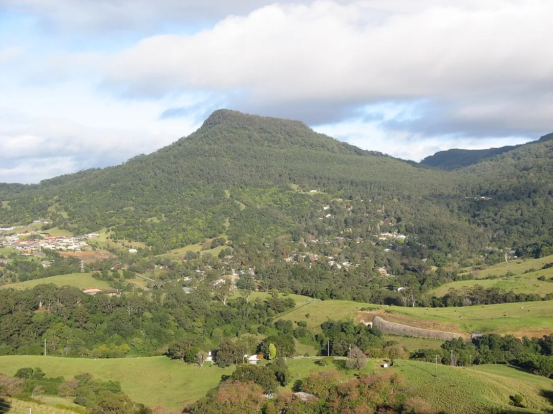
Mount Kembla is a suburb and a mountain in the Illawarra region of New South Wales, Australia. Mount Kembla is 6 kilometres (4 miles) west of Wollongong and 72 kilometres (45 miles) south of Sydney in the City of Wollongong.
The suburb is a semi-rural township of Wollongong. It is named after the adjacent MountRead more
Kembla, which is located on the Illawarra escarpment. The summit has an elevation of 534 metres (1,752 ft) above sea level.
The name Mount Kembla is derived from an Aboriginal word, kembla, meaning "plenty of game". The satellite localities of Kembla Heights, Windy Gully, Cordeaux Valley and Kembla Village are also parts of the suburb of Mount Kembla, which at the time of the 2021 census, had a population of 1,083.
The area surrounding Mount Kembla is a coal mining area, notable for the Mount Kembla Mine disaster of 1902 in which 96 people died.
Compare prices across Booking.com, Airbnb, Expedia, and more. Select your dates to see availability.
Pick your must-haves once: provider links open pre-filtered. Each filter lists which sites it applies to.
Compare before you book!
Prices can vary significantly between platforms. We recommend checking at least 2-3 sites to find the best deal for your stay in Mount Kembla.
Discover famous landmarks, scenic roads, and more near Mount Kembla.
Within an hour or so of Mount Kembla: Macquarie Pass (21 km), Sea Cliff Bridge (24 km), Robertson Pie Shop (25 km), Grand Pacific Drive (27 km).
The nearest famous roads are Macquarie Pass and Grand Pacific Drive.
Mount Kembla is in New South Wales, Australia, about 4 km from Unanderra.
Road trip
Add it as a stop and the planner works out the driving, the nights and what's worth seeing on the way.
Start planningSwipe through places to go
Places within a drive of Mount Kembla. Keep the ones you like and add them to your trip.
Essential numbers in Australia
112 works from mobiles. Distances between fuel stops in the outback can exceed 200 km: plan ahead. Wildlife is most active at dawn/dusk.
Full driving guide for Australia6 notable places within an hour's drive.
mountain pass
A twisting rainforest climb on the Illawarra Highway, hauling drivers 400 m up the escarpment between Albion Park and the Southern Highlands through 100-plus curves.
21 km · about 25 min drive
bridge
A 665 m balanced-cantilever bridge that curves off the Illawarra escarpment and hangs over the Pacific, the photogenic centrepiece of Grand Pacific Drive south of Sydney.
24 km · about 30 min drive
cafe
A Southern Highlands roadside pie shop on the Illawarra Highway, operating since 1968 and long the mandatory stop for anyone driving between Sydney and the coast via Macquarie Pass.
25 km · about 30 min drive
coastal drive
140 km coastal route from the Royal National Park to Wollongong and beyond, sweeping past Bald Hill's hang-glider lookout, seaside villages and the famous Sea Cliff Bridge.
27 km · about 30 min drive
scenic viewpoint
Clifftop lookout and hang-gliding launch at Stanwell Tops overlooking the Sea Cliff Bridge and Illawarra coastline, with roadside parking.
27 km · about 30 min drive
bridge
Sandstone-towered suspension bridge from 1898 carrying Moss Vale Road over the Kangaroo River, the oldest of its type still in use in Australia.
43 km · about 50 min drive
Other places to explore near Mount Kembla.
Your trip starts here
Pick the days, drop in the stops, and share it with whoever's coming.