PYRTPlan Your Road Trips
Create TripCommunityMerchandise
PYRTPlan Your Road Trips
Create TripCommunityMerchandise
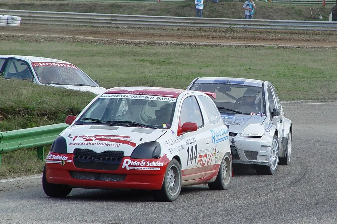
Rally Cross Duivelsbergcircuit Maasmechelen
2014-07-26 in Maasmechelen.
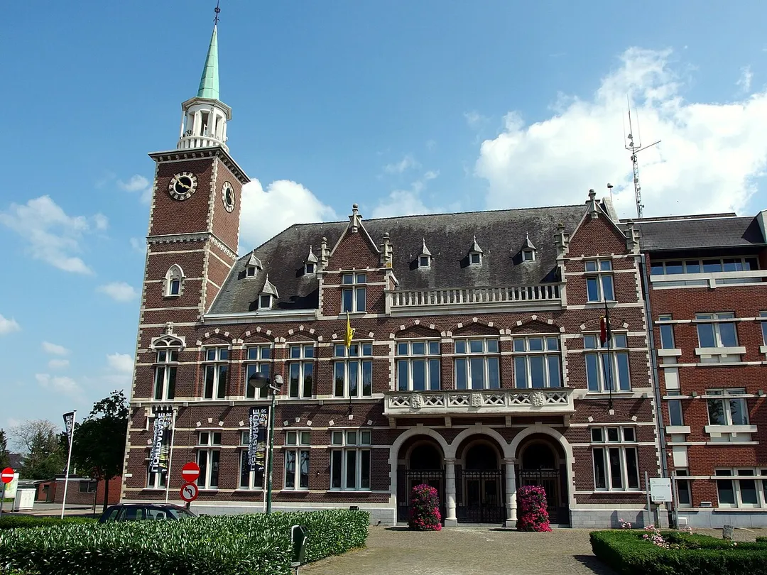
This photo of immovable heritage has been taken in the Flemish Region
Photo by Maarten Van Camp
Destinations
Home›Destinations›Mechelen-aan-de-Maas
EuropeBelgiumFlanders

Mechelen-aan-de-Maas

Flanders, Belgium · Europe

About Mechelen-aan-de-Maas

Mechelen-aan-de-Maas works well as a base: 10 minutes from Leut, 3km from Hoge Kempen National Park.

Mechelen-aan-de-Maas is in Flanders, Belgium, with about 15,000 people. You drive on the right here. The nearest town is Leut, about 4 km away.

Where to Stay in Mechelen-aan-de-Maas

Compare prices across Booking.com, Airbnb, Expedia, and more. Select your dates to see availability.

Filter presets

Pick your must-haves once: provider links open pre-filtered. Each filter lists which sites it applies to.

Booking.comExpediaTripAdvisorHotels.comAgodaAirbnb

Compare before you book!

Prices can vary significantly between platforms. We recommend checking at least 2-3 sites to find the best deal for your stay in Mechelen-aan-de-Maas.

Explore the Area

Discover famous landmarks, scenic roads, and more near Mechelen-aan-de-Maas.

Loading map...
Open in Google Maps

Frequently Asked Questions

What is there to see near Mechelen-aan-de-Maas?

Within an hour or so of Mechelen-aan-de-Maas: Hoge Kempen National Park (3 km), Vrijthof Maastricht (13 km), Valkenburg Marl Caves (15 km), Thorn (24 km).

Are there any good drives near Mechelen-aan-de-Maas?

The nearest famous roads are Baraque de Fraiture, Chimay Street Circuit and Mosel Valley Wine Route.

Where is Mechelen-aan-de-Maas?

Mechelen-aan-de-Maas is in Flanders, Belgium, about 4 km from Leut.

Road trip

Drive to Mechelen-aan-de-Maas

Add it as a stop and the planner works out the driving, the nights and what's worth seeing on the way.

Start planning

What's nearby?

Swipe through places to go

Places within a drive of Mechelen-aan-de-Maas. Keep the ones you like and add them to your trip.

Explore now

Quick Information

Population
15,374
Continent
Europe
Country
Belgium
Region
Flanders
Timezone
Europe/Brussels
Coordinates
50.9659, 5.6914

Emergency & Services

Essential numbers in Belgium

Police
101
Ambulance
112
Fire
112
All emergencies
112
Driving side
right
Full driving guide for Belgium

Tags

EuropeBelgiumFlandersTown

Worth the detour from Mechelen-aan-de-Maas

8 notable places within an hour's drive.

national park

Hoge Kempen National Park

Belgium's first national park, a heath and pine landscape in Limburg with six gateway entrances and visitor car parks.

3 km · about 5 min drive

landmark

Vrijthof Maastricht

A grand cafe-ringed square anchored by two medieval churches in the Netherlands' oldest, most Burgundian city.

13 km · about 25 min drive

landmark

Valkenburg Marl Caves

Hill-country Valkenburg hides Roman-era marl tunnels, a ruined castle and the Netherlands' only true hilltop drives.

15 km · about 30 min drive

landmark

Thorn

The 'white village' of Limburg: an entire former abbey-principality of whitewashed brick lanes and cobbles beside the Maas, painted white in the Napoleonic era to dodge a window tax and kept that way ever since.

24 km · about 30 min drive

racetrack

Circuit Zolder

A Belgian circuit tragically linked to Gilles Villeneuve's death in 1982, with a rich history in Formula 1 and touring car racing.

31 km · about 35 min drive

scenic viewpoint

Vaalserberg Drielandenpunt

The Netherlands' highest mainland point at 322.4 metres, where the Dutch, Belgian and German borders meet near Vaals.

33 km · about 40 min drive

cathedral

Aachen Cathedral (Aachener Dom)

The first UNESCO World Heritage Site in Germany, built by Charlemagne as his palatine chapel in the 9th century.

35 km · about 40 min drive

scenic viewpoint

Gileppe Dam

A 19th-century dam near Spa crowned by a 13-ton stone lion, with a 78 m panorama tower and forested Ardennes reservoir views a short detour off the Verviers road.

46 km · about 55 min drive

Driving roads near Mechelen-aan-de-Maas

  • 33 kmVaalserberg DrielandenpuntThe Netherlands' highest mainland point at 322.4 metres, where the Dutch, Belgian and German borders meet near Vaals.
  • 46 kmGileppe DamA 19th-century dam near Spa crowned by a 13-ton stone lion, with a 78 m panorama tower and forested Ardennes reservoir views a short detour off the Verviers road.
  • 59 kmSignal de BotrangeAt 694m this is the highest point in Belgium, marked by a stone tower on the Hautes Fagnes plateau.
  • 80 kmBaraque de FraitureBelgium's second-highest point at 652 m, a windswept Ardennes plateau crossroads on the N89 with a small ski station and sweeping high-fen scenery.

Driving in Belgium

Drives on
the right
Petrol
~€1.74/litre
Motorway tolls
None

When to drive here

April to October

Nearby Destinations

Other places to explore near Mechelen-aan-de-Maas.

Maasmechelen

🇧🇪 Belgium

0 km awayPop. 36,251

Vucht

🇧🇪 Belgium

2 km awayPop. 3,410

Eisden

🇧🇪 Belgium

3 km awayPop. 10,152

Leut

🇧🇪 Belgium

4 km awayPop. 1,599

Stein

🇳🇱 Netherlands

5 km awayPop. 11,290

Nieuwdorp

🇳🇱 Netherlands

6 km awayPop. 2,445

Kerensheide

🇳🇱 Netherlands

6 km awayPop. 2,740

Urmond

🇳🇱 Netherlands

6 km awayPop. 3,560

Plan a trip around Mechelen-aan-de-Maas

Europe road trip planner

Your trip starts here

Plan a road trip from Mechelen-aan-de-Maas.

Pick the days, drop in the stops, and share it with whoever's coming.

Start planning
PYRT

The ultimate road trip planning platform. Discover 150,000+ destinations worldwide, plan scenic routes, and create unforgettable adventures.

Inspiration

  • Discover Trips
  • Travel Guides
  • Community

The Product

  • Calendar Planner
  • Integrations
  • How It Works
  • Collaboration Mode
  • Get the App
  • Merchandise: PYRT Supply Co.
  • Become a Creator
  • Trip Marketplace

Plan Your Trip

  • Road Trip Planner
  • Famous Routes
  • Drive Times & Distances
  • Planners by Country
  • Best Road Trip Planner App
  • Discover Road Trips
  • Events
  • Travel Guides
  • How It Works
  • My Trips
  • Community Groups

Company

  • Terms of Service
  • Privacy Policy
  • About PYRT
  • Support
  • Contact Us
  • Sign In
  • Create Account

© 2026 Plan Your Road Trips. All rights reserved.

•[email protected]
Data sources:GeoNames (CC BY 4.0)•Wikimedia Commons (CC BY-SA)•Mapbox•Photography: George Lawrence