PYRTPlan Your Road Trips
Create TripCommunityMerchandise
PYRTPlan Your Road Trips
Create TripCommunityMerchandise
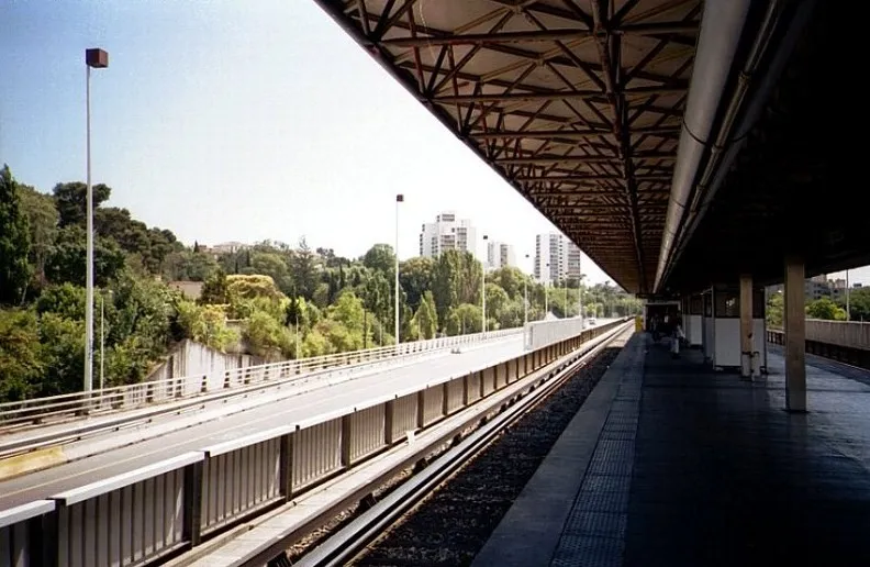
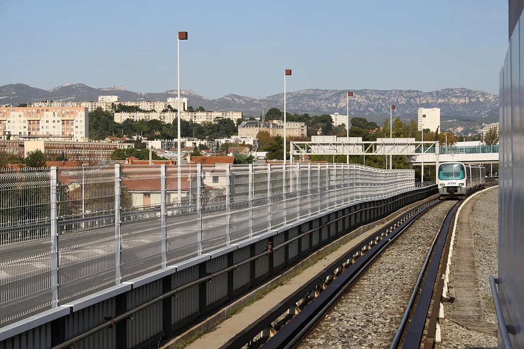
Station "Malpassé" de la ligne 1 du métro de Marseille.
Métro Marseille Linie 1
HT Malpasse 1010 (7)
Photo by Revolutionjoyeuse
Destinations
Home›Destinations›Malpassé
EuropeFranceProvence-Alpes-Côte d'Azur

Malpassé

Provence-Alpes-Côte d'Azur, France · Europe

About Malpassé

Malpassé works well as a base: 12km from Calanques National Park.

Malpassé is in Provence-Alpes-Côte d'Azur, France, with about 11,000 people. You drive on the right here.

Where to Stay in Malpassé

Compare prices across Booking.com, Airbnb, Expedia, and more. Select your dates to see availability.

Filter presets

Pick your must-haves once: provider links open pre-filtered. Each filter lists which sites it applies to.

Booking.comExpediaTripAdvisorHotels.comAgodaAirbnb

Compare before you book!

Prices can vary significantly between platforms. We recommend checking at least 2-3 sites to find the best deal for your stay in Malpassé.

Explore the Area

Discover famous landmarks, scenic roads, and more near Malpassé.

Loading map...
Open in Google Maps

Frequently Asked Questions

What is there to see near Malpassé?

Within an hour or so of Malpassé: Notre-Dame de la Garde Viewpoint (6 km), Calanques National Park (12 km), Calanque d'En-Vau (15 km), Route des Crêtes (Cassis) (17 km).

Are there any good drives near Malpassé?

The nearest famous roads are Route des Crêtes (Cassis), Gorges de la Nesque Road and Corniche Sublime (D71).

Where is Malpassé?

Malpassé is in Provence-Alpes-Côte d'Azur, France.

Road trip

Drive to Malpassé

Add it as a stop and the planner works out the driving, the nights and what's worth seeing on the way.

Start planning

What's nearby?

Swipe through places to go

Places within a drive of Malpassé. Keep the ones you like and add them to your trip.

Explore now

Quick Information

Population
11,148
Continent
Europe
Country
France
Region
Provence-Alpes-Côte d'Azur
Timezone
Europe/Paris
Coordinates
43.3217, 5.4155

Emergency & Services

Essential numbers in France

Police
17
Ambulance
15
Fire
18
All emergencies
112
Driving side
right

Carrying a warning triangle and hi-vis vest in your vehicle is mandatory. Motorway emergency phones connect to official breakdown services only.

Full driving guide for France

Tags

EuropeFranceProvence-Alpes-Côte d'AzurTown

Worth the detour from Malpassé

6 notable places within an hour's drive.

scenic viewpoint

Notre-Dame de la Garde Viewpoint

Marseille's 'Bonne Mere' basilica crowns a 149 m limestone peak reachable by a winding drive, with a sweeping 360-degree panorama over the Old Port, the Frioul islands and the Calanques.

6 km · about 10 min drive

national park

Calanques National Park

Dramatic limestone fjord-like inlets with turquoise waters and white cliffs stretching between Marseille and Cassis on the Mediterranean coast.

12 km · about 25 min drive

beach

Calanque d'En-Vau

The most beautiful of the Calanques, a slender turquoise inlet hemmed by needle-sharp white pinnacles.

15 km · about 30 min drive

coastal drive

Route des Crêtes (Cassis)

A clifftop corniche from Cassis to La Ciotat climbing the highest sea cliffs in France with stunning overlooks.

17 km · about 20 min drive

racetrack

Circuit Paul Ricard

French Formula 1 circuit near the Côte d'Azur famous for its distinctive blue and red run-off stripes.

31 km · about 35 min drive

scenic viewpoint

Mont Faron Summit

A 584 m limestone mountain looming over Toulon, climbed by a narrow corniche road of tight hairpins beloved of the Tour de France; the summit offers superb views over one of Europe's finest natural harbours.

47 km · about 55 min drive

Driving roads near Malpassé

6 named roads, passes and coastal drives within 100km.

  • Right hereNotre-Dame de la Garde ViewpointMarseille's 'Bonne Mere' basilica crowns a 149 m limestone peak reachable by a winding drive, with a sweeping 360-degree panorama over the Old Port, the Frioul islands and the Calanques.
  • 17 kmRoute des Crêtes (Cassis)A clifftop corniche from Cassis to La Ciotat climbing the highest sea cliffs in France with stunning overlooks.
  • 47 kmMont Faron SummitA 584 m limestone mountain looming over Toulon, climbed by a narrow corniche road of tight hairpins beloved of the Tour de France; the summit offers superb views over one of Europe's finest natural harbours.
  • 73 kmLavender Fields of ValensoleVast purple lavender plateaus that bloom spectacularly from mid-June to mid-August across the Valensole plain.

Driving in France

Drives on
the right
Petrol
~€1.85/litre
Motorway tolls
~€10.00/100km

When to drive here

April to October

Nearby Destinations

Other places to explore near Malpassé.

Marseille 13

🇫🇷 France

1 km awayPop. 89,316

Montolivet

🇫🇷 France

1 km awayPop. 12,310

Saint-Just

🇫🇷 France

1 km awayPop. 14,417

La Rose

🇫🇷 France

1 km awayPop. 13,835

Saint-Jérôme

🇫🇷 France

1 km awayPop. 10,087

Les Chartreux

🇫🇷 France

1 km awayPop. 9,273

Saint-Barthélémy

🇫🇷 France

1 km awayPop. 18,655

Chutes-Lavie

🇫🇷 France

2 km awayPop. 9,495

Plan a trip around Malpassé

France road trip planner

Your trip starts here

Plan a road trip from Malpassé.

Pick the days, drop in the stops, and share it with whoever's coming.

Start planning
PYRT

The ultimate road trip planning platform. Discover 150,000+ destinations worldwide, plan scenic routes, and create unforgettable adventures.

Inspiration

  • Discover Trips
  • Travel Guides
  • Community

The Product

  • Calendar Planner
  • Integrations
  • How It Works
  • Collaboration Mode
  • Get the App
  • Merchandise: PYRT Supply Co.
  • Become a Creator
  • Trip Marketplace

Plan Your Trip

  • Road Trip Planner
  • Famous Routes
  • Drive Times & Distances
  • Planners by Country
  • Best Road Trip Planner App
  • Discover Road Trips
  • Events
  • Travel Guides
  • How It Works
  • My Trips
  • Community Groups

Company

  • Terms of Service
  • Privacy Policy
  • About PYRT
  • Support
  • Contact Us
  • Sign In
  • Create Account

© 2026 Plan Your Road Trips. All rights reserved.

•[email protected]
Data sources:GeoNames (CC BY 4.0)•Wikimedia Commons (CC BY-SA)•Mapbox•Photography: George Lawrence