PYRTPlan Your Road Trips
Create TripCommunityMerchandise
PYRTPlan Your Road Trips
Create TripCommunityMerchandise
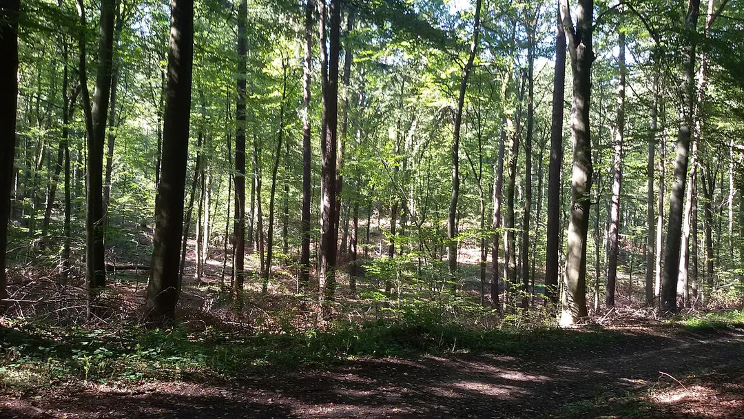
Sommerende im Warndt
Photo by Whereismymind
Destinations
Home›Destinations›Ludweiler-Warndt
EuropeGermanySaarland

Ludweiler-Warndt

Saarland, Germany · Europe

About Ludweiler-Warndt

Ludweiler-Warndt is worth a stop: 10 minutes from Fürstenhausen, 48km from Route du Vin.

Ludweiler-Warndt is in Saarland, Germany, with about 5,900 people. You drive on the right here. The nearest town is Fürstenhausen, about 5 km away.

Where to Stay in Ludweiler-Warndt

Compare prices across Booking.com, Airbnb, Expedia, and more. Select your dates to see availability.

Filter presets

Pick your must-haves once: provider links open pre-filtered. Each filter lists which sites it applies to.

Booking.comExpediaTripAdvisorHotels.comAgodaAirbnb

Compare before you book!

Prices can vary significantly between platforms. We recommend checking at least 2-3 sites to find the best deal for your stay in Ludweiler-Warndt.

Explore the Area

Discover famous landmarks, scenic roads, and more near Ludweiler-Warndt.

Loading map...
Open in Google Maps

Frequently Asked Questions

What is there to see near Ludweiler-Warndt?

Within an hour or so of Ludweiler-Warndt: Völklinger Hütte (4 km), Saarschleife (37 km), Schengen (43 km), Metz Cathedral (48 km).

Are there any good drives near Ludweiler-Warndt?

The nearest famous roads are Route du Vin, Moselle Valley Road (B53) and Deutsche Weinstraße.

Where is Ludweiler-Warndt?

Ludweiler-Warndt is in Saarland, Germany, about 5 km from Fürstenhausen.

Road trip

Drive to Ludweiler-Warndt

Add it as a stop and the planner works out the driving, the nights and what's worth seeing on the way.

Start planning

What's nearby?

Swipe through places to go

Places within a drive of Ludweiler-Warndt. Keep the ones you like and add them to your trip.

Explore now

Quick Information

Population
5,922
Continent
Europe
Country
Germany
Region
Saarland
Timezone
Europe/Berlin
Coordinates
49.2207, 6.8120

Emergency & Services

Essential numbers in Germany

Police
110
Ambulance
112
Fire
112
All emergencies
112
Driving side
right

ADAC roadside assistance: +49 89 22 22 22. No general speed limit on some autobahn sections but advisory 130 km/h.

Full driving guide for Germany

Tags

EuropeGermanySaarlandTown

Worth the detour from Ludweiler-Warndt

7 notable places within an hour's drive.

museum

Völklinger Hütte

A vast decommissioned ironworks turned UNESCO industrial monument, where you can climb 27 m up the old blast furnaces.

4 km · about 10 min drive
scenic viewpoint

Saarschleife

From the Cloef viewpoint and treetop walk, the Saar River carves a spectacular horseshoe through forested hills.

37 km · about 40 min drive

landmark

Schengen

Moselle village at the France-Germany-Luxembourg tripoint where the 1985 Schengen Agreement was signed, with a European Museum and parking.

43 km · about 50 min drive

cathedral

Metz Cathedral

Nicknamed the 'Lantern of God' for its immense expanse of stained glass, including windows by Chagall.

48 km · about 55 min drive

famous road

Route du Vin

Wine road running about 42 kilometres along the Moselle from Schengen to Wasserbillig, linking terraced vineyards and riverside villages.

48 km · about 55 min drive

landmark

Rodemack

Fortified Lorraine village dubbed the 'Little Carcassonne', minutes from the Luxembourg border, with 700 m of intact medieval ramparts, a massive gate tower and flower-lined lanes.

50 km · about 60 min drive

scenic viewpoint

Luxembourg Moselle Valley

Terraced Riesling vineyards line the gentle Moselle, a string of wine villages on a slow scenic river drive.

58 km · about 65 min drive

Driving roads near Ludweiler-Warndt

  • 37 kmSaarschleifeFrom the Cloef viewpoint and treetop walk, the Saar River carves a spectacular horseshoe through forested hills.
  • 48 kmRoute du VinWine road running about 42 kilometres along the Moselle from Schengen to Wasserbillig, linking terraced vineyards and riverside villages.
  • 58 kmLuxembourg Moselle ValleyTerraced Riesling vineyards line the gentle Moselle, a string of wine villages on a slow scenic river drive.
  • 65 kmChemin de la CornicheRampart walkway along Luxembourg City's old walls, described as Europe's most beautiful balcony, overlooking the Grund quarter.
  • 66 kmGrand Duchess Charlotte BridgeLuxembourg City's striking 'Red Bridge', a scarlet steel span soaring 74 m above the Alzette valley to link the old town with the Kirchberg European quarter.

Driving in Germany

Drives on
the right
Petrol
~€1.78/litre
Motorway tolls
None

When to drive here

April to October

Nearby Destinations

Other places to explore near Ludweiler-Warndt.

Petite-Rosselle

🇫🇷 France

3 km awayPop. 6,973

Bous

🇩🇪 Germany

6 km awayPop. 7,605

Forbach

🇫🇷 France

7 km awayPop. 21,358

Creutzwald

🇫🇷 France

9 km awayPop. 14,416

Überherrn

🇩🇪 Germany

9 km awayPop. 12,071

Hombourg-Haut

🇫🇷 France

11 km awayPop. 9,702

Saarlouis

🇩🇪 Germany

11 km awayPop. 38,333

Farébersviller

🇫🇷 France

12 km awayPop. 7,068

Plan a trip around Ludweiler-Warndt

Germany road trip planner

Your trip starts here

Plan a road trip from Ludweiler-Warndt.

Pick the days, drop in the stops, and share it with whoever's coming.

Start planning
PYRT

The ultimate road trip planning platform. Discover 150,000+ destinations worldwide, plan scenic routes, and create unforgettable adventures.

Inspiration

  • Discover Trips
  • Travel Guides
  • Community

The Product

  • Calendar Planner
  • Integrations
  • How It Works
  • Collaboration Mode
  • Get the App
  • Merchandise: PYRT Supply Co.
  • Become a Creator
  • Trip Marketplace

Plan Your Trip

  • Road Trip Planner
  • Famous Routes
  • Drive Times & Distances
  • Planners by Country
  • Best Road Trip Planner App
  • Discover Road Trips
  • Events
  • Travel Guides
  • How It Works
  • My Trips
  • Community Groups

Company

  • Terms of Service
  • Privacy Policy
  • About PYRT
  • Support
  • Contact Us
  • Sign In
  • Create Account

© 2026 Plan Your Road Trips. All rights reserved.

•[email protected]
Data sources:GeoNames (CC BY 4.0)•Wikimedia Commons (CC BY-SA)•Mapbox•Photography: George Lawrence