waterfall
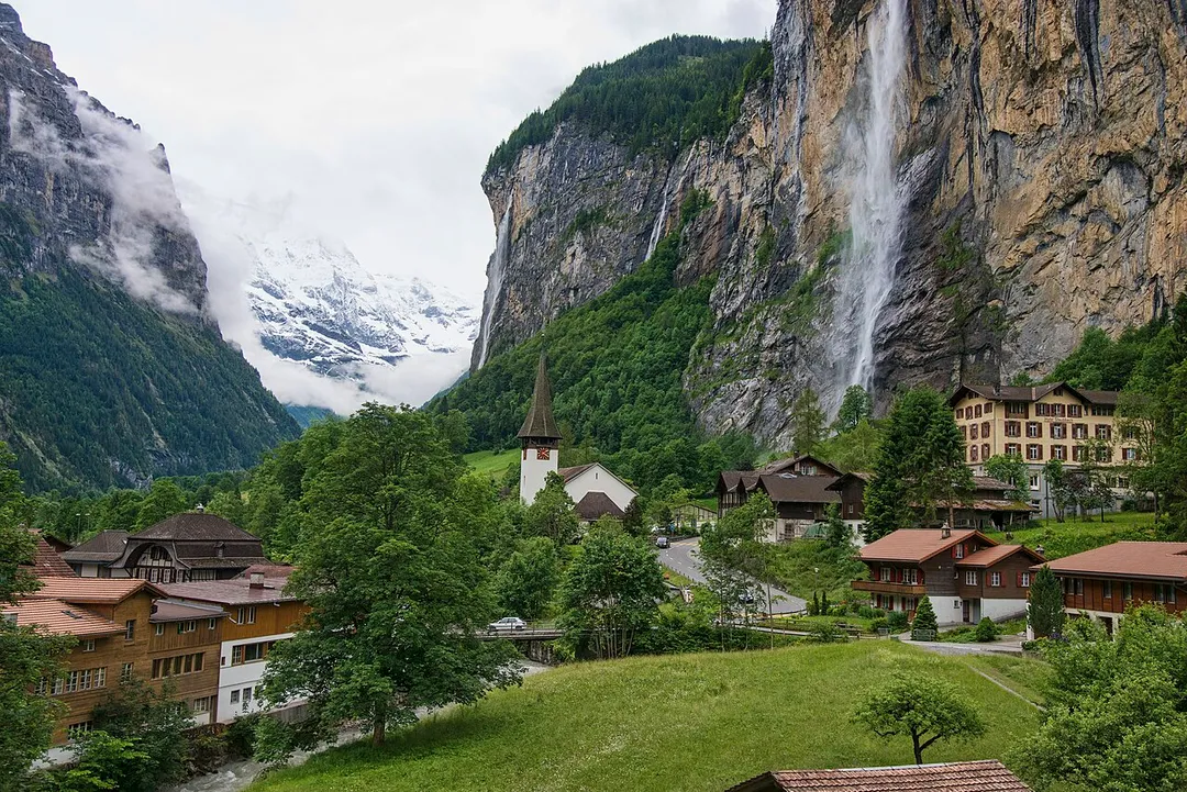
Staubbach Falls
A free-falling 297-meter waterfall in the Lauterbrunnen Valley that inspired Goethe's poem 'Song of the Spirits over the Waters.'
1 km · about 5 min drive
Bern, Switzerland · Europe
Lauterbrunnen works well as a base: 15 minutes from Wilderswil, 15km from Lake Brienz.
Lauterbrunnen is in Bern, Switzerland, with about 2,600 people. You drive on the right here. The nearest town is Wilderswil, about 9 km away.
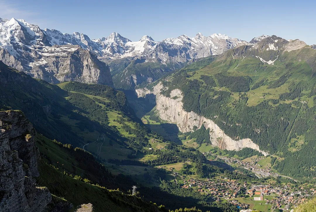
Lauterbrunnen (Swiss Standard German pronunciation: [ˈlaʊtərˌbrʊnən]) is a village and municipality in the Interlaken-Oberhasli administrative district in the canton of Bern in Switzerland. The municipality comprises the other villages of Wengen, Mürren, Gimmelwald, Stechelberg, and Isenfluh, as well as several otherRead more
hamlets. The population of the village of Lauterbrunnen is less than that of Wengen, but larger than that of the others.
The municipality comprises the Lauterbrunnen Valley (German: Lauterbrunnental), located at the foot of the Bernese Alps. It is overlooked by the Eiger, Mönch, Jungfrau and many other high peaks. The valley, drained by the White Lütschine, comprises the Soustal, the Sefinental and the upper Lauterbrunnen Valley with Untersteinberg. The valley includes several glaciers. Together with the adjacent valley of Grindelwald, the Lauterbrunnen Valley forms part of the Jungfrau Region of the Bernese Oberland, between Interlaken and the main crest of the Bernese Alps.
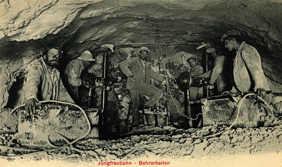
Similarly to Grindelwald, Lauterbrunnen has become a major tourist destination. It is connected to Interlaken by the Bernese Oberland Railway and is the start of the Wengernalp Railway, leading to Kleine Scheidegg. The latter resort is the start of the Jungfrau Railway, the highest railway in Europe and a gateway to the Jungfrau-Aletsch protected area.
Compare prices across Booking.com, Airbnb, Expedia, and more. Select your dates to see availability.
Pick your must-haves once: provider links open pre-filtered. Each filter lists which sites it applies to.
Compare before you book!
Prices can vary significantly between platforms. We recommend checking at least 2-3 sites to find the best deal for your stay in Lauterbrunnen.
Discover famous landmarks, scenic roads, and more near Lauterbrunnen.
Within an hour or so of Lauterbrunnen: Staubbach Falls (1 km), Trümmelbach Falls (3 km), Schilthorn & Piz Gloria (7 km), Jungfraujoch – Top of Europe (8 km).
The nearest famous roads are Grosse Scheidegg, Brünig Pass and Glaubenbielen Pass.
Lauterbrunnen is in Bern, Switzerland, about 9 km from Wilderswil.
Road trip
Add it as a stop and the planner works out the driving, the nights and what's worth seeing on the way.
Start planningSwipe through places to go
Places within a drive of Lauterbrunnen. Keep the ones you like and add them to your trip.
Essential numbers in Switzerland
Motorway vignette (toll sticker) required: buy at the border or online. Roadside assistance (TCS): 140.
Full driving guide for Switzerland8 notable places within an hour's drive.
waterfall
A free-falling 297-meter waterfall in the Lauterbrunnen Valley that inspired Goethe's poem 'Song of the Spirits over the Waters.'
1 km · about 5 min drive
waterfall
The only glacier waterfalls in Europe accessible inside a mountain, draining the Eiger, Mönch, and Jungfrau glaciers.
3 km · about 5 min drive
scenic viewpoint
A 2,970-metre peak with a revolving restaurant made famous as a Bond villain's lair in On Her Majesty's Secret Service.
7 km · about 15 min drive
scenic viewpoint
Europe's highest railway station at 3,454 metres, offering views of the Aletsch Glacier and an ice palace carved inside the mountain.
8 km · about 15 min drive
landmark
The adventure capital of Switzerland, set between Lake Thun and Lake Brienz with the Eiger, Mönch, and Jungfrau as its backdrop.
11 km · about 20 min drive
scenic viewpoint
An iconic Swiss Alpine village beneath the Eiger's north face, with the First cliff walk, gondola, and adventure playground above.
11 km · about 20 min drive
landmark
A tiny village on Lake Brienz made world-famous by the Netflix series Crash Landing on You, with a photogenic jetty extending into turquoise waters.
14 km · about 25 min drive
natural wonder
A dazzling turquoise lake in the Bernese Oberland, fed by glacier meltwater and famed for the Giessbach waterfalls on its southern shore.
15 km · about 30 min drive
17 named roads, passes and coastal drives within 60km.
April to October
Other places to explore near Lauterbrunnen.
Your trip starts here
Pick the days, drop in the stops, and share it with whoever's coming.