
PYRTPlan Your Road Trips
Create TripCommunityMerchandise
PYRTPlan Your Road Trips
Create TripCommunityMerchandise
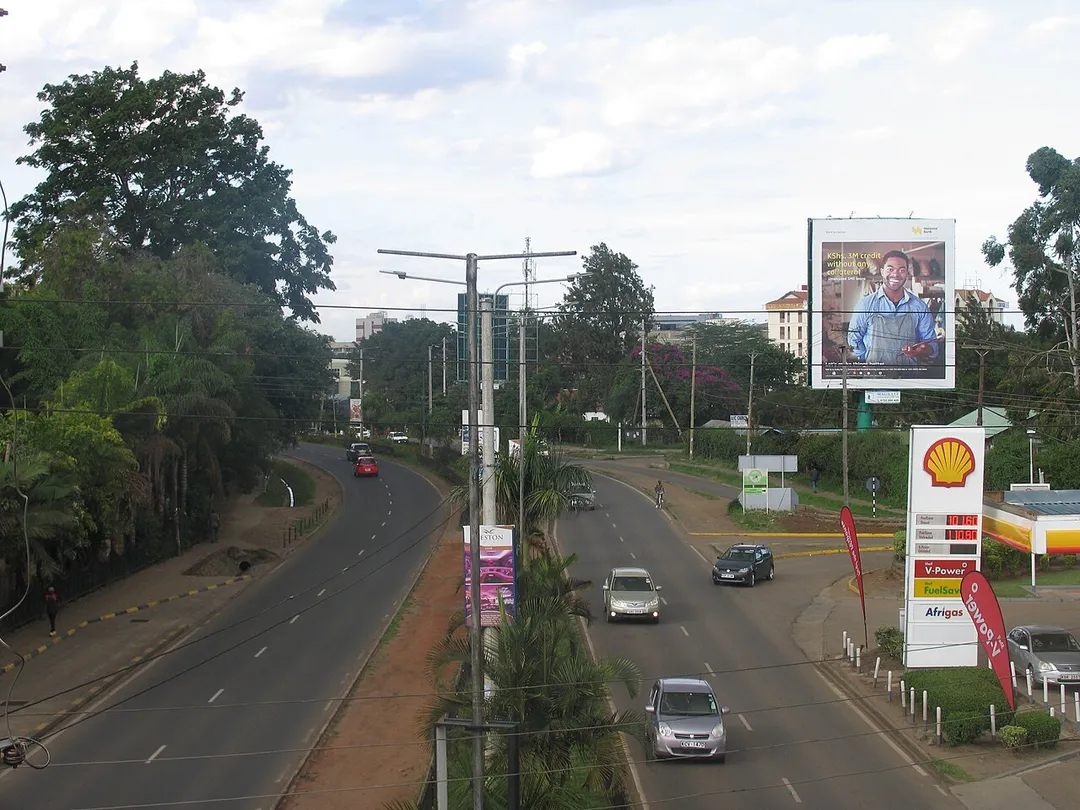
This is an image with the theme "Africa on the Move or Transport" from: Kenya
Image of sclp samaj college
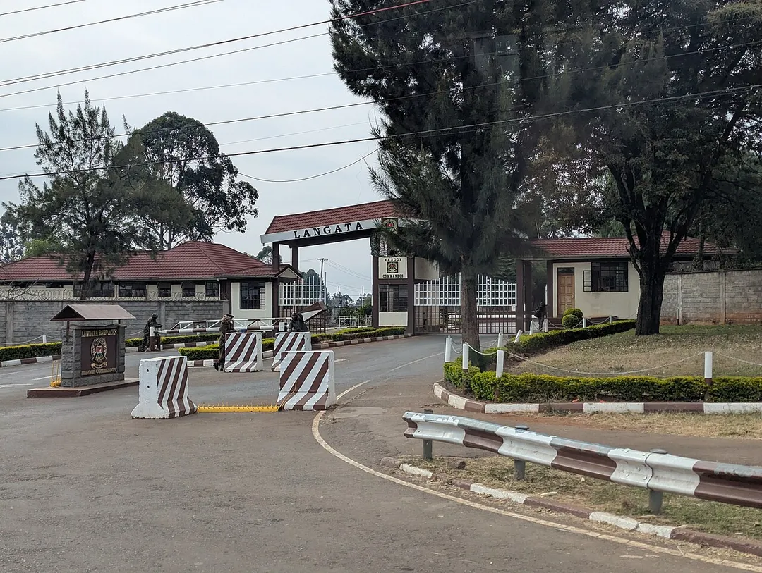
Langata Barracks
Photo by Ikanzo
Destinations
Home›Destinations›Lang'ata
AfricaKenyaNairobi County

Lang'ata

Nairobi County, Kenya · Africa

About Lang'ata

Lang'ata is worth a stop: 10 minutes from Ongata Rongai, 9km from Carnivore Restaurant.

Lang'ata is in Nairobi County, Kenya, with about 170,000 people. You drive on the left here. The nearest town is Ongata Rongai, about 5 km away.

Lang'ata is a predominantly upper middle-class residential suburb of Nairobi in Kenya. The suburb consists of many smaller housing developments, referred to as estates. They include Nairobi Dam, Otiende, Southlands, Ngei, Jambo Estate, Onyonka, Madaraka Estate, Kutch Prant, Rubia, NHC Langata, Akiba, Sun Valley, Royal

Read more Park and many others. These developments are primarily maisonettes or apartment blocks.

Read more on Wikipedia

Where to Stay in Lang'ata

Compare prices across Booking.com, Airbnb, Expedia, and more. Select your dates to see availability.

Filter presets

Pick your must-haves once: provider links open pre-filtered. Each filter lists which sites it applies to.

Booking.comExpediaTripAdvisorHotels.comAgodaAirbnb

Compare before you book!

Prices can vary significantly between platforms. We recommend checking at least 2-3 sites to find the best deal for your stay in Lang'ata.

Explore the Area

Discover famous landmarks, scenic roads, and more near Lang'ata.

Loading map...
Open in Google Maps

Frequently Asked Questions

What is there to see near Lang'ata?

Within an hour or so of Lang'ata: Carnivore Restaurant (9 km).

Where is Lang'ata?

Lang'ata is in Nairobi County, Kenya, about 5 km from Ongata Rongai.

Road trip

Drive to Lang'ata

Add it as a stop and the planner works out the driving, the nights and what's worth seeing on the way.

Start planning

What's nearby?

Swipe through places to go

Places within a drive of Lang'ata. Keep the ones you like and add them to your trip.

Explore now

Quick Information

Population
172,569
Continent
Africa
Country
Kenya
Region
Nairobi County
Timezone
Africa/Nairobi
Coordinates
-1.3666, 36.7332

Emergency & Services

Essential numbers in Kenya

Police
999
Ambulance
999
Fire
999
All emergencies
112
Driving side
left
Full driving guide for Kenya

Tags

AfricaKenyaNairobi CountyCity

Worth the detour from Lang'ata

1 notable place within an hour's drive.

restaurant

Carnivore Restaurant

An open-air Nairobi institution founded in 1980, where meat is carved from Maasai swords onto cast-iron plates until you lower the paper flag on your table. Long a first or last night ritual for Kenyan safari trips.

9 km · about 15 min drive

When to drive here

Year-round

Tropical latitude: plan around the wet season rather than temperature.

Nearby Destinations

Other places to explore near Lang'ata.

Ongata Rongai

🇰🇪 Kenya

5 km awayPop. 172,569

Kiserian

🇰🇪 Kenya

9 km awayPop. 76,903

Nairobi

🇰🇪 Kenya

13 km awayPop. 4,397,073

Kikuyu

🇰🇪 Kenya

15 km awayPop. 323,881

Pumwani

🇰🇪 Kenya

16 km awayPop. 29,616

Karuri

🇰🇪 Kenya

21 km awayPop. 194,342

Mlolongo

🇰🇪 Kenya

23 km awayPop. 136,351

Kawaida

🇰🇪 Kenya

25 km awayPop. 14,038

Your trip starts here

Plan a road trip from Lang'ata.

Pick the days, drop in the stops, and share it with whoever's coming.

Start planning
PYRT

The ultimate road trip planning platform. Discover 150,000+ destinations worldwide, plan scenic routes, and create unforgettable adventures.

Inspiration

  • Discover Trips
  • Travel Guides
  • Community

The Product

  • Calendar Planner
  • Integrations
  • How It Works
  • Collaboration Mode
  • Get the App
  • Merchandise: PYRT Supply Co.
  • Become a Creator
  • Trip Marketplace

Plan Your Trip

  • Road Trip Planner
  • Famous Routes
  • Drive Times & Distances
  • Planners by Country
  • Best Road Trip Planner App
  • Discover Road Trips
  • Events
  • Travel Guides
  • How It Works
  • My Trips
  • Community Groups

Company

  • Terms of Service
  • Privacy Policy
  • About PYRT
  • Support
  • Contact Us
  • Sign In
  • Create Account

© 2026 Plan Your Road Trips. All rights reserved.

•[email protected]
Data sources:GeoNames (CC BY 4.0)•Wikimedia Commons (CC BY-SA)•Mapbox•Photography: George Lawrence