PYRTPlan Your Road Trips
Create TripCommunityMerchandise
PYRTPlan Your Road Trips
Create TripCommunityMerchandise
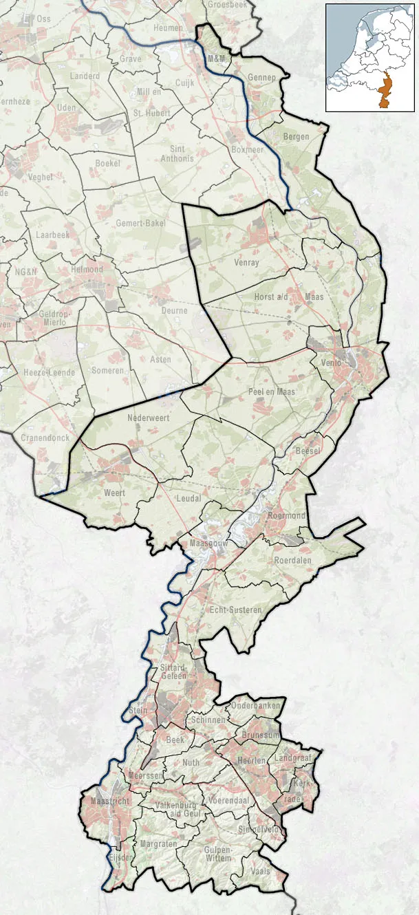
Referentiekaart van Provincie Limburg, met indeling van gemeenten (2010) en impressie van het landschap.
Door Jan-Willem van Aalst, samengesteld uit publiek beschikbare geo-data:

Referentie-ondergrond (kustlijn, steden, wegen) gerasterd uit de OpenStreet Map OSM. (http://www.openstreetmap.org/index.html) Inhoud is beschikbaar onder de Creative Commons Attribution-ShareAlike 3.0 license.
Referentie-ondergrond op water bewerkt vanuit http://satfoto.geoserve.nl/false-nl/index.html. Gebruik is vrij met bronvermelding NLR en ESA.
Vectorgrenzen van gemeenten en regio's vrij ter beschikking gesteld met dank aan cartografen van brandweerregio's Hollands-Midden en IJsselland; gerasterd in Photoshop.
Hoogte-aanduidingen (reliëf) gerasterd uit de AHN Viewer (http://www.ahn.nl/kaart/); gebruik is vrij met bronvermelding (c) AHN, www.ahn.nl;
Overige kenmerken op de kaart: eigen tekenwerk van Jan-Willem van Aalst, op basis van gerasterde gemeentegrenzen.
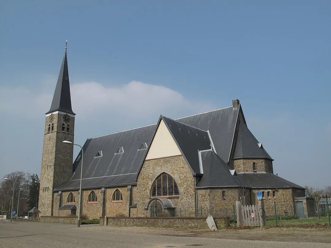
Koningsbosch, church
Koningsbosch (Echt-Susteren) voormalig klooster zuidgevel
Photo by Janwillemvanaalst
Destinations
Home›Destinations›Koningsbosch
EuropeNetherlandsLimburg

Koningsbosch

Limburg, Netherlands · Europe

About Koningsbosch

Koningsbosch works well as a base: 10 minutes from Heide, 24km from Hoge Kempen National Park.

Koningsbosch is in Limburg, Netherlands, with about 1,500 people. You drive on the right here. The nearest town is Heide, about 6 km away.

Koningsbosch (Dutch pronunciation: [ˈkoːnɪŋzbɔs], Limburgish: De Boesj [də ˈbuːʃ]) is a village within the municipality of Echt-Susteren, in the Dutch province of Limburg. Koningsbosch is located next to the German border, approximately 10 kilometres east of the town of Echt. The neighbourhood of Koningsbosch, which

Read more also includes the hamlets Echterbosch, Spaanshuisken, Aan Reijans and the surrounding countryside, covers an area of 0.27 km², has 1.711 inhabitants (as of 1 May 2005) and consists of some 700 houses. The village is slowly growing with the younger generation moving in and the recent construction of additional playgrounds and a community center.

Read more on Wikipedia

Where to Stay in Koningsbosch

Compare prices across Booking.com, Airbnb, Expedia, and more. Select your dates to see availability.

Filter presets

Pick your must-haves once: provider links open pre-filtered. Each filter lists which sites it applies to.

Booking.comExpediaTripAdvisorHotels.comAgodaAirbnb

Compare before you book!

Prices can vary significantly between platforms. We recommend checking at least 2-3 sites to find the best deal for your stay in Koningsbosch.

Explore the Area

Discover famous landmarks, scenic roads, and more near Koningsbosch.

Loading map...
Open in Google Maps

Frequently Asked Questions

What is there to see near Koningsbosch?

Within an hour or so of Koningsbosch: Thorn (15 km), Valkenburg Marl Caves (23 km), Hoge Kempen National Park (24 km), Vrijthof Maastricht (29 km).

Are there any good drives near Koningsbosch?

The nearest famous roads are Baraque de Fraiture, Mosel Valley Wine Route and Moselle Valley Road (B53).

Where is Koningsbosch?

Koningsbosch is in Limburg, Netherlands, about 6 km from Heide.

Road trip

Drive to Koningsbosch

Add it as a stop and the planner works out the driving, the nights and what's worth seeing on the way.

Start planning

What's nearby?

Swipe through places to go

Places within a drive of Koningsbosch. Keep the ones you like and add them to your trip.

Explore now

Quick Information

Population
1,540
Continent
Europe
Country
Netherlands
Region
Limburg
Timezone
Europe/Amsterdam
Coordinates
51.0517, 5.9583

Emergency & Services

Essential numbers in Netherlands

Police
112
Ambulance
112
Fire
112
Non-emergency police
0900-8844
Driving side
right

Watch for cyclists. They generally have priority.

Full driving guide for Netherlands

Tags

EuropeNetherlandsLimburgTown

Worth the detour from Koningsbosch

8 notable places within an hour's drive.

landmark

Thorn

The 'white village' of Limburg: an entire former abbey-principality of whitewashed brick lanes and cobbles beside the Maas, painted white in the Napoleonic era to dodge a window tax and kept that way ever since.

15 km · about 30 min drive

landmark

Valkenburg Marl Caves

Hill-country Valkenburg hides Roman-era marl tunnels, a ruined castle and the Netherlands' only true hilltop drives.

23 km · about 25 min drive

national park

Hoge Kempen National Park

Belgium's first national park, a heath and pine landscape in Limburg with six gateway entrances and visitor car parks.

24 km · about 30 min drive

landmark

Vrijthof Maastricht

A grand cafe-ringed square anchored by two medieval churches in the Netherlands' oldest, most Burgundian city.

29 km · about 35 min drive

cathedral

Aachen Cathedral (Aachener Dom)

The first UNESCO World Heritage Site in Germany, built by Charlemagne as his palatine chapel in the 9th century.

32 km · about 35 min drive

scenic viewpoint

Vaalserberg Drielandenpunt

The Netherlands' highest mainland point at 322.4 metres, where the Dutch, Belgian and German borders meet near Vaals.

33 km · about 40 min drive

landmark

Toverland

Dutch indoor-outdoor theme park in Limburg offering a mix of thrill rides and family attractions in themed areas.

38 km · about 45 min drive

racetrack

Circuit Zolder

A Belgian circuit tragically linked to Gilles Villeneuve's death in 1982, with a rich history in Formula 1 and touring car racing.

50 km · about 55 min drive

Driving roads near Koningsbosch

  • 33 kmVaalserberg DrielandenpuntThe Netherlands' highest mainland point at 322.4 metres, where the Dutch, Belgian and German borders meet near Vaals.
  • 52 kmGileppe DamA 19th-century dam near Spa crowned by a 13-ton stone lion, with a 78 m panorama tower and forested Ardennes reservoir views a short detour off the Verviers road.
  • 62 kmSignal de BotrangeAt 694m this is the highest point in Belgium, marked by a stone tower on the Hautes Fagnes plateau.
Driving in Netherlands

Drives on
the right
Petrol
~€2.04/litre
Motorway tolls
None

When to drive here

April to October

Nearby Destinations

Other places to explore near Koningsbosch.

Saeffelen

🇩🇪 Germany

2 km awayPop. 1,100

Waldfeucht

🇩🇪 Germany

3 km awayPop. 9,305

Heide

🇳🇱 Netherlands

6 km awayPop. 1,040

Broeksittard

🇳🇱 Netherlands

7 km awayPop. 1,550

Gangelt

🇩🇪 Germany

7 km awayPop. 11,484

Stadbroek

🇳🇱 Netherlands

8 km awayPop. 2,525

Overhoven

🇳🇱 Netherlands

8 km awayPop. 3,450

Sittard

🇳🇱 Netherlands

9 km awayPop. 48,400

Plan a trip around Koningsbosch

Netherlands road trip planner

Your trip starts here

Plan a road trip from Koningsbosch.

Pick the days, drop in the stops, and share it with whoever's coming.

Start planning
PYRT

The ultimate road trip planning platform. Discover 150,000+ destinations worldwide, plan scenic routes, and create unforgettable adventures.

Inspiration

  • Discover Trips
  • Travel Guides
  • Community

The Product

  • Calendar Planner
  • Integrations
  • How It Works
  • Collaboration Mode
  • Get the App
  • Merchandise: PYRT Supply Co.
  • Become a Creator
  • Trip Marketplace

Plan Your Trip

  • Road Trip Planner
  • Famous Routes
  • Drive Times & Distances
  • Planners by Country
  • Best Road Trip Planner App
  • Discover Road Trips
  • Events
  • Travel Guides
  • How It Works
  • My Trips
  • Community Groups

Company

  • Terms of Service
  • Privacy Policy
  • About PYRT
  • Support
  • Contact Us
  • Sign In
  • Create Account

© 2026 Plan Your Road Trips. All rights reserved.

•[email protected]
Data sources:GeoNames (CC BY 4.0)•Wikimedia Commons (CC BY-SA)•Mapbox•Photography: George Lawrence