PYRTPlan Your Road Trips
Create TripCommunityMerchandise
PYRTPlan Your Road Trips
Create TripCommunityMerchandise
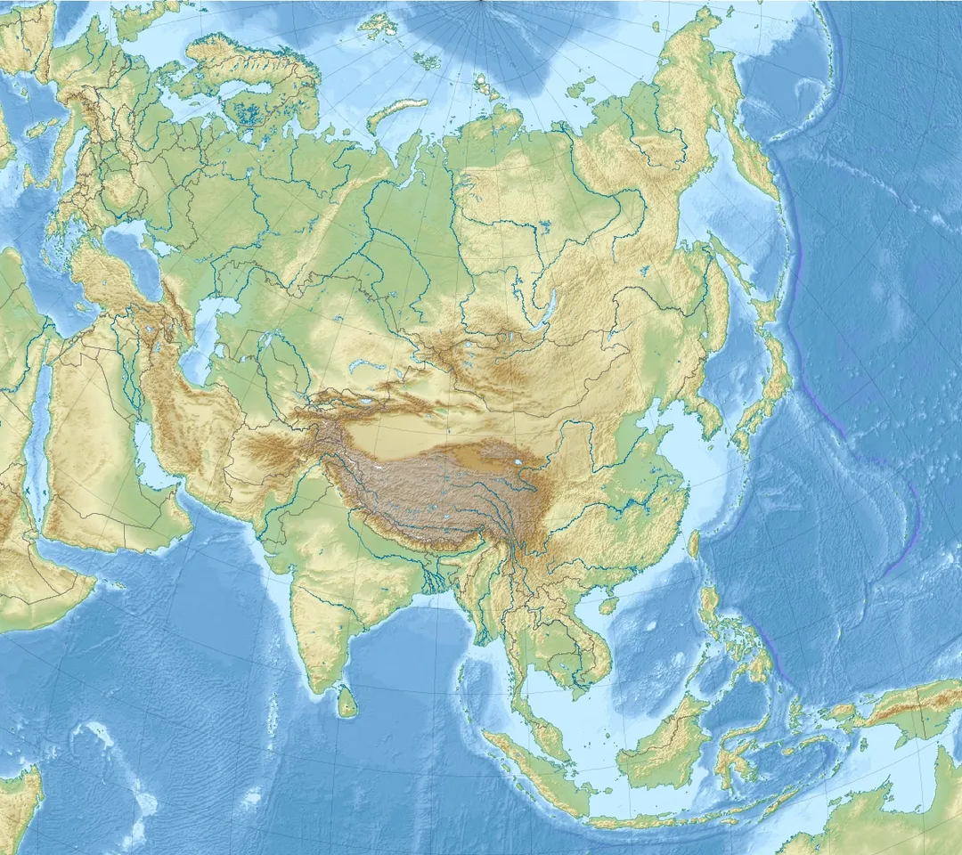
Relief Location map of Asia.
Projection: Lambert azimuthal equal-area projection.
Area of interest:
N: 90.0° N
S: -10.0° N
W: 45.0° E
E: 145.0° E
Projection center:
NS: 40.0° N
WE: 95.0° E
GMT projection: -JA95/50/20.0c
GMT region: -R45.70461034279053/-25.193892806246794/-158.9850042825966/36.990936559512505r
GMT region for grdcut: -R-20.0/-26.0/205.0/90.0r
Relief: SRTM30plus.
Made with Natural Earth. Free vector and raster map data @ naturalearthdata.com.
Identifier: acrossasiaminoro00chiluoft (find matches)
Title: Across Asia Minor on foot
Year: 1917 (1910s)
Authors:  Childs, W. J
Subjects:  Turkey -- Description and travel
Publisher:  Edinburgh : W. Blackwood
Contributing Library:  Robarts - University of Toronto
Digitizing Sponsor:  MSN

View Book Page: Book Viewer
About This Book: Catalog Entry
View All Images: All Images From Book
Click here to view book online to see this illustration in context in a browseable online version of this book.

Text Appearing Before Image:
t before bringing them indoors,—that beingthe careful native custom. All natives know that a freshly-lighted mangal iscapable of killing every soul in a closed room, andare careful therefore in the use of these fires. Inci-dentally it may be remarked that they think thisknowledge peculiar to the country, and not sharedby foreigners. Call for a mangal at a khan, and itis placed outside the door, with explicit instructionsto let it remain there until it has burnt to a clearglow ; you may notice also that from time to timea careful Man-keeper or his man will come and makesure that you have not been impatient, and that all isstill well with you. To these sophisticated people ofthe East a European seems much the simpleton inmany matters. Dwellers in Talas see no more of Argaeus from theirhomes than if that mountain did not exist, althoughthe summit is not fifteen miles away; for Ali Daghintervenes, a hump of mountain like a vast pit-headheap, and rises three thousand feet above the town.
Text Appearing After Image:
A Glen in Talas. ALI DAGH AND ARGAEUS 185 Cross a ravine from the romantic streets of Talas, andyou are on the steep slope of Ali Dagh, which goes upso abruptly and with such economy of distance that,in spite of snow, I reached the top by a zigzag pathin an hour and a half, and returned down a gully ofrolling stones in half the time. No position givesso good a view of Argaeus as the ridge of AliDagh,—the two summits are only twelve miles apartby air-line, and the one becomes a grand-stand forthe other. From Ali Dagh the giant is seen as awhole, and his detachment from outlying heightsbecomes more apparent than ever, A deep narrowvalley, in which roads and fields are seen as in amap, separates the great mountain from the lesser.You see the whole profile of Argaeus from base tosummit on two sides, see the lower slopes steepen,see the domical mounds which surround the mountainat about a third the way up, and then see the upperbulk heaved into air in an unsymmetrical obtuse cone.I saw A

Note About Images

Please note that these images are extracted from scanned page images that may have been digitally enhanced for readability - coloration and appearance of these illustrations may not perfectly resemble the original work.
One of several pictures I took. Always of the exterior, with fine stonework at portals and windows. 
This Hacı Kılıç Camii was built by vizier Ebu’l-Kasım bin Ali Tüsî, at the very end of the heydays of the Seljuk sultanate of Rûm. (In fact, their defeat at Kösedağ against the Ilkhanid Mongols happened 6 years earlier, in 1243). The building has two parts: adjacent to the mosque, to its south, stands a medrese/school. Originally the prayer room of the mosque opened directly into the open courtyard of the medrese; now these arches have been closed by glass windows. Both entrances (to the mosque’s prayer hall, and to the medrese) are placed in the eastern wall (the one shown on this picture).
The mosque got its actual name in the 16th century, due to a restoration that turned the medrese into a zaviye (dervish house). Hacı Kılıç was a prominent şeyh (= leader) of that dervish Order.

The slender minaret is much younger than the rest (not dated, but probably 19th century).
Photo by Uwe Dedering
Destinations
Home›Destinations›Kayseri
AsiaTurkeyKayseri

Kayseri

Kayseri, Turkey · Asia

About Kayseri

Kayseri sits on the route: 5 minutes from Melikgazi, 58km from Göreme National Park.

Kayseri is in Turkey, with about 1.5 million people. You drive on the right here. The nearest town is Melikgazi, about 4 km away.

Kayseri (Turkish pronunciation: [ˈkajseɾi]) is a large city in Central Anatolia, Turkey, and the capital of Kayseri province. Historically known as Caesarea, it has been the historical capital of Cappadocia since ancient times. The Kayseri Metropolitan Municipality area is composed of five districts: the two central

Read more districts of Kocasinan and Melikgazi, and since 2004, also outlying Hacılar, İncesu, and Talas. As of 31 December 2024, the province had a population of 1,452,458 of whom 1,210,983 lived in the four urban districts (Melikgazi, Kocasinan, Talas, Incesu), excluding İncesu which is not conurbated, meaning it is not contiguous and has a largely non-protected buffer zone. Kayseri sits at the foot of Mount Erciyes (Turkish: Erciyes Dağı), a dormant volcano that reaches an altitude of 3,917 metres (12,851 feet), more than 1,500 metres above the city's mean altitude. It contains a number of historic monuments, particularly from the Seljuk period. Tourists often pass through Kayseri en route to the attractions of Cappadocia to the west. Kayseri is known for local dishes such as sucuk, pastırma, and mantı, which are commonly associated with the region. Kayseri is served by Erkilet International Airport and is home to Erciyes University.

Read more on Wikipedia

Where to Stay in Kayseri

Compare prices across Booking.com, Airbnb, Expedia, and more. Select your dates to see availability.

Filter presets

Pick your must-haves once: provider links open pre-filtered. Each filter lists which sites it applies to.

Booking.comExpediaTripAdvisorHotels.comAgodaAirbnb

Compare before you book!

Prices can vary significantly between platforms. We recommend checking at least 2-3 sites to find the best deal for your stay in Kayseri.

Explore the Area

Discover famous landmarks, scenic roads, and more near Kayseri.

Loading map...
Open in Google Maps

Frequently Asked Questions

What is there to see near Kayseri?

Within an hour or so of Kayseri: Göreme National Park (58 km), Göreme Open-Air Museum (58 km), Cappadocia (58 km), Cappadocia Hot Air Balloon Viewpoint (58 km).

Where is Kayseri?

Kayseri is in Kayseri, Turkey, about 4 km from Melikgazi.

Road trip

Drive to Kayseri

Add it as a stop and the planner works out the driving, the nights and what's worth seeing on the way.

Start planning

What's nearby?

Swipe through places to go

Places within a drive of Kayseri. Keep the ones you like and add them to your trip.

Explore now

Quick Information

Population
1,452,458
Continent
Asia
Country
Turkey
Region
Kayseri
Timezone
Europe/Istanbul
Coordinates
38.7322, 35.4853

Emergency & Services

Essential numbers in Turkey

Police
155
Ambulance
112
Fire
110
All emergencies
112
Driving side
right
Full driving guide for Turkey

Tags

AsiaTurkeyKayseriMajor City

Worth the detour from Kayseri

4 notable places within an hour's drive.

national park

Göreme National Park

Surreal fairy chimney rock formations and ancient cave churches in the heart of Cappadocia.

58 km · about 65 min drive

ancient ruins

Göreme Open-Air Museum

A UNESCO-listed complex of rock-cut churches and monasteries with stunning Byzantine frescoes carved into Cappadocia's famous fairy chimneys.

58 km · about 65 min drive

landmark

Cappadocia

Surreal landscape of fairy chimneys, cave dwellings, and underground cities shaped by volcanic eruptions and erosion.

58 km · about 65 min drive

scenic viewpoint

Cappadocia Hot Air Balloon Viewpoint

The world-famous sunrise balloon experience over Cappadocia's surreal landscape of fairy chimneys, valleys, and rock-cut settlements.

58 km · about 65 min drive

Driving roads near Kayseri

  • 58 kmCappadocia Hot Air Balloon ViewpointThe world-famous sunrise balloon experience over Cappadocia's surreal landscape of fairy chimneys, valleys, and rock-cut settlements.

Nearby Destinations

Other places to explore near Kayseri.

Ürgüp

🇹🇷 Turkey

51 km away

Avanos

🇹🇷 Turkey

55 km awayPop. 12,833

Göreme

🇹🇷 Turkey

58 km away

Nevşehir

🇹🇷 Turkey

68 km awayPop. 75,527

Derinkuyu

🇹🇷 Turkey

76 km awayPop. 12,408

Plan a trip around Kayseri

Asia road trip planner

Your trip starts here

Plan a road trip from Kayseri.

Pick the days, drop in the stops, and share it with whoever's coming.

Start planning
PYRT

The ultimate road trip planning platform. Discover 150,000+ destinations worldwide, plan scenic routes, and create unforgettable adventures.

Inspiration

  • Discover Trips
  • Travel Guides
  • Community

The Product

  • Calendar Planner
  • Integrations
  • How It Works
  • Collaboration Mode
  • Get the App
  • Merchandise: PYRT Supply Co.
  • Become a Creator
  • Trip Marketplace

Plan Your Trip

  • Road Trip Planner
  • Famous Routes
  • Drive Times & Distances
  • Planners by Country
  • Best Road Trip Planner App
  • Discover Road Trips
  • Events
  • Travel Guides
  • How It Works
  • My Trips
  • Community Groups

Company

  • Terms of Service
  • Privacy Policy
  • About PYRT
  • Support
  • Contact Us
  • Sign In
  • Create Account

© 2026 Plan Your Road Trips. All rights reserved.

•[email protected]
Data sources:GeoNames (CC BY 4.0)•Wikimedia Commons (CC BY-SA)•Mapbox•Photography: George Lawrence