Kamieniec Ząbkowicki sits on the route: 15 minutes from Ząbkowice Śląskie, 38km from Road of a Hundred Bends.
Kamieniec Ząbkowicki is in Lower Silesia, Poland, with about 4,200 people. You drive on the right here. The nearest town is Ząbkowice Śląskie, about 9 km away.
Kamieniec Ząbkowicki [kaˈmjɛɲɛt͡s zɔmpkɔˈvit͡ski] (German: Kamenz N.S.) is a town in Ząbkowice County, Lower Silesian Voivodeship, in south-western Poland. It is the seat of the administrative district (gmina) called Gmina Kamieniec Ząbkowicki. The town is an important railway junction, located on the main line whichRead more links Wrocław with Kłodzko and Prague. In Kamieniec, this route crosses with the west-east connection from Jaworzyna Śląska to Kędzierzyn-Koźle. The village has a population of 4,200.
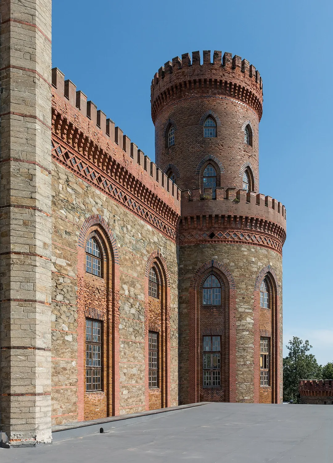
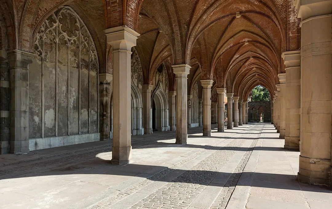
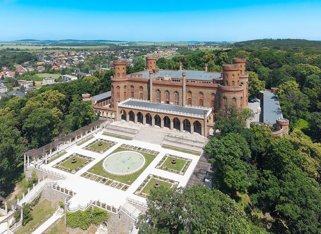
The architectural and landscape ensemble, containing the local landmarks, the abbey and palace, is a Historic Monument of Poland.
Within an hour or so of Kamieniec Ząbkowicki: Osówka Underground City (36 km), Road of a Hundred Bends (38 km), Szczeliniec Wielki (38 km), Błędne Skały (42 km).
Are there any good drives near Kamieniec Ząbkowicki?
The nearest famous roads are Road of a Hundred Bends and Cervenohorske Sedlo.
Where is Kamieniec Ząbkowicki?
Kamieniec Ząbkowicki is in Lower Silesia, Poland, about 9 km from Ząbkowice Śląskie.
Road trip
Drive to Kamieniec Ząbkowicki
Add it as a stop and the planner works out the driving, the nights and what's worth seeing on the way.
The largest visitable complex of Nazi Germany's Project Riese: 3.1 km of tunnels bored into the Owl Mountains in 1943–45 for a purpose still debated. Partly flooded sections are toured by boat.
36 km · about 40 min drive
famous road
Road of a Hundred Bends
Route 387 between Radkow and Kudowa-Zdroj corkscrews through the surreal rock labyrinths of the Table Mountains, packing dozens of hairpins into a forested drive beloved by Polish motorists.
38 km · about 45 min drive
scenic viewpoint
Szczeliniec Wielki
The highest summit of the Table Mountains (919 m): a sandstone plateau of eroded rock labyrinths, chasms and terraces reached by a historic stone stairway from Karłów, with views into Czechia on clear days.
38 km · about 45 min drive
photogenic
Błędne Skały
A rock labyrinth at 853 m in the Table Mountains where a marked trail squeezes between mushroom-shaped sandstone blocks and metre-wide corridors: a filming location for The Chronicles of Narnia. Car access via a timed toll road from Karłów.
42 km · about 50 min drive
cathedral
Church of Peace, Świdnica
Europe's largest timber-framed church, raised in 1656–57 by Silesian Lutherans who were forbidden stone, nails or a tower: the wattle-and-daub interior holds 7,500 people under painted galleries. UNESCO-listed.
45 km · about 50 min drive
landmark
Skull Chapel, Czermna
A small Baroque chapel (1776–1784) in Kudowa-Zdrój whose walls and ceiling are lined with 3,000 human skulls and bones, with 21,000 more in the crypt below: Poland's only ossuary of its kind.
46 km · about 55 min drive
mountain pass
Cervenohorske Sedlo
A 1,013 m saddle on the I/44 road over the Jeseniky Mountains, linking Sumperk and Jesenik with long chains of sweeping switchbacks through spruce forest: one of Czechia's best mountain drives.
49 km · about 55 min drive
scenic viewpoint
Dlouhé stráně Upper Reservoir
An artificial lake set improbably on a flattened 1,350 m mountaintop in the Jeseníky range: the upper basin of Czechia's biggest pumped-storage plant, ringed by a walkable rim with huge views. Reached by shuttle bus, bike or cable car from Kouty.
53 km · about 60 min drive
Driving roads near Kamieniec Ząbkowicki
38 kmRoad of a Hundred BendsRoute 387 between Radkow and Kudowa-Zdroj corkscrews through the surreal rock labyrinths of the Table Mountains, packing dozens of hairpins into a forested drive beloved by Polish motorists.
38 kmSzczeliniec WielkiThe highest summit of the Table Mountains (919 m): a sandstone plateau of eroded rock labyrinths, chasms and terraces reached by a historic stone stairway from Karłów, with views into Czechia on clear days.
49 kmCervenohorske SedloA 1,013 m saddle on the I/44 road over the Jeseniky Mountains, linking Sumperk and Jesenik with long chains of sweeping switchbacks through spruce forest: one of Czechia's best mountain drives.
53 kmDlouhé stráně Upper ReservoirAn artificial lake set improbably on a flattened 1,350 m mountaintop in the Jeseníky range: the upper basin of Czechia's biggest pumped-storage plant, ringed by a walkable rim with huge views. Reached by shuttle bus, bike or cable car from Kouty.
55 kmPradedThe highest peak of Moravia at 1,491 m, topped by a TV tower with a viewing platform; the road climbing toward Ovcarna is the highest in Czechia and a favourite of cyclists and drivers alike.
Driving in Poland
Drives on
the right
Petrol
~€1.42/litre
Motorway tolls
~€5.00/100km
When to drive here
April to October
Nearby Destinations
Other places to explore near Kamieniec Ząbkowicki.