PYRTPlan Your Road Trips
Create TripCommunityMerchandise
PYRTPlan Your Road Trips
Create TripCommunityMerchandise
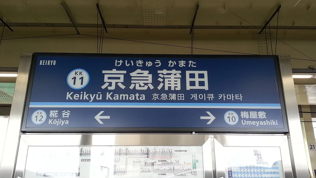
A sign of Keikyū Kamata Station
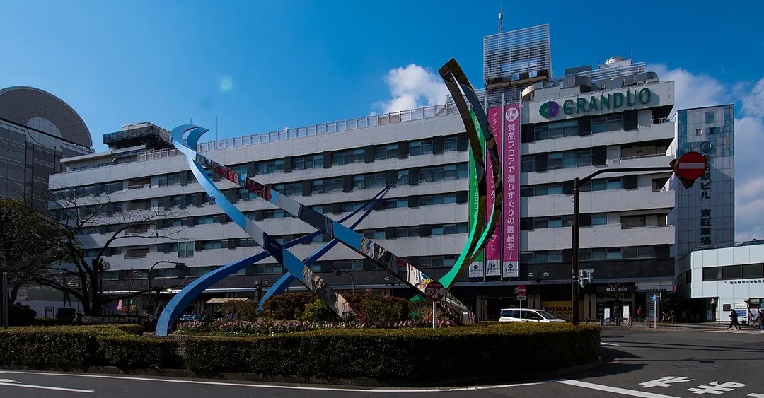
東日本旅客鉄道株式会社京浜東北線(東海道本線)蒲田駅東口駅舎(グランデュオ東館)
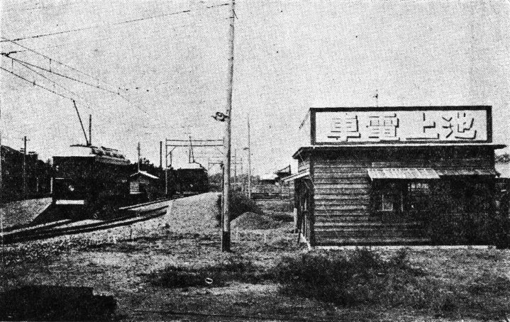
池上電気鉄道蒲田駅(1920年代)
Photo by LERK
Destinations
Home›Destinations›Kamata
AsiaJapanTokyo

Kamata

Tokyo, Japan · Asia

About Kamata

Kamata works well as a base: 10 minutes from Futaba, 11km from teamLab Borderless Tokyo.

Kamata is in Tokyo, Japan, with about 23,000 people. You drive on the left here. The nearest town is Futaba, about 5 km away.

The Kamata Mosque (Japanese: 蒲田モスク) is a mosque in Kamata District, Ōta, Tokyo, Japan.

Read more on Wikipedia

Where to Stay in Kamata

Compare prices across Booking.com, Airbnb, Expedia, and more. Select your dates to see availability.

Filter presets

Pick your must-haves once: provider links open pre-filtered. Each filter lists which sites it applies to.

Booking.comExpediaTripAdvisorHotels.comAgodaAirbnb

Compare before you book!

Prices can vary significantly between platforms. We recommend checking at least 2-3 sites to find the best deal for your stay in Kamata.

Explore the Area

Discover famous landmarks, scenic roads, and more near Kamata.

Loading map...
Open in Google Maps

Frequently Asked Questions

What is there to see near Kamata?

Within an hour or so of Kamata: teamLab Borderless Tokyo (11 km), Tokyo Tower (11 km), Shibuya Crossing (11 km), Tatsumi Parking Area (12 km).

Are there any good drives near Kamata?

The nearest famous roads are Yabitsu Pass, Hakone Turnpike and Mount Haruna Touge.

Where is Kamata?

Kamata is in Tokyo, Japan, about 5 km from Futaba.

Road trip

Drive to Kamata

Add it as a stop and the planner works out the driving, the nights and what's worth seeing on the way.

Start planning

What's nearby?

Swipe through places to go

Places within a drive of Kamata. Keep the ones you like and add them to your trip.

Explore now

Quick Information

Population
22,939
Continent
Asia
Country
Japan
Region
Tokyo
Timezone
Asia/Tokyo
Coordinates
35.5635, 139.7210

Emergency & Services

Essential numbers in Japan

Police
110
Ambulance
119
Fire
119
Driving side
left

Japan Helpline (24h English assistance): 0570-000-911. An International Driving Permit (1949 convention) is required to drive.

Full driving guide for Japan

Tags

AsiaJapanTokyoTown

Worth the detour from Kamata

8 notable places within an hour's drive.

museum

teamLab Borderless Tokyo

An immersive digital art museum where interactive, boundary-less artworks flow from room to room in a mesmerizing sensory experience.

11 km · about 20 min drive

landmark

Tokyo Tower

Red-and-white communications tower inspired by the Eiffel Tower, an enduring symbol of post-war Japan.

11 km · about 20 min drive

landmark

Shibuya Crossing

The world's busiest pedestrian crossing, where thousands of people cross simultaneously from all directions at this iconic Tokyo intersection.

11 km · about 20 min drive

cafe

Tatsumi Parking Area

A legendary late-night gathering spot for Tokyo's car culture scene on the Bayshore Route, immortalized in street racing culture and the Wangan Midnight series.

12 km · about 20 min drive

cafe

Deus Ex Machina Tokyo

Deus's Harajuku outpost in Tokyo bringing Australian motorcycle and surf culture to the heart of Japanese street fashion.

12 km · about 20 min drive

landmark

Tsukiji Outer Market

Tokyo's legendary outer market offering fresh seafood, street food, and culinary delights in a bustling atmosphere.

12 km · about 25 min drive

cafe

Daikoku Parking Area

Legendary Yokohama expressway rest stop beneath the Bayshore Route ramps, the world's most famous JDM car-meet spot. On weekend nights it fills with supercars, drift builds and kaido racers.

12 km · about 20 min drive

landmark

Meiji Shrine

A serene Shinto shrine surrounded by a lush forested park, dedicated to Emperor Meiji and Empress Shoken in the heart of Tokyo.

13 km · about 25 min drive

Driving roads near Kamata

6 named roads, passes and coastal drives within 150km.

  • 18 kmTokyo Bay Aqua-LineA 14 km highway crossing Tokyo Bay via the world's fourth-longest undersea road tunnel, surfacing at the Umihotaru rest-island. Drive under the bay, then sip coffee mid-ocean with skyline views.
  • 48 kmYabitsu PassA tight, tree-walled climb over the Tanzawa mountains west of Tokyo, long a favourite of motorcyclists and cyclists for its relentless switchbacks. The narrow western descent to Lake Miyagase is single-track in places.
  • 72 kmHakone TurnpikeA toll road climbing from Odawara to a Mount Fuji viewpoint, a Japanese car-culture institution.
  • 74 kmHakone Mount Fuji ViewpointThe Hakone region offers some of the best vantage points for viewing Mount Fuji, especially from the Owakudani volcanic valley.
  • 74 kmMount Taikan ViewpointThe summit lay-by on the Hakone Turnpike, looking across Lake Ashi to Mount Fuji from 1,011 m. A long-standing gathering point for drivers on one of Japan's best-known toll driving roads.

Nearby Destinations

Other places to explore near Kamata.

Ōta

🇯🇵 Japan

1 km awayPop. 748,081

Ikegami

🇯🇵 Japan

2 km awayPop. 30,959

Nishimagome

🇯🇵 Japan

3 km awayPop. 6,462

Minami-ōi

🇯🇵 Japan

3 km awayPop. 27,201

Kawasaki

🇯🇵 Japan

5 km awayPop. 1,538,262

Ebara

🇯🇵 Japan

6 km awayPop. 21,232

Jiyūgaoka

🇯🇵 Japan

7 km awayPop. 7,503

Takanawa

🇯🇵 Japan

8 km awayPop. 22,731

Plan a trip around Kamata

Asia road trip planner

Your trip starts here

Plan a road trip from Kamata.

Pick the days, drop in the stops, and share it with whoever's coming.

Start planning
PYRT

The ultimate road trip planning platform. Discover 150,000+ destinations worldwide, plan scenic routes, and create unforgettable adventures.

Inspiration

  • Discover Trips
  • Travel Guides
  • Community

The Product

  • Calendar Planner
  • Integrations
  • How It Works
  • Collaboration Mode
  • Get the App
  • Merchandise: PYRT Supply Co.
  • Become a Creator
  • Trip Marketplace

Plan Your Trip

  • Road Trip Planner
  • Famous Routes
  • Drive Times & Distances
  • Planners by Country
  • Best Road Trip Planner App
  • Discover Road Trips
  • Events
  • Travel Guides
  • How It Works
  • My Trips
  • Community Groups

Company

  • Terms of Service
  • Privacy Policy
  • About PYRT
  • Support
  • Contact Us
  • Sign In
  • Create Account

© 2026 Plan Your Road Trips. All rights reserved.

•[email protected]
Data sources:GeoNames (CC BY 4.0)•Wikimedia Commons (CC BY-SA)•Mapbox•Photography: George Lawrence