landmark
Antigua Guatemala
A UNESCO colonial city framed by volcanoes, filled with cobblestone streets, pastel-colored buildings, and stunning ruined churches.
2 km · about 5 min drive

Sacatepéquez, Guatemala · North America
Jocotenango is worth a stop: 10 minutes from San Antonio Aguas Calientes, 26km from Pacaya Volcano.
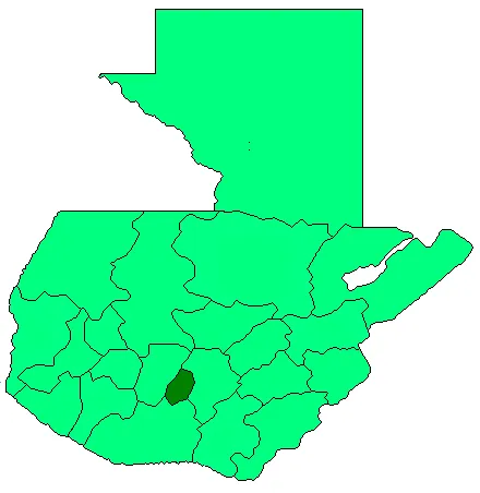
Jocotenango is in Sacatepéquez, Guatemala, with about 18,000 people. The nearest town is San Antonio Aguas Calientes, about 6 km away.
Jocotenango (alternate: Xocotenango; translation from Kaqchikel: "place of many plums") is a town and small municipality in the northeast section of Guatemalan department of Sacatepéquez, and is situated north of Antigua Guatemala. It has seven zones, two villages, and one hamlet. According to the 2018 census, theRead more
municipality has a total population of 21,657 of which 1,680 are native population and the rest are non-indigenous; and approximately 19,280 live in an urban area, while the rest are rural dwellers.
Jocotenango is the birthplace of multi Grammy Award-winning singer and songwriter Ricardo Arjona.
Compare prices across Booking.com, Airbnb, Expedia, and more. Select your dates to see availability.
Pick your must-haves once: provider links open pre-filtered. Each filter lists which sites it applies to.
Compare before you book!
Prices can vary significantly between platforms. We recommend checking at least 2-3 sites to find the best deal for your stay in Jocotenango.
Discover famous landmarks, scenic roads, and more near Jocotenango.
Within an hour or so of Jocotenango: Antigua Guatemala (2 km), Acatenango (17 km), Pacaya Volcano (26 km), Lake Atitlan (49 km).
The nearest famous roads are Ruta de las Flores.
Jocotenango is in Sacatepéquez, Guatemala, about 6 km from San Antonio Aguas Calientes.
Road trip
Add it as a stop and the planner works out the driving, the nights and what's worth seeing on the way.
Start planningSwipe through places to go
Places within a drive of Jocotenango. Keep the ones you like and add them to your trip.
6 notable places within an hour's drive.
landmark
A UNESCO colonial city framed by volcanoes, filled with cobblestone streets, pastel-colored buildings, and stunning ruined churches.
2 km · about 5 min drive
scenic viewpoint
A 3,976 m stratovolcano near Antigua climbed overnight so hikers can camp on the ridge and watch neighbouring Volcán de Fuego erupt through the night: one of the most reliable live-eruption views on earth.
17 km · about 20 min drive
natural wonder
An active volcano near Antigua Guatemala where hikers can roast marshmallows on volcanic vents and see glowing lava flows.
26 km · about 30 min drive
natural wonder
A breathtaking volcanic lake surrounded by three towering volcanoes and traditional Mayan villages, often called the most beautiful lake in the world.
49 km · about 55 min drive
landmark
Central America's largest indigenous market held every Thursday and Sunday, overflowing with textiles, masks, flowers, and Maya rituals.
57 km · about 65 min drive
landmark
A backpacker and artist hub on Lake Atitlán's shores beneath San Pedro Volcano, known for Spanish schools and Tz'utujil Maya culture.
59 km · about 70 min drive
Year-round
Tropical latitude: plan around the wet season rather than temperature.
Other places to explore near Jocotenango.
Your trip starts here
Pick the days, drop in the stops, and share it with whoever's coming.