PYRTPlan Your Road Trips
Create TripCommunityMerchandise
PYRTPlan Your Road Trips
Create TripCommunityMerchandise
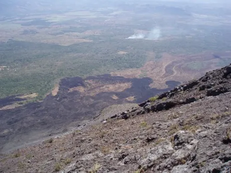
Lava flow from Izalco volcano
Physical location map of El Salvador
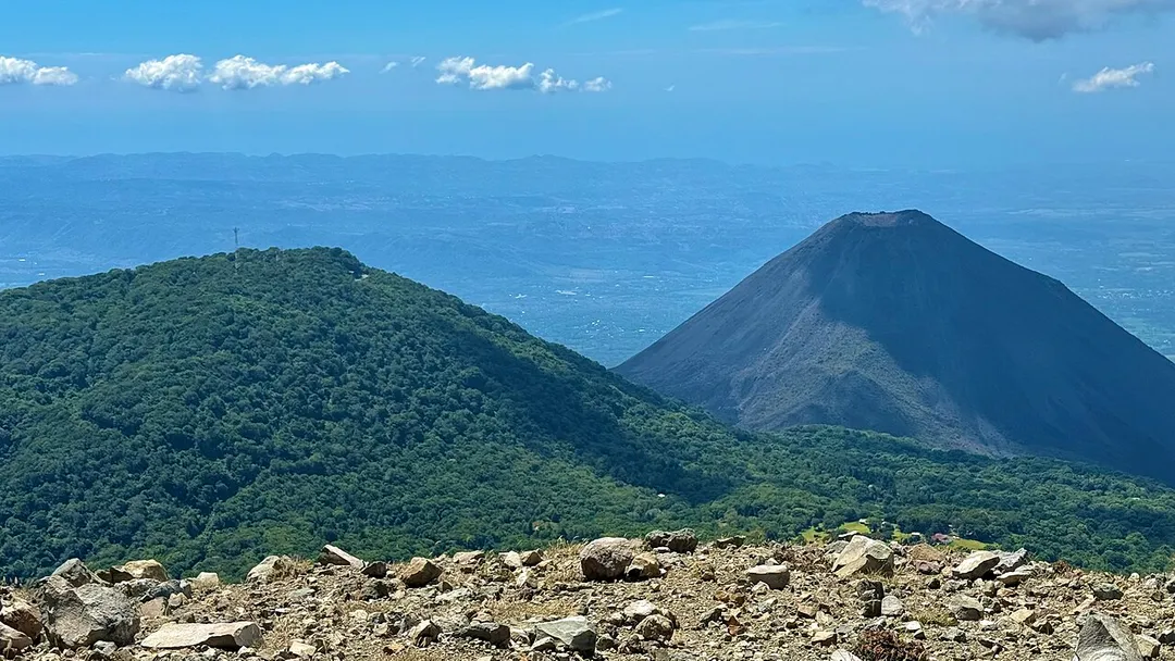
Cerro Verde and Izalco Volcano
Photo by Public domainPublic domainfalsefalse   This work has been released into the public domain by its author, Ukiedukie, at the English Wikipedia project. This applies worldwide. In case this is not legally possible: Ukiedukie grants anyone the right to use this work for any purpose, without any conditions, unless such conditions are required by law.
Destinations
Home›Destinations›Izalco
North AmericaEl SalvadorSonsonate Department

Izalco

Sonsonate Department, El Salvador · North America

About Izalco

Izalco is worth a stop: 10 minutes from Sonzacate, 19km from Lake Coatepeque.

Izalco is in Sonsonate Department, El Salvador, with about 19,000 people. The nearest town is Sonzacate, about 5 km away.

Izalco (Pipil: Itzalku) is a town and a municipality in the Sonsonate department of El Salvador. Volcan Izalco is an icon of the country of El Salvador, a very young volcano on the flank of Santa Ana volcano. From when it was born in 1770 until 1966, it was in almost continuous eruption and was known as the

Read more "lighthouse of the Pacific." Since then it has been nearly inactive.

Read more on Wikipedia

Where to Stay in Izalco

Compare prices across Booking.com, Airbnb, Expedia, and more. Select your dates to see availability.

Filter presets

Pick your must-haves once: provider links open pre-filtered. Each filter lists which sites it applies to.

Booking.comExpediaTripAdvisorHotels.comAgodaAirbnb

Compare before you book!

Prices can vary significantly between platforms. We recommend checking at least 2-3 sites to find the best deal for your stay in Izalco.

Explore the Area

Discover famous landmarks, scenic roads, and more near Izalco.

Loading map...
Open in Google Maps

Frequently Asked Questions

What is there to see near Izalco?

Within an hour or so of Izalco: Santa Ana Volcano (Ilamatepec) (13 km), Lake Coatepeque (19 km), Ruta de las Flores (23 km), Joya de Cerén (35 km).

Are there any good drives near Izalco?

The nearest famous roads are Ruta de las Flores.

Where is Izalco?

Izalco is in Sonsonate Department, El Salvador, about 5 km from Sonzacate.

Road trip

Drive to Izalco

Add it as a stop and the planner works out the driving, the nights and what's worth seeing on the way.

Start planning

What's nearby?

Swipe through places to go

Places within a drive of Izalco. Keep the ones you like and add them to your trip.

Explore now

Quick Information

Population
19,197
Continent
North America
Country
El Salvador
Region
Sonsonate Department
Timezone
America/El_Salvador
Coordinates
13.7447, -89.6731

Tags

North AmericaEl SalvadorSonsonate DepartmentTown

Worth the detour from Izalco

6 notable places within an hour's drive.

scenic viewpoint

Santa Ana Volcano (Ilamatepec)

El Salvador's highest volcano, whose nested craters hold a sulphurous turquoise lake. A two-hour guided hike from Cerro Verde car park ends on a rim looking down at the acid lake and across to Izalco and Lake Coatepeque.

13 km · about 25 min drive

natural wonder

Lake Coatepeque

A stunning volcanic crater lake in western El Salvador with turquoise water, surrounded by forested hills and lakeside restaurants.

19 km · about 20 min drive

famous road

Ruta de las Flores

A picturesque route through the western highlands of El Salvador connecting colorful colonial villages and coffee plantations.

23 km · about 25 min drive

ancient ruins

Joya de Cerén

A UNESCO site known as the Pompeii of the Americas, a Maya farming village preserved under volcanic ash from the 6th century.

35 km · about 40 min drive

beach

El Tunco

El Salvador's top surf beach with a distinctive pig-shaped rock formation, vibrant nightlife, and consistent Pacific waves.

42 km · about 50 min drive

natural wonder

El Boquerón Crater

The 1.5-km-wide crater of San Salvador Volcano, reached by a scenic road climbing from the capital to 1,800 m: peer into the perfect cinder cone left by the 1917 eruption.

42 km · about 50 min drive

Driving roads near Izalco

  • Right hereSanta Ana Volcano (Ilamatepec)El Salvador's highest volcano, whose nested craters hold a sulphurous turquoise lake. A two-hour guided hike from Cerro Verde car park ends on a rim looking down at the acid lake and across to Izalco and Lake Coatepeque.
  • 23 kmRuta de las FloresA picturesque route through the western highlands of El Salvador connecting colorful colonial villages and coffee plantations.

When to drive here

Year-round

Tropical latitude: plan around the wet season rather than temperature.

Nearby Destinations

Other places to explore near Izalco.

Sonsonate

🇸🇻 El Salvador

6 km awayPop. 59,468

San Antonio del Monte

🇸🇻 El Salvador

8 km awayPop. 9,135

Nahuizalco

🇸🇻 El Salvador

8 km awayPop. 7,358

Armenia

🇸🇻 El Salvador

19 km awayPop. 14,997

Concepción de Ataco

🇸🇻 El Salvador

24 km awayPop. 7,797

Acajutla

🇸🇻 El Salvador

24 km awayPop. 22,763

Ahuachapán

🇸🇻 El Salvador

27 km awayPop. 34,102

Santa Ana

🇸🇻 El Salvador

30 km awayPop. 176,661

Plan a trip around Izalco

North America road trip planner

Your trip starts here

Plan a road trip from Izalco.

Pick the days, drop in the stops, and share it with whoever's coming.

Start planning
PYRT

The ultimate road trip planning platform. Discover 150,000+ destinations worldwide, plan scenic routes, and create unforgettable adventures.

Inspiration

  • Discover Trips
  • Travel Guides
  • Community

The Product

  • Calendar Planner
  • Integrations
  • How It Works
  • Collaboration Mode
  • Get the App
  • Merchandise: PYRT Supply Co.
  • Become a Creator
  • Trip Marketplace

Plan Your Trip

  • Road Trip Planner
  • Famous Routes
  • Drive Times & Distances
  • Planners by Country
  • Best Road Trip Planner App
  • Discover Road Trips
  • Events
  • Travel Guides
  • How It Works
  • My Trips
  • Community Groups

Company

  • Terms of Service
  • Privacy Policy
  • About PYRT
  • Support
  • Contact Us
  • Sign In
  • Create Account

© 2026 Plan Your Road Trips. All rights reserved.

•[email protected]
Data sources:GeoNames (CC BY 4.0)•Wikimedia Commons (CC BY-SA)•Mapbox•Photography: George Lawrence