PYRTPlan Your Road Trips
Create TripCommunityMerchandise
PYRTPlan Your Road Trips
Create TripCommunityMerchandise
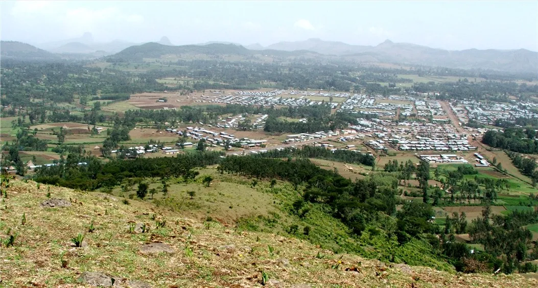
Injibara (Kosober) town in Ethiopia viewed from the south-east
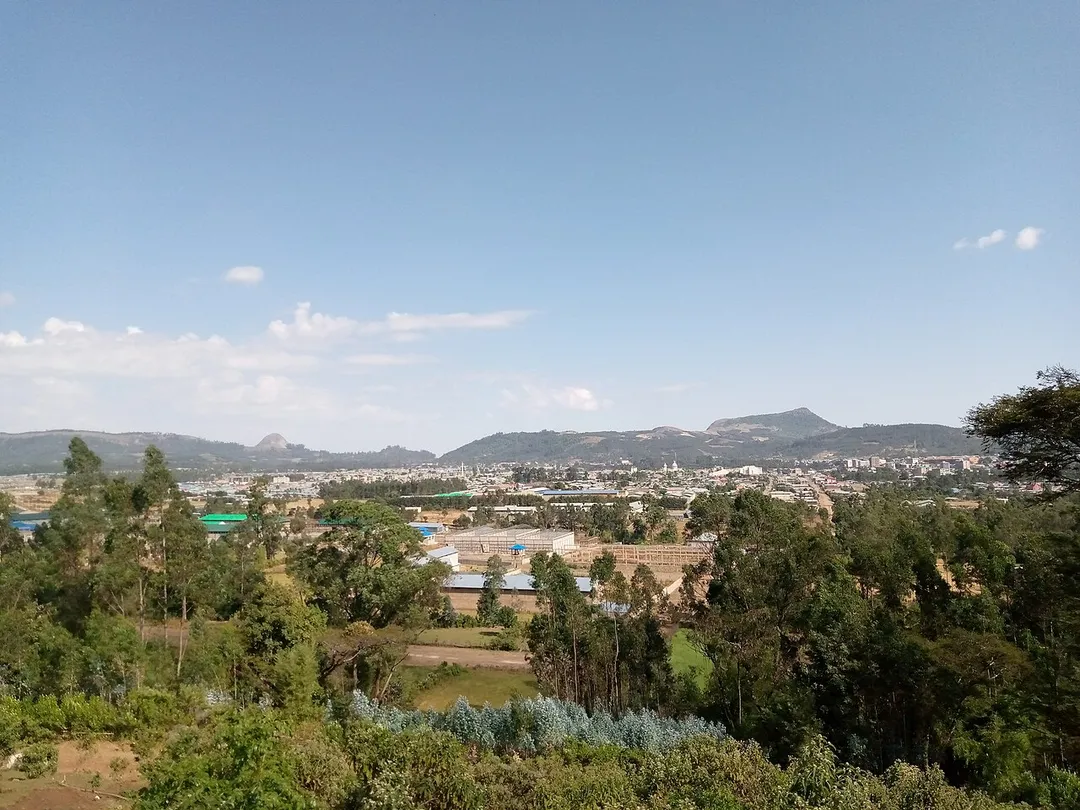
injibara,Agew Awi,Amhara 2022 photo of the town injibara Injibara (እንጅባራ) is a town in Ethiopia. It is the administrative center of the Awi Zone in the Amhara Region. Injibara is located at 10°57′N 36°56′E, in Banja Shekudadworeda at an elevation of 2560 meters above sea level. Injibara is situated in a predominantly mountainous location. Entering the town by the Bahir Dar road, it is impossible not to notice the great Mount Zerehi to the right, one of many massive stone monoliths found in the area. Another geographical feature of the area is the Zengena crater lake just south of the town. The hills and valleys receive high amounts of rain, especially in the rainy season. This high rainfall permits farmers to grow multiple crops a year. With this rainy weather comes hail, however, which is a major problem for the local farmers
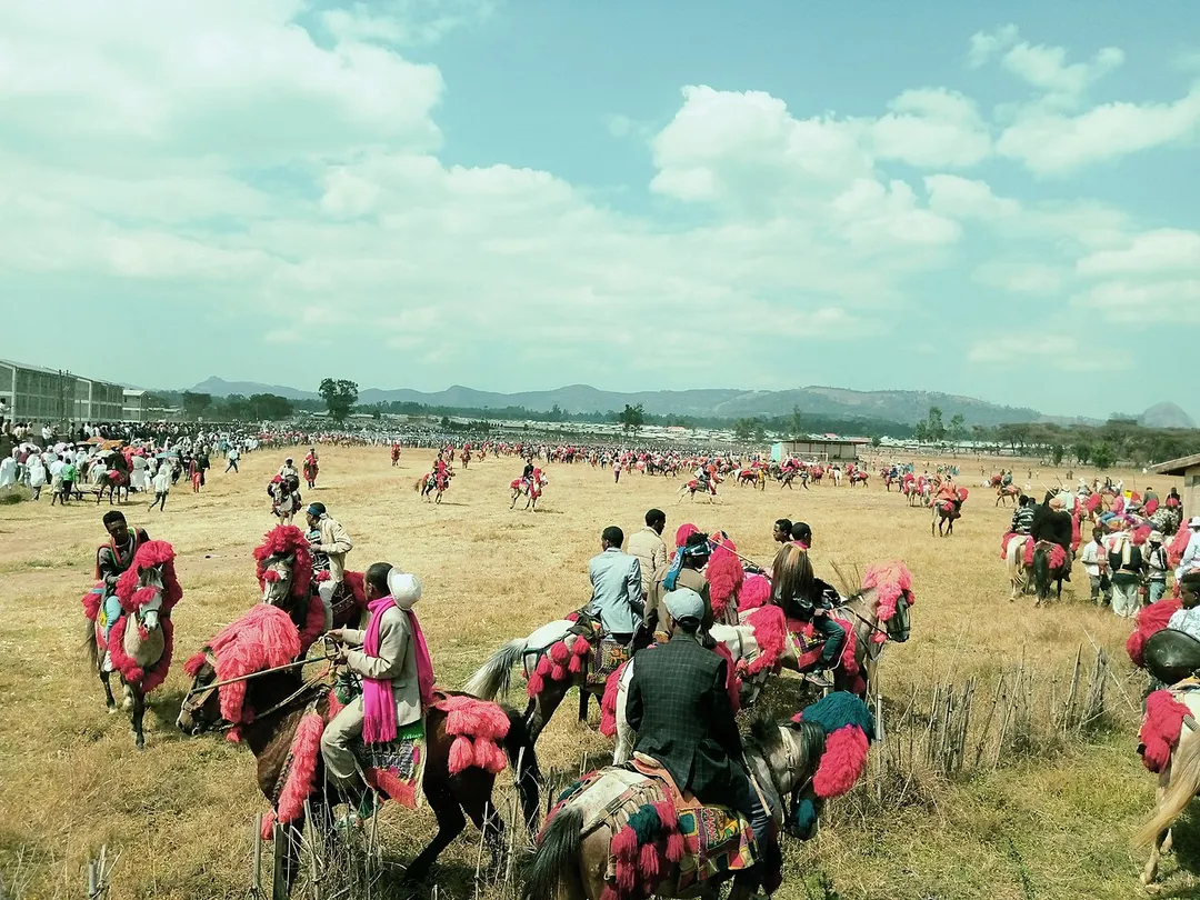
Before 81 years horse riders in the Awi Zone of the Amhara region established the sebat bet Agew horse rider associations. Today more than 40,000 horse riders are the member of the association. By the end of January, the association annually conducts a horse-riding parade and show in Injibara town. The sebat bet Agew horse riders association was established by people of the local who were fighting the Italian invaders. The annual horse-riding festival is probably the largest horse riding festival on the planet level. Riders colorfully decorate their horses, local people prepare the cultural food and beverage of the society, and it’s a real day of the feast.
Photo by Landroving Linguist
Destinations
Home›Destinations›Injibara
AfricaEthiopiaAmhara

Injibara

Amhara, Ethiopia · Africa

About Injibara

Injibara sits on the route: 20 minutes from Ādīs K’idamē.

Injibara is in Amhara, Ethiopia, with about 48,000 people. The nearest town is Ādīs K’idamē, about 10 km away.

Injibara (Amharic: እንጅባራ) is a town in Ethiopia. It is the administrative center of the Agew Awi Zone in the Amhara Region. Injibara is located at 10°57′N 36°56′E, in Banja Shekudad woreda at an elevation of 2,560 meters (8,400 ft) above sea level. Injibara is situated in a predominantly mountainous location. Mount

Read more Zerehi, one of many massive stone monoliths found in the area, is to the west of the Bahir Dar road as it enters the town. Another geographical feature of the area is the Zengena crater lake just south of the town. The hills and valleys receive high amounts of rain, especially in the rainy season. This high rainfall permits farmers to grow multiple crops a year. With this rainy weather comes hail, however, which is a major problem for the local farmers. Based on figures from the 2007 census Archived 2010-11-14 at the Wayback Machine, Injibara has an estimated total population of 21,065, of whom 10,596 are males and 10,469 are females.

Read more on Wikipedia

Where to Stay in Injibara

Compare prices across Booking.com, Airbnb, Expedia, and more. Select your dates to see availability.

Filter presets

Pick your must-haves once: provider links open pre-filtered. Each filter lists which sites it applies to.

Booking.comExpediaTripAdvisorHotels.comAgodaAirbnb

Compare before you book!

Prices can vary significantly between platforms. We recommend checking at least 2-3 sites to find the best deal for your stay in Injibara.

Explore the Area

Discover famous landmarks, scenic roads, and more near Injibara.

Loading map...
Open in Google Maps

Frequently Asked Questions

Where is Injibara?

Injibara is in Amhara, Ethiopia, about 10 km from Ādīs K’idamē.

Road trip

Drive to Injibara

Add it as a stop and the planner works out the driving, the nights and what's worth seeing on the way.

Start planning

What's nearby?

Swipe through places to go

Places within a drive of Injibara. Keep the ones you like and add them to your trip.

Explore now

Quick Information

Population
47,500
Continent
Africa
Country
Ethiopia
Region
Amhara
Timezone
Africa/Addis_Ababa
Coordinates
11.0000, 36.9167

Tags

AfricaEthiopiaAmharaTown

When to drive here

Year-round

Tropical latitude: plan around the wet season rather than temperature.

Nearby Destinations

Other places to explore near Injibara.

Mambuk

🇪🇹 Ethiopia

83 km awayPop. 24,100

Bahir Dar

🇪🇹 Ethiopia

84 km awayPop. 350,000

T’īs Isat

🇪🇹 Ethiopia

90 km awayPop. 39,200

Mot’a

🇪🇹 Ethiopia

104 km awayPop. 59,000

Debre Mark’os

🇪🇹 Ethiopia

115 km awayPop. 140,700

Ādīs Zemen

🇪🇹 Ethiopia

156 km awayPop. 36,300

Dejen

🇪🇹 Ethiopia

162 km awayPop. 11,739

K’ola Diba

🇪🇹 Ethiopia

164 km awayPop. 27,300

Your trip starts here

Plan a road trip from Injibara.

Pick the days, drop in the stops, and share it with whoever's coming.

Start planning
PYRT

The ultimate road trip planning platform. Discover 150,000+ destinations worldwide, plan scenic routes, and create unforgettable adventures.

Inspiration

  • Discover Trips
  • Travel Guides
  • Community

The Product

  • Calendar Planner
  • Integrations
  • How It Works
  • Collaboration Mode
  • Get the App
  • Merchandise: PYRT Supply Co.
  • Become a Creator
  • Trip Marketplace

Plan Your Trip

  • Road Trip Planner
  • Famous Routes
  • Drive Times & Distances
  • Planners by Country
  • Best Road Trip Planner App
  • Discover Road Trips
  • Events
  • Travel Guides
  • How It Works
  • My Trips
  • Community Groups

Company

  • Terms of Service
  • Privacy Policy
  • About PYRT
  • Support
  • Contact Us
  • Sign In
  • Create Account

© 2026 Plan Your Road Trips. All rights reserved.

•[email protected]
Data sources:GeoNames (CC BY 4.0)•Wikimedia Commons (CC BY-SA)•Mapbox•Photography: George Lawrence