PYRTPlan Your Road Trips
Create TripCommunityMerchandise
PYRTPlan Your Road Trips
Create TripCommunityMerchandise
Tranquil hilltop view overlooking Nagano, Japan with empty benches and mountain backdrop.
Vibrant scene of a traditional Japanese festival parade featuring participants carrying a Mikoshi through the streets.
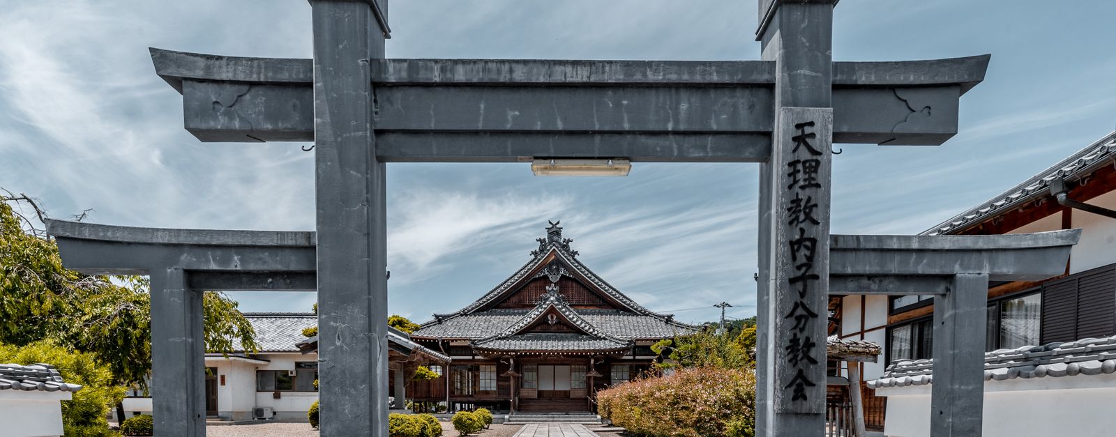
Peaceful view of a traditional Japanese temple entrance with a Torii gate.
Photo by Johnny Song on Pexels
Destinations
Home›Destinations›Hōjō
AsiaJapanEhime

Hōjō

Ehime, Japan · Asia

About Hōjō

Hōjō is worth a stop: 30 minutes from Matsuyama, 25km from Shimanami Kaido.

Hōjō is in Ehime, Japan, with about 28,000 people. You drive on the left here. The nearest town is Matsuyama, about 15 km away.

Where to Stay in Hōjō

Compare prices across Booking.com, Airbnb, Expedia, and more. Select your dates to see availability.

Filter presets

Pick your must-haves once: provider links open pre-filtered. Each filter lists which sites it applies to.

Booking.comExpediaTripAdvisorHotels.comAgodaAirbnb

Compare before you book!

Prices can vary significantly between platforms. We recommend checking at least 2-3 sites to find the best deal for your stay in Hōjō.

Explore the Area

Discover famous landmarks, scenic roads, and more near Hōjō.

Loading map...
Open in Google Maps

Frequently Asked Questions

What is there to see near Hōjō?

Within an hour or so of Hōjō: Dogo Onsen (14 km), Shimanami Kaido (25 km), Mazda Museum (51 km), Mount Misen (Miyajima) (54 km).

Are there any good drives near Hōjō?

The nearest famous roads are Shimanami Kaido and Shikoku Karst.

Where is Hōjō?

Hōjō is in Ehime, Japan, about 15 km from Matsuyama.

Road trip

Drive to Hōjō

Add it as a stop and the planner works out the driving, the nights and what's worth seeing on the way.

Start planning

What's nearby?

Swipe through places to go

Places within a drive of Hōjō. Keep the ones you like and add them to your trip.

Explore now

Quick Information

Population
27,992
Continent
Asia
Country
Japan
Region
Ehime
Timezone
Asia/Tokyo
Coordinates
33.9766, 132.7777

Emergency & Services

Essential numbers in Japan

Police
110
Ambulance
119
Fire
119
Driving side
left

Japan Helpline (24h English assistance): 0570-000-911. An International Driving Permit (1949 convention) is required to drive.

Full driving guide for Japan

Tags

AsiaJapanEhimeTown

Worth the detour from Hōjō

8 notable places within an hour's drive.

landmark

Dogo Onsen

One of Japan's oldest and most famous hot springs, housed in a striking Victorian-era bathhouse that inspired the bathhouse in Spirited Away.

14 km · about 25 min drive

coastal drive

Shimanami Kaido

A 60 km island-hopping expressway across the Seto Inland Sea from Onomichi to Imabari, leaping between six islands on soaring suspension bridges including the world-class Kurushima-Kaikyo Bridge.

25 km · about 30 min drive

museum

Mazda Museum

Factory museum offering tours of Mazda's assembly line and showcasing the marque's rotary engine heritage.

51 km · about 60 min drive

scenic viewpoint

Mount Misen (Miyajima)

The highest peak on Miyajima Island with ancient forests, wild deer, and panoramic views of the Seto Inland Sea from its summit.

54 km · about 60 min drive

museum

Hiroshima Peace Memorial Museum

A profoundly moving museum documenting the atomic bombing of Hiroshima and advocating for the elimination of nuclear weapons.

55 km · about 65 min drive

landmark

Miyajima Island

A sacred island home to the floating Itsukushima Shrine and its iconic torii gate rising from the sea.

55 km · about 65 min drive

landmark

Hiroshima Peace Memorial (Atomic Bomb Dome)

The skeletal ruins of the former Prefectural Industrial Promotion Hall, preserved as a haunting symbol of nuclear devastation and a call for peace.

55 km · about 65 min drive

landmark

Itsukushima Shrine (Miyajima)

A Shinto shrine on Miyajima Island famous for its iconic floating torii gate that appears to hover above the water at high tide.

55 km · about 65 min drive

Driving roads near Hōjō

  • 25 kmShimanami KaidoA 60 km island-hopping expressway across the Seto Inland Sea from Onomichi to Imabari, leaping between six islands on soaring suspension bridges including the world-class Kurushima-Kaikyo Bridge.
  • 54 kmMount Misen (Miyajima)The highest peak on Miyajima Island with ancient forests, wild deer, and panoramic views of the Seto Inland Sea from its summit.
  • 59 kmShikoku KarstA limestone plateau road running the Ehime–Kochi border at around 1,400 m, with cattle grazing among white karst outcrops and unbroken ridge views. One of the highest and most open drives in western Japan.

Nearby Destinations

Other places to explore near Hōjō.

Matsuyama

🇯🇵 Japan

15 km awayPop. 511,192

Imabari

🇯🇵 Japan

23 km awayPop. 170,986

Kure

🇯🇵 Japan

34 km awayPop. 214,592

Sakaridani

🇯🇵 Japan

35 km awayPop. 7,158

Saijō

🇯🇵 Japan

38 km awayPop. 104,791

Etajima

🇯🇵 Japan

40 km awayPop. 24,596

Takehara

🇯🇵 Japan

42 km awayPop. 30,506

Shinagawa

🇯🇵 Japan

43 km awayPop. 422,488

Plan a trip around Hōjō

Asia road trip planner

Your trip starts here

Plan a road trip from Hōjō.

Pick the days, drop in the stops, and share it with whoever's coming.

Start planning
PYRT

The ultimate road trip planning platform. Discover 150,000+ destinations worldwide, plan scenic routes, and create unforgettable adventures.

Inspiration

  • Discover Trips
  • Travel Guides
  • Community

The Product

  • Calendar Planner
  • Integrations
  • How It Works
  • Collaboration Mode
  • Get the App
  • Merchandise: PYRT Supply Co.
  • Become a Creator
  • Trip Marketplace

Plan Your Trip

  • Road Trip Planner
  • Famous Routes
  • Drive Times & Distances
  • Planners by Country
  • Best Road Trip Planner App
  • Discover Road Trips
  • Events
  • Travel Guides
  • How It Works
  • My Trips
  • Community Groups

Company

  • Terms of Service
  • Privacy Policy
  • About PYRT
  • Support
  • Contact Us
  • Sign In
  • Create Account

© 2026 Plan Your Road Trips. All rights reserved.

•[email protected]
Data sources:GeoNames (CC BY 4.0)•Wikimedia Commons (CC BY-SA)•Mapbox•Photography: George Lawrence