PYRTPlan Your Road Trips
Create TripCommunityMerchandise
PYRTPlan Your Road Trips
Create TripCommunityMerchandise
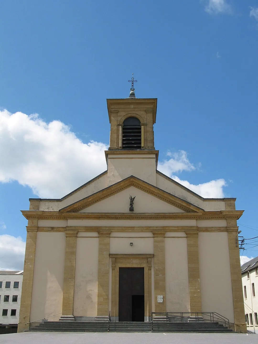
Neufchâteau (Belgium), St. Michael's church.
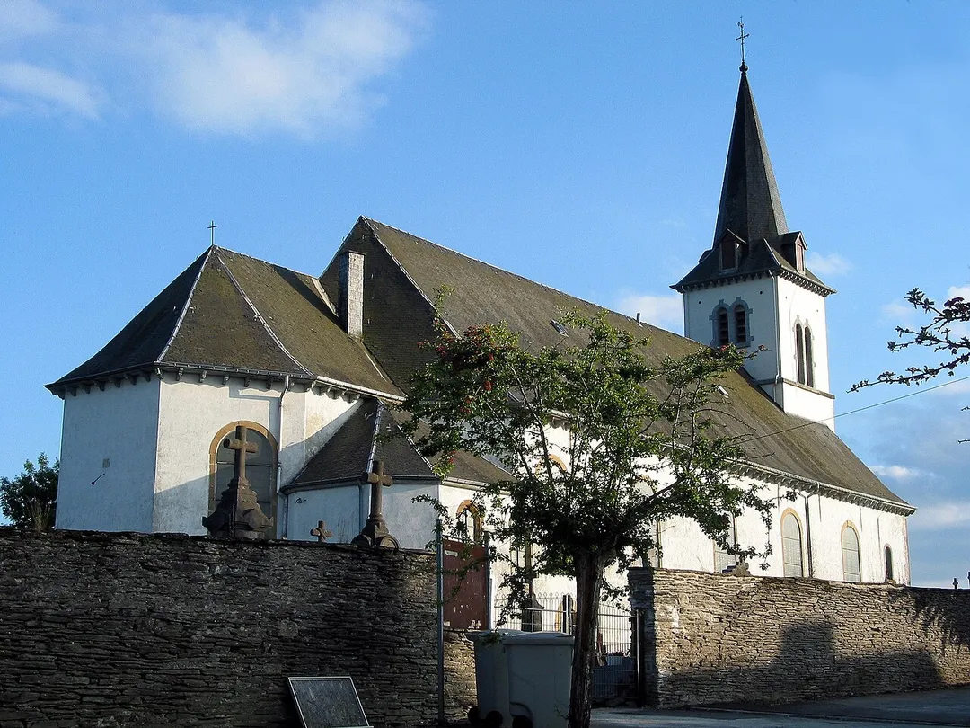
Longlier   (Belgium), St. Stephens’ church (XVIIIth century).
Grand Place in Neufchâteau (Belgium).
Photo by Jean-Pol GRANDMONT
Destinations
Home›Destinations›Hamipré
EuropeBelgiumWallonia

Hamipré

Wallonia, Belgium · Europe

About Hamipré

Hamipré works well as a base: 5 minutes from Assenois, 28km from Belgian Ardennes.

Hamipré is in Wallonia, Belgium, with about 1,300 people. You drive on the right here. The nearest town is Assenois, about 4 km away.

Where to Stay in Hamipré

Compare prices across Booking.com, Airbnb, Expedia, and more. Select your dates to see availability.

Filter presets

Pick your must-haves once: provider links open pre-filtered. Each filter lists which sites it applies to.

Booking.comExpediaTripAdvisorHotels.comAgodaAirbnb

Compare before you book!

Prices can vary significantly between platforms. We recommend checking at least 2-3 sites to find the best deal for your stay in Hamipré.

Explore the Area

Discover famous landmarks, scenic roads, and more near Hamipré.

Loading map...
Open in Google Maps

Frequently Asked Questions

What is there to see near Hamipré?

Within an hour or so of Hamipré: Orval Abbey (23 km), Belgian Ardennes (28 km), Bastogne War Museum (28 km), Castle of Bouillon (28 km).

Are there any good drives near Hamipré?

The nearest famous roads are Baraque de Fraiture, Route du Vin and Chimay Street Circuit.

Where is Hamipré?

Hamipré is in Wallonia, Belgium, about 4 km from Assenois.

Road trip

Drive to Hamipré

Add it as a stop and the planner works out the driving, the nights and what's worth seeing on the way.

Start planning

What's nearby?

Swipe through places to go

Places within a drive of Hamipré. Keep the ones you like and add them to your trip.

Explore now

Quick Information

Population
1,281
Continent
Europe
Country
Belgium
Region
Wallonia
Timezone
Europe/Brussels
Coordinates
49.8373, 5.4569

Emergency & Services

Essential numbers in Belgium

Police
101
Ambulance
112
Fire
112
All emergencies
112
Driving side
right
Full driving guide for Belgium

Tags

EuropeBelgiumWalloniaTown

Worth the detour from Hamipré

8 notable places within an hour's drive.

landmark

Orval Abbey

Romantic medieval abbey ruins beside a working Trappist monastery in the Gaume forest, source of the cult Orval beer; visit the ruins and museum, then drink the beer at the Ange Gardien inn opposite the gate.

23 km · about 25 min drive

national park

Belgian Ardennes

Forested highland region of southeastern Belgium with deep river valleys, castles, and outdoor adventure.

28 km · about 35 min drive

museum

Bastogne War Museum

Immersive museum commemorating the Battle of the Bulge, one of the most pivotal WWII battles fought in the Ardennes.

28 km · about 30 min drive

castle

Castle of Bouillon

Medieval fortress on a rock spur in a Semois river loop in the Ardennes, associated with Godfrey of Bouillon.

28 km · about 35 min drive

landmark

Redu

Ardennes hamlet reborn in 1984 as Europe's second 'book town', its barns and cottages housing a dozen second-hand bookshops, binderies and galleries, with the Euro Space Center just across the motorway.

28 km · about 35 min drive

castle

Château de Bouillon

Godfrey of Bouillon's rambling medieval fortress sprawls over a rocky spur in a loop of the Semois in the Ardennes.

29 km · about 35 min drive

scenic viewpoint

Tombeau du Géant

A famous Semois viewpoint where the river loops around a tree-covered ridge resembling a giant's tomb near Botassart.

31 km · about 35 min drive

natural wonder

Upper Sûre Lake

Luxembourg's largest reservoir in the Ardennes, ringed by wooded roads with viewpoints, swimming areas and boat hire at Insenborn.

31 km · about 35 min drive

Driving roads near Hamipré

  • 31 kmTombeau du GéantA famous Semois viewpoint where the river loops around a tree-covered ridge resembling a giant's tomb near Botassart.
  • 50 kmBaraque de FraitureBelgium's second-highest point at 652 m, a windswept Ardennes plateau crossroads on the N89 with a small ski station and sweeping high-fen scenery.
  • 54 kmGrand Duchess Charlotte BridgeLuxembourg City's striking 'Red Bridge', a scarlet steel span soaring 74 m above the Alzette valley to link the old town with the Kirchberg European quarter.
  • 55 kmChemin de la CornicheRampart walkway along Luxembourg City's old walls, described as Europe's most beautiful balcony, overlooking the Grund quarter.
Driving in Belgium

Drives on
the right
Petrol
~€1.74/litre
Motorway tolls
None

When to drive here

April to October

Nearby Destinations

Other places to explore near Hamipré.

Assenois

🇧🇪 Belgium

4 km awayPop. 1,471

Ochamps

🇧🇪 Belgium

16 km awayPop. 1,184

Habay-la-Vieille

🇧🇪 Belgium

17 km awayPop. 7,704

Florenville

🇧🇪 Belgium

19 km awayPop. 5,464

Sibret

🇧🇪 Belgium

20 km awayPop. 1,443

Étalle

🇧🇪 Belgium

21 km awayPop. 5,228

Libin

🇧🇪 Belgium

21 km awayPop. 4,609

Saint-Hubert

🇧🇪 Belgium

22 km awayPop. 5,538

Plan a trip around Hamipré

Europe road trip planner

Your trip starts here

Plan a road trip from Hamipré.

Pick the days, drop in the stops, and share it with whoever's coming.

Start planning
PYRT

The ultimate road trip planning platform. Discover 150,000+ destinations worldwide, plan scenic routes, and create unforgettable adventures.

Inspiration

  • Discover Trips
  • Travel Guides
  • Community

The Product

  • Calendar Planner
  • Integrations
  • How It Works
  • Collaboration Mode
  • Get the App
  • Merchandise: PYRT Supply Co.
  • Become a Creator
  • Trip Marketplace

Plan Your Trip

  • Road Trip Planner
  • Famous Routes
  • Drive Times & Distances
  • Planners by Country
  • Best Road Trip Planner App
  • Discover Road Trips
  • Events
  • Travel Guides
  • How It Works
  • My Trips
  • Community Groups

Company

  • Terms of Service
  • Privacy Policy
  • About PYRT
  • Support
  • Contact Us
  • Sign In
  • Create Account

© 2026 Plan Your Road Trips. All rights reserved.

•[email protected]
Data sources:GeoNames (CC BY 4.0)•Wikimedia Commons (CC BY-SA)•Mapbox•Photography: George Lawrence