PYRTPlan Your Road Trips
Create TripCommunityMerchandise
PYRTPlan Your Road Trips
Create TripCommunityMerchandise
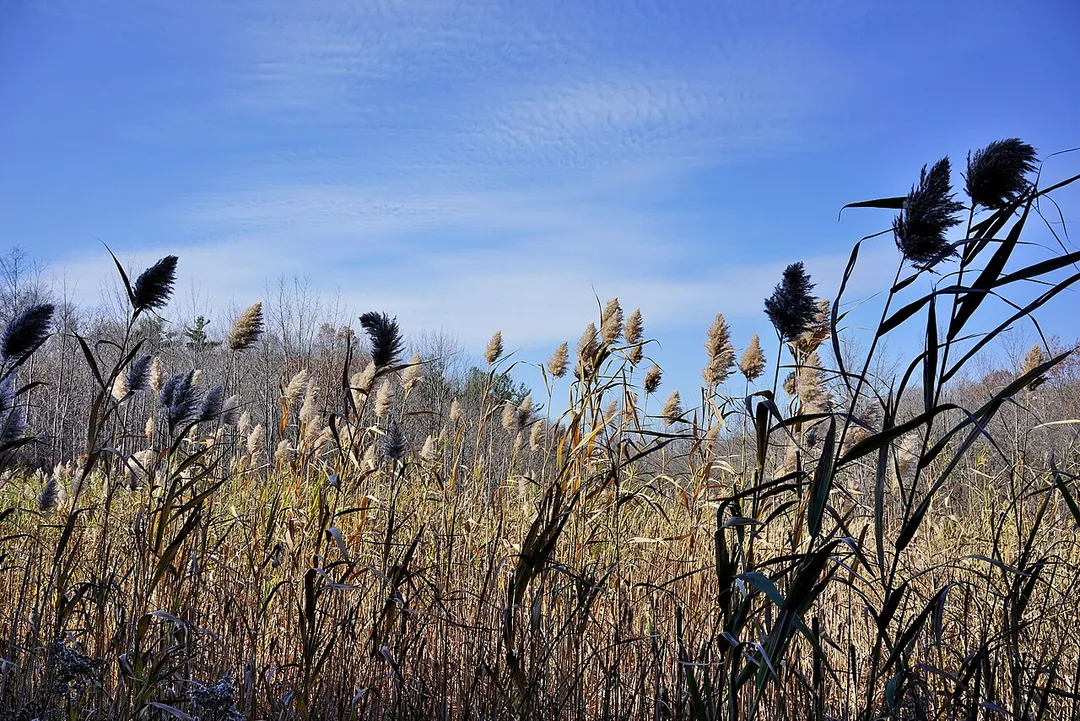
Kings Forest Marsh looking south on a clear day
Identifier: forestprotectio00cana (find matches)
Title: Forest protection in Canada, 1912-1914, by Clyde Leavitt
Year: 1913 (1910s)
Authors:  Canada. Commission of Conservation. Committee on Forests Leavitt, Clyde
Subjects:  Forest fires Forests and forestry
Publisher:  Toronto
Contributing Library:  Robarts - University of Toronto
Digitizing Sponsor:  University of Toronto

View Book Page: Book Viewer
About This Book: Catalog Entry
View All Images: All Images From Book
Click here to view book online to see this illustration in context in a browseable online version of this book.

Text Appearing Before Image:
ty ofits physical features. It consists of a plateau broken by low hum-mocky hills and ridges rising at most only a few hundred feet abovethe general level, the valleys being occupied by lakes, muskegs, andstreams. (i) FROM SUDBURY TO PORT ARTHUR From Sudbury to Port Arthur, generally speaking, the countryalong the railway has been burned at one time or another for the entiredistance of 550 miles.* Not much has escaped except the spruce swamps.The burned areas have been partially recovered by temporary standsof poplar, white birch and jack pine, either pure or in mixture. Butto a vast extent the country has been burned so repeatedly that thereis nothing left but bare rock. As to the amount of destruction north and eastward from the rail-way little is known. In many cases the fire has not run back overfive to ten miles ; but in many others it has run back in streaks betweenwaterways for great but unknown distances. In 1 So 1 lire swept from *See Fire Losses in Ontario bv J. F. Whitson,
Text Appearing After Image:
SUDBURY—PORT ARTHUR DISTRICT 157 Pogma station to Woman river, a distance of some 60 miles. Fiveyears later this same territory was burned over again in a larger firewhich swept the country from the headwaters of the Mississaga andSpanish rivers northward between Matagaming and Pishkanogamalakes to Flying Post. Much of this area was covered with white andred pine. West of this again, and north from Ridout to Chapleau,the fire has run back a long way destroying much white and jackpine. From east of Pardee to Windermere lakes the burn extendsnortheastward at least 15 miles. Other known burns are indicatedon the map. From Heron bay westward the country is very rough ;it bears a growth of dwarf spruce, and is badly burned ; the riversare short and drivable for only a brief time in the spring. South and west from the railway, owing to the prevailing winddirection, the fires have not burned over as large areas. From Daltonto Grassett southwestward, however, the country has been badlyburne

Note About Images

Please note that these images are extracted from scanned page images that may have been digitally enhanced for readability - coloration and appearance of these illustrations may not perfectly resemble the original work.
Looking south along Bathurst Street towards Eglinton Avenue from the Old Forest Hill Road bridge in Toronto
Photo by Michael hunter
Destinations
Home›Destinations›Forest Hill South
North AmericaCanadaOntario

Forest Hill South

Ontario, Canada · North America

About Forest Hill South

Forest Hill South works well as a base: 3km from Royal Ontario Museum.

Forest Hill South is in Ontario, Canada, with about 11,000 people. You drive on the right here.

Where to Stay in Forest Hill South

Compare prices across Booking.com, Airbnb, Expedia, and more. Select your dates to see availability.

Filter presets

Pick your must-haves once: provider links open pre-filtered. Each filter lists which sites it applies to.

Booking.comExpediaTripAdvisorHotels.comAgodaAirbnb

Compare before you book!

Prices can vary significantly between platforms. We recommend checking at least 2-3 sites to find the best deal for your stay in Forest Hill South.

Explore the Area

Discover famous landmarks, scenic roads, and more near Forest Hill South.

Loading map...
Open in Google Maps

Frequently Asked Questions

What is there to see near Forest Hill South?

Within an hour or so of Forest Hill South: Royal Ontario Museum (3 km), CN Tower (6 km), Ripley's Aquarium of Canada (6 km), Canada's Wonderland (19 km).

Where is Forest Hill South?

Forest Hill South is in Ontario, Canada.

Road trip

Drive to Forest Hill South

Add it as a stop and the planner works out the driving, the nights and what's worth seeing on the way.

Start planning

What's nearby?

Swipe through places to go

Places within a drive of Forest Hill South. Keep the ones you like and add them to your trip.

Explore now

Quick Information

Population
10,732
Continent
North America
Country
Canada
Region
Ontario
Timezone
America/Toronto
Coordinates
43.6945, -79.4143

Emergency & Services

Essential numbers in Canada

Police
911
Ambulance
911
Fire
911
Driving side
right

CAA roadside assistance: 1-800-222-4357. Winter tyres mandatory in Quebec December–March.

Full driving guide for Canada

Tags

North AmericaCanadaOntarioTown

Worth the detour from Forest Hill South

7 notable places within an hour's drive.

museum

Royal Ontario Museum

Canada's largest museum of world cultures and natural history, topped by Daniel Libeskind's dramatic crystalline extension.

3 km · about 5 min drive

landmark

CN Tower

Soaring 553-metre communications and observation tower that defines the Toronto skyline.

6 km · about 10 min drive

landmark

Ripley's Aquarium of Canada

Toronto's spectacular aquarium at the base of the CN Tower with a stunning underwater tunnel and 20,000 aquatic animals.

6 km · about 10 min drive

landmark

Canada's Wonderland

Canada's premier amusement park near Toronto with over 200 attractions including 17 roller coasters.

19 km · about 20 min drive

landmark

Toronto Zoo

Canada's largest zoo spanning 287 hectares with over 5,000 animals organized by geographic region.

23 km · about 25 min drive

museum

Canadian Automotive Museum

Museum celebrating Canadian motoring heritage with a collection of rare Canadian-built cars in Oshawa.

50 km · about 55 min drive

landmark

Niagara-on-the-Lake

A charming heritage town at the mouth of the Niagara River with award-winning wineries, the Shaw Festival theatre, and beautiful 19th-century streetscapes.

56 km · about 65 min drive

Nearby Destinations

Other places to explore near Forest Hill South.

Humewood-Cedarvale

🇨🇦 Canada

1 km awayPop. 14,365

Casa Loma

🇨🇦 Canada

1 km awayPop. 10,968

Yonge-Eglinton

🇨🇦 Canada

1 km awayPop. 11,817

Yonge-St.Clair

🇨🇦 Canada

2 km awayPop. 12,528

Forest Hill North

🇨🇦 Canada

2 km awayPop. 12,806

Toronto

🇨🇦 Canada

2 km awayPop. 2,794,356

Wychwood

🇨🇦 Canada

2 km awayPop. 14,349

Mount Pleasant West

🇨🇦 Canada

2 km awayPop. 29,658

Plan a trip around Forest Hill South

North America road trip planner

Your trip starts here

Plan a road trip from Forest Hill South.

Pick the days, drop in the stops, and share it with whoever's coming.

Start planning
PYRT

The ultimate road trip planning platform. Discover 150,000+ destinations worldwide, plan scenic routes, and create unforgettable adventures.

Inspiration

  • Discover Trips
  • Travel Guides
  • Community

The Product

  • Calendar Planner
  • Integrations
  • How It Works
  • Collaboration Mode
  • Get the App
  • Merchandise: PYRT Supply Co.
  • Become a Creator
  • Trip Marketplace

Plan Your Trip

  • Road Trip Planner
  • Famous Routes
  • Drive Times & Distances
  • Planners by Country
  • Best Road Trip Planner App
  • Discover Road Trips
  • Events
  • Travel Guides
  • How It Works
  • My Trips
  • Community Groups

Company

  • Terms of Service
  • Privacy Policy
  • About PYRT
  • Support
  • Contact Us
  • Sign In
  • Create Account

© 2026 Plan Your Road Trips. All rights reserved.

•[email protected]
Data sources:GeoNames (CC BY 4.0)•Wikimedia Commons (CC BY-SA)•Mapbox•Photography: George Lawrence