PYRTPlan Your Road Trips
Create TripCommunityMerchandise
PYRTPlan Your Road Trips
Create TripCommunityMerchandise
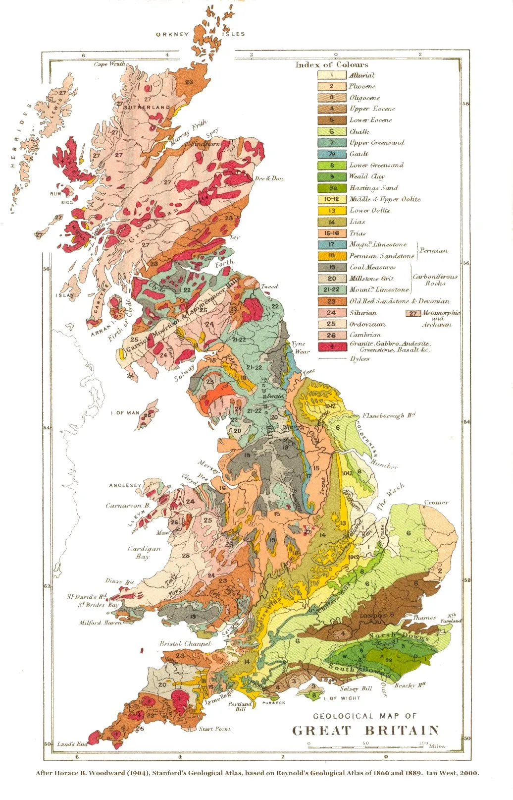
A geological map of Great Britain and neighbouring islands (excluding Ireland).
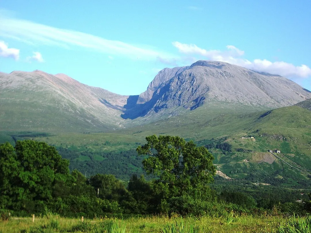
Ben Nevis, 1,344 metres, Scotland. Photograph taken from Banavie about 8 km north west. 18:55, 11 July 2005.  The summit is beyond and to the left of the apparent highest point, Càrn Dearg North, 1,221 metres, (many Scottish mountains are called Càrn Dearg). Càrn Mòr Dearg, 1,223 metres, is to the left, connected to the Ben by the Càrn Mòr Dearg Arête at the head of Coire Leis (slightly in shadow). The pipelines of the Lochaber hydroelectric scheme are visible lower right.
Ireland and the United Kingdom on 26 May 2012, during a heat wave.  Original NASA text:
Sunny and cloud-free skies helped fuel a record-breaking heat wave in Ireland and the United Kingdom in the last week of May 2012. The Moderate Resolution Imaging Spectroradiometer aboard the Terra satellite captured this true-colour image of the brilliantly green islands basking in late spring heat on 26 May 2012. A lone, thin cloud bank hovers far off the northeast shore of Scotland, and to the east of England, swirls of blue and green indicate a phytoplankton bloom.
Temperatures soared across the entire United Kingdom and in Ireland over the last several days, with many record highs reached on 25 May. All-time high temperatures set on that date in England include London at 25.5°C (78°F) and Bournemouth at 28°C (82.4°F). In Scotland, Glasgow set a record of 23.8°C (75°F) and, just to the north, Bishopton reached 27.3°C (81.1°F). Ireland was also setting records, with Ardfert, County Kerry at 28.3°C (82.9°F) and Shannon reaching 27.8°C (82°F). Average maximum temperatures for England in May are 14°C to 17°C (57.2°F to 62.6°F), and for Scotland between 13°C and 15°C (55.4°F to 59°F). Average May temperature in Dublin, Ireland is 15°C (59°F).
The unaccustomed heat caused people to throng to the beaches, rivers and lakes. As citizens sought relief, several drownings were reported, including a teenager who lost his life in the River Thames in Oxford, England and a 25 year old man who died rescuing two children in Sussex.
Not all problems brought by high temperatures were so profound, however. The Scottish SPCA rescued two budgies, a canary, a parakeet and an exotic sun conure found flying loose in various locations. It is believed the pet birds escaped through doors and windows which were left open when their owners attempted to cool the homes.

By May 28, severe weather warnings were posted by England's Met Office as scattered and brief storms rolled in, bringing a break in the toasty temperatures across the region.
Photo by Horace Bolingbroke Woodward
Destinations
Home›Destinations›Flint
EuropeUnited KingdomWales

Flint

Wales, United Kingdom · Europe

About Flint

Flint works well as a base: 10 minutes from Northop, 32km from Llyn Brenig.

Flint is in Wales, United Kingdom, with about 26,000 people. You drive on the left here. The nearest town is Northop, about 4 km away.

Flint (Welsh: Y Fflint) is a town and community in Flintshire, Wales, lying on the estuary of the River Dee. It is the former county town of Flintshire. According to the 2011 Census, the population of the community of Flint was 12,953, increasing to 13,732 at the 2021 census. The urban area including Holywell and

Read more Bagillt had a population of 26,442.

Read more on Wikipedia

Where to Stay in Flint

Compare prices across Booking.com, Airbnb, Expedia, and more. Select your dates to see availability.

Filter presets

Pick your must-haves once: provider links open pre-filtered. Each filter lists which sites it applies to.

Booking.comExpediaTripAdvisorHotels.comAgodaAirbnb

Compare before you book!

Prices can vary significantly between platforms. We recommend checking at least 2-3 sites to find the best deal for your stay in Flint.

Explore the Area

Discover famous landmarks, scenic roads, and more near Flint.

Loading map...
Open in Google Maps

Frequently Asked Questions

What is there to see near Flint?

Within an hour or so of Flint: Chester Zoo (17 km), Ponderosa Cafe (25 km), Horseshoe Pass (26 km), Horseshoe Pass (Bwlch yr Oernant) (26 km).

Are there any good drives near Flint?

The nearest famous roads are Horseshoe Pass, Evo Triangle and B4391 Milltir Gerrig.

Where is Flint?

Flint is in Wales, United Kingdom, about 4 km from Northop.

Road trip

Drive to Flint

Add it as a stop and the planner works out the driving, the nights and what's worth seeing on the way.

Start planning

What's nearby?

Swipe through places to go

Places within a drive of Flint. Keep the ones you like and add them to your trip.

Explore now

Quick Information

Population
26,442
Continent
Europe
Country
United Kingdom
Region
Wales
Timezone
Europe/London
Coordinates
53.2449, -3.1323

Emergency & Services

Essential numbers in United Kingdom

Police
999
Ambulance
999
Fire
999
Non-emergency police
101
Driving side
left

112 also works. NHS non-emergency medical advice: 111. National Highways breakdown assistance on motorways: 0300 123 5000.

Full driving guide for United Kingdom

Tags

EuropeUnited KingdomWalesTown

Worth the detour from Flint

8 notable places within an hour's drive.

landmark

Chester Zoo

The UK's most-visited zoo housing over 35,000 animals across 128 acres with award-winning conservation programs.

17 km · about 20 min drive

cafe

Ponderosa Cafe

A legendary biker stop high on the Horseshoe Pass above Llangollen with panoramic views across the Welsh valleys.

25 km · about 30 min drive

mountain pass

Horseshoe Pass

Sweeping A542 mountain pass curling above Llangollen in a giant horseshoe, climbing to 417m past the Ponderosa Cafe with wide views over the Dee Valley. A classic North Wales driving and biking road.

26 km · about 30 min drive

mountain pass

Horseshoe Pass (Bwlch yr Oernant)

A sweeping 417m moorland pass on the A542 above Llangollen, with the Ponderosa cafe at the top and views to the Berwyns.

26 km · about 30 min drive

racetrack

Aintree Motor Racing Circuit

Historic circuit inside Aintree Racecourse that hosted five British Grands Prix in the 1950s-60s, where Stirling Moss took his first home GP win. Club sprints still run on the old track.

29 km · about 35 min drive

natural wonder

Llyn Brenig

A large reservoir on the Denbigh Moors beside the Evo Triangle roads, with a 10-mile shore trail, Bronze Age sites and big open skies.

32 km · about 35 min drive

racetrack

Oulton Park

A picturesque Cheshire circuit winding through parkland with dramatic elevation changes, a favourite of British club and national racing.

35 km · about 40 min drive

famous road

Evo Triangle

Legendary 20-mile loop of the A5, A543 and B4501 across the empty Denbigh Moors, made famous as evo magazine's road-test circuit. Fast, open sightlines past Llyn Brenig make it a pilgrimage for keen drivers.

35 km · about 40 min drive

Driving roads near Flint

7 named roads, passes and coastal drives within 60km.

  • 26 kmHorseshoe PassSweeping A542 mountain pass curling above Llangollen in a giant horseshoe, climbing to 417m past the Ponderosa Cafe with wide views over the Dee Valley. A classic North Wales driving and biking road.
  • 26 kmHorseshoe Pass (Bwlch yr Oernant)A sweeping 417m moorland pass on the A542 above Llangollen, with the Ponderosa cafe at the top and views to the Berwyns.
  • 35 kmEvo TriangleLegendary 20-mile loop of the A5, A543 and B4501 across the empty Denbigh Moors, made famous as evo magazine's road-test circuit. Fast, open sightlines past Llyn Brenig make it a pilgrimage for keen drivers.
  • 48 kmB4391 Milltir GerrigA high, empty moorland crossing of the Berwyn range between Bala and Llangynog, all long sightlines and sheep.
  • 50 kmGreat Orme Marine DriveOne-way Victorian toll road looping 4 miles around the cliffs of the Great Orme headland at Llandudno, with sheer limestone drops, seabirds and views to Anglesey and the Irish Sea.
  • 57 kmCarnedd LlewelynAt 1,064m the third-highest peak in Wales, at the heart of the wild, rolling Carneddau plateau with its wild ponies.

Driving in United Kingdom

Drives on
the left
Petrol
~€1.73/litre
Motorway tolls
None

When to drive here

April to October

Nearby Destinations

Other places to explore near Flint.

Northop

🇬🇧 United Kingdom

4 km awayPop. 1,001

Neston

🇬🇧 United Kingdom

7 km awayPop. 15,064

Deeside

🇬🇧 United Kingdom

8 km awayPop. 32,000

Queensferry

🇬🇧 United Kingdom

8 km away

Buckley

🇬🇧 United Kingdom

9 km awayPop. 63,576

Heswall

🇬🇧 United Kingdom

9 km awayPop. 29,075

Hawarden

🇬🇧 United Kingdom

10 km awayPop. 25,513

Saughall

🇬🇧 United Kingdom

12 km awayPop. 2,569

Plan a trip around Flint

Wales road trip planner

Your trip starts here

Plan a road trip from Flint.

Pick the days, drop in the stops, and share it with whoever's coming.

Start planning
PYRT

The ultimate road trip planning platform. Discover 150,000+ destinations worldwide, plan scenic routes, and create unforgettable adventures.

Inspiration

  • Discover Trips
  • Travel Guides
  • Community

The Product

  • Calendar Planner
  • Integrations
  • How It Works
  • Collaboration Mode
  • Get the App
  • Merchandise: PYRT Supply Co.
  • Become a Creator
  • Trip Marketplace

Plan Your Trip

  • Road Trip Planner
  • Famous Routes
  • Drive Times & Distances
  • Planners by Country
  • Best Road Trip Planner App
  • Discover Road Trips
  • Events
  • Travel Guides
  • How It Works
  • My Trips
  • Community Groups

Company

  • Terms of Service
  • Privacy Policy
  • About PYRT
  • Support
  • Contact Us
  • Sign In
  • Create Account

© 2026 Plan Your Road Trips. All rights reserved.

•[email protected]
Data sources:GeoNames (CC BY 4.0)•Wikimedia Commons (CC BY-SA)•Mapbox•Photography: George Lawrence