

landmark
Morgan Motor Company
The last family-owned British car maker in Malvern, offering factory tours where hand-crafted sports cars are built.
14 km · about 25 min drive
England, United Kingdom · Europe
Fernhill Heath is worth a stop: 10 minutes from Hallow, 27km from Tewkesbury Abbey.
Fernhill Heath is in England, United Kingdom, with about 3,300 people. You drive on the left here. The nearest town is Hallow, about 4 km away.
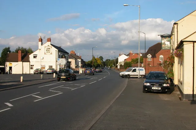
Fernhill Heath is a village in Worcestershire, England. It is in the civil parish of North Claines in Wychavon district. Its built-up area population was 3,297 in 2021.
Fernhill Heath is located on the A38 main road on the north-side of the City of Worcester and is approximately 3 miles (5 km) north of Worcester and 3Read more
miles (5 km) south of Droitwich. The population of Fernhill Heath is around 3,000 people. The village features two public houses, "The White Hart" and "The Bull", a sub-post office, three shops, a primary school, a Baptist church, a war memorial hall and a community centre.
Fernhill Heath railway station opened in 1852 as Fearnall Heath but was closed in April 1965.
One of the oldest properties within Fernhill Heath is Fernhill Heath House which was once owned and occupied by Lady Hindlip (Mrs Allsopp) who had moved into this as a widower upon the death of Lord Hindlip. The house is now owned after extensive renovation 30-ish years ago by Richard Pearce. Agatha Hindlip donated money to the village upon her death to build a bowling green - however only the street name remaining Agatha Gardens.
Compare prices across Booking.com, Airbnb, Expedia, and more. Select your dates to see availability.
Pick your must-haves once: provider links open pre-filtered. Each filter lists which sites it applies to.
Compare before you book!
Prices can vary significantly between platforms. We recommend checking at least 2-3 sites to find the best deal for your stay in Fernhill Heath.
Discover famous landmarks, scenic roads, and more near Fernhill Heath.
Within an hour or so of Fernhill Heath: Morgan Motor Company (14 km), Shelsley Walsh Speed Hill Climb (15 km), Tewkesbury Abbey (27 km), Prescott Speed Hill Climb (32 km).
The nearest famous roads are Gospel Pass, A466 Wye Valley (Chepstow to Monmouth) and Elan Valley Mountain Road (Rhayader to Aberystwyth).
Fernhill Heath is in England, United Kingdom, about 4 km from Hallow.
Road trip
Add it as a stop and the planner works out the driving, the nights and what's worth seeing on the way.
Start planningSwipe through places to go
Places within a drive of Fernhill Heath. Keep the ones you like and add them to your trip.
Essential numbers in United Kingdom
112 also works. NHS non-emergency medical advice: 111. National Highways breakdown assistance on motorways: 0300 123 5000.
Full driving guide for United Kingdom8 notable places within an hour's drive.
landmark
The last family-owned British car maker in Malvern, offering factory tours where hand-crafted sports cars are built.
14 km · about 25 min drive
racetrack
The world's oldest motorsport venue still using its original course, running since 1905. A 1,000-yard blast up a wooded Worcestershire hillside, steeped in Edwardian racing heritage.
15 km · about 30 min drive
cathedral
A Norman abbey church with the tallest surviving Romanesque tower in the world, saved from dissolution by the townspeople.
27 km · about 30 min drive
racetrack
Famous Cotswolds hill climb owned by the Bugatti Owners' Club since 1937, twisting up through the grounds of Prescott House. Home of the celebrated La Vie en Bleu vintage festival.
32 km · about 35 min drive
landmark
A folly castle crowning the Cotswold escarpment at 1,024 feet, with views across 16 counties from the second-highest point.
33 km · about 40 min drive
museum
Open-air museum rebuilding an industrial Black Country town: canal boats, a working replica Newcomen engine, 1930s fish and chips fried in beef dripping, and a coal mine walk. A key Peaky Blinders filming location.
33 km · about 40 min drive
film location
The open-air museum in Dudley provides the canal-side streets and workshops of Peaky Blinders' Small Heath.
33 km · about 40 min drive
landmark
A timeless hilltop hamlet famed for its lavender fields and the eccentric manor of collector Charles Wade.
34 km · about 40 min drive
April to October
Other places to explore near Fernhill Heath.
Your trip starts here
Pick the days, drop in the stops, and share it with whoever's coming.