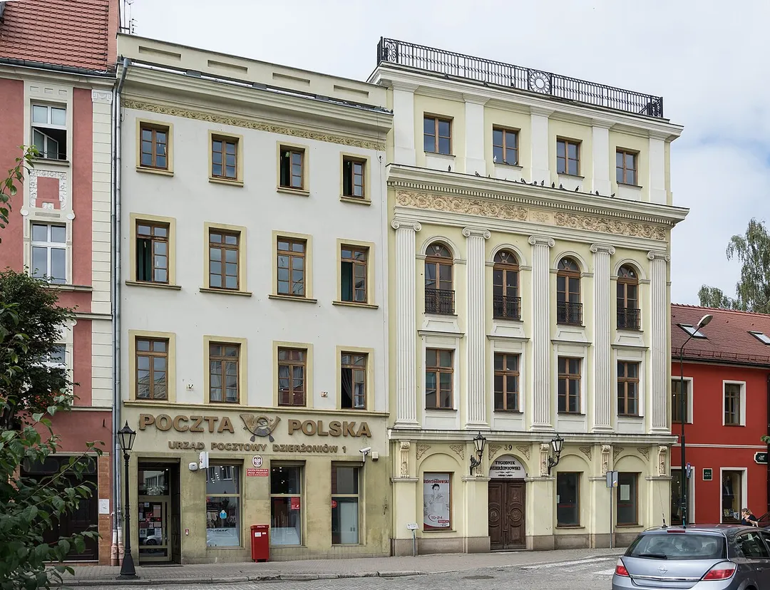
Dzierżoniów is worth a stop: 5 minutes from Uciechów, 35km from Road of a Hundred Bends.
Dzierżoniów is in Lower Silesia, Poland, with about 34,000 people. You drive on the right here. The nearest town is Uciechów, about 4 km away.
Dzierżoniów (Polish: [d͡ʑɛrˈʐɔɲuf] ; until 1946 Polish: Rychbach; German: Reichenbach im Eulengebirge [ˈʁaɪçn̩bax]) is a town located at the foot of the Owl Mountains in southwestern Poland, within the Lower Silesian Voivodeship. It is the seat of Dzierżoniów County, and of Gmina Dzierżoniów (although it is not partRead more of the territory of the latter, since the town forms a separate urban gmina).
Established in the 13th century, Dzierżoniów is a historical Lower Silesian town that covers an area of 20.1 square kilometres (7.8 sq mi), and as of December 2021 it has a population of 32,346. It is named after Polish priest and scientist Jan Dzierżon.
Unique and architecturally rich, Dzierżoniów features a central market square with elegant tenements and a town hall as well as few museums and restaurants. The Old Town is a venue for several annual events and fairs.
Within an hour or so of Dzierżoniów: Church of Peace, Świdnica (17 km), Osówka Underground City (18 km), Ksiaz Castle (28 km), Road of a Hundred Bends (35 km).
Are there any good drives near Dzierżoniów?
The nearest famous roads are Road of a Hundred Bends and Cervenohorske Sedlo.
Where is Dzierżoniów?
Dzierżoniów is in Lower Silesia, Poland, about 4 km from Uciechów.
Road trip
Drive to Dzierżoniów
Add it as a stop and the planner works out the driving, the nights and what's worth seeing on the way.
Europe's largest timber-framed church, raised in 1656–57 by Silesian Lutherans who were forbidden stone, nails or a tower: the wattle-and-daub interior holds 7,500 people under painted galleries. UNESCO-listed.
17 km · about 20 min drive
museum
Osówka Underground City
The largest visitable complex of Nazi Germany's Project Riese: 3.1 km of tunnels bored into the Owl Mountains in 1943–45 for a purpose still debated. Partly flooded sections are toured by boat.
18 km · about 20 min drive
castle
Ksiaz Castle
Lower Silesia's largest castle, perched dramatically on a rock above a gorge, riddled with WWII tunnels.
28 km · about 35 min drive
famous road
Road of a Hundred Bends
Route 387 between Radkow and Kudowa-Zdroj corkscrews through the surreal rock labyrinths of the Table Mountains, packing dozens of hairpins into a forested drive beloved by Polish motorists.
35 km · about 40 min drive
scenic viewpoint
Szczeliniec Wielki
The highest summit of the Table Mountains (919 m): a sandstone plateau of eroded rock labyrinths, chasms and terraces reached by a historic stone stairway from Karłów, with views into Czechia on clear days.
35 km · about 40 min drive
photogenic
Błędne Skały
A rock labyrinth at 853 m in the Table Mountains where a marked trail squeezes between mushroom-shaped sandstone blocks and metre-wide corridors: a filming location for The Chronicles of Narnia. Car access via a timed toll road from Karłów.
38 km · about 45 min drive
natural wonder
Adršpach-Teplice Rocks
A mesmerizing labyrinth of towering sandstone rock formations sculpted by millions of years of erosion into surreal shapes.
39 km · about 45 min drive
landmark
Skull Chapel, Czermna
A small Baroque chapel (1776–1784) in Kudowa-Zdrój whose walls and ceiling are lined with 3,000 human skulls and bones, with 21,000 more in the crypt below: Poland's only ossuary of its kind.
42 km · about 50 min drive
Driving roads near Dzierżoniów
35 kmRoad of a Hundred BendsRoute 387 between Radkow and Kudowa-Zdroj corkscrews through the surreal rock labyrinths of the Table Mountains, packing dozens of hairpins into a forested drive beloved by Polish motorists.
35 kmSzczeliniec WielkiThe highest summit of the Table Mountains (919 m): a sandstone plateau of eroded rock labyrinths, chasms and terraces reached by a historic stone stairway from Karłów, with views into Czechia on clear days.
64 kmSnezkaCzechia's highest peak in the Krkonose, reached by chairlift and ridge trails with views into Poland.
64 kmSniezkaHighest peak of the Karkonosze range at 1603 metres on the Polish-Czech border, topped by a distinctive disc-shaped meteorological observatory.
76 kmCervenohorske SedloA 1,013 m saddle on the I/44 road over the Jeseniky Mountains, linking Sumperk and Jesenik with long chains of sweeping switchbacks through spruce forest: one of Czechia's best mountain drives.