
landmark
National Aquarium
Baltimore's Inner Harbor aquarium showcasing over 20,000 animals including dolphins, sharks, and tropical fish.
7 km · about 15 min drive
Maryland, United States · North America
Curtis Bay is worth a stop: 10 minutes from Baltimore Highlands, 7km from National Aquarium.
Curtis Bay is in Maryland, United States, with about 3,800 people. You drive on the right here. The nearest town is Baltimore Highlands, about 4 km away.
Curtis Bay is a residential, commercial, and industrial neighborhood in the southern portion of the City of Baltimore, Maryland, United States.
The n is on steep sloping heights, about four city blocks wide (west to east) and fifteen blocks long (north to south) and above and surrounded on three sides (northeast -Read more
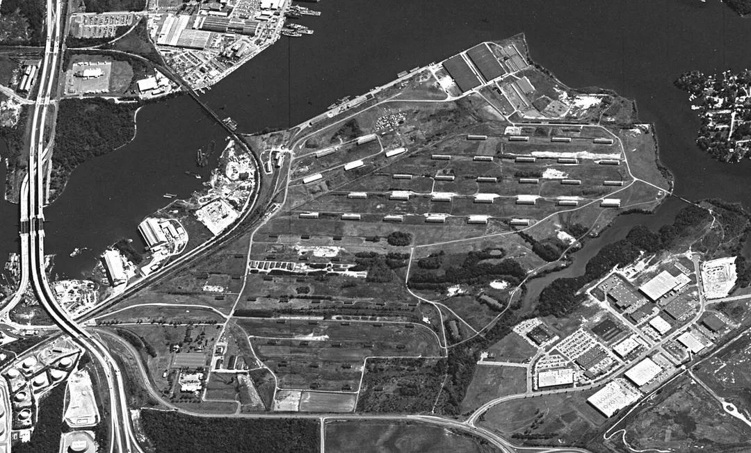
east - southeast) in a highly industrialized waterfront area in the southern part of the city, and receives its name from the body (cove) of water to the east in which it sits. The cove of "Curtis Bay" with two small branches - Stone House Cove and Cabin Branch is fed from the southwest by Curtis Creek which in turn is formed further south by Marley Creek and Furnace Branch/Creek in Anne Arundel County. Adjoining nearby to the east is Thoms Cove near Hawkins Point at the north end of the Marley Neck peninsula. Curtis Bay cove itself also has a dredged deep water channel with considerable port facilities and waterfront industries and is a branch of the main stem of the Patapsco River, which forms the extensive frontage of Baltimore Harbor and Port, northwest off of the Chesapeake Bay.
The residential community of Curtis Bay is along three major north–south thoroughfares of Curtis Avenue, Pennington Avenue (Maryland Route 173 on which most commercial businesses are located) and residential Fairhaven Avenue and a partial street of Prudence Street. Running west to east are fifteen smaller residential streets named alphabetically for various types of trees.
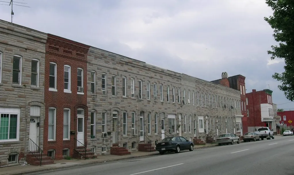
"The Bay", as it is often called colloquially, also offers a variety of housing, townhouses, rowhouses, individual homes, (both constructed of wood-frame, brick, stone and concrete block/stuccoed) and corner stores, taverns/bars.
Curtis Bay is also home since 1897 to the United States Coast Guard Yard
(formerly the U.S. Revenue Cutter Service until 1915) on Hawkins Point Road / extending south from Pennington Avenue (Maryland Route 173) on Arundel Cove off Curtis Creek on the border line with neighboring suburban Anne Arundel County to the south.
During the middle and late 19th and early 20th centuries, there was a quarantine station and lazaretto run by the United States Government agency (future U.S. Public Health Service) along Thoms Cove between Sledds Point and Hawkins Point.
There is a large Polish American community in Curtis Bay. The former town hall, real estate office, volunteer fire station, and meeting/assembly hall on the second floor for Curtis Bay was constructed on the heights overlooking the new town and rapidly developing industrial waterfront along Fairview Avenue (now Fairhaven Avenue) facing Filbert Street by a successor developing firm, the South Baltimore Harbor and Improvement Company in 1905. In 1925, the United Polish Societies purchased the building and named it Polish Home Hall and it became central to the Polish ethnic experience in Curtis Bay, functioning as a social, educational, and political center for Curtis Bay's Polish community into the 1970s.
Compare prices across Booking.com, Airbnb, Expedia, and more. Select your dates to see availability.
Pick your must-haves once: provider links open pre-filtered. Each filter lists which sites it applies to.
Compare before you book!
Prices can vary significantly between platforms. We recommend checking at least 2-3 sites to find the best deal for your stay in Curtis Bay.
Discover famous landmarks, scenic roads, and more near Curtis Bay.
Within an hour or so of Curtis Bay: National Aquarium (7 km), United States Capitol (52 km), Smithsonian's National Zoo (52 km), National Mall (53 km).
Curtis Bay is in Maryland, United States, about 4 km from Baltimore Highlands.
Road trip
Add it as a stop and the planner works out the driving, the nights and what's worth seeing on the way.
Start planningSwipe through places to go
Places within a drive of Curtis Bay. Keep the ones you like and add them to your trip.
Essential numbers in United States
AAA roadside assistance: 1-800-222-4357. Right turn on red is legal in most states unless signed otherwise.
Full driving guide for United States8 notable places within an hour's drive.
landmark
Baltimore's Inner Harbor aquarium showcasing over 20,000 animals including dolphins, sharks, and tropical fish.
7 km · about 15 min drive
landmark
Neoclassical seat of the US Congress topped by the iconic cast-iron dome, a centrepiece of the National Mall.
52 km · about 60 min drive
landmark
Free-admission zoo in Washington, D.C. that is part of the Smithsonian Institution, famous for its giant pandas.
52 km · about 60 min drive
landmark
America's front yard stretching from the US Capitol to the Lincoln Memorial, lined with iconic monuments, memorials, and Smithsonian museums.
53 km · about 60 min drive
museum
Home to the Hope Diamond and over 148 million specimens, making it one of the world's premier natural history collections.
53 km · about 60 min drive
museum
A free world-class museum on the National Mall featuring masterpieces from the Middle Ages to the present, including the only Leonardo da Vinci painting in the Americas.
53 km · about 60 min drive
museum
The world's largest museum complex with 21 museums and galleries, all free, including the Air and Space Museum and Natural History Museum.
53 km · about 60 min drive
landmark
Official residence and workplace of the President of the United States since 1800, a symbol of American democracy.
53 km · about 60 min drive
Other places to explore near Curtis Bay.
Your trip starts here
Pick the days, drop in the stops, and share it with whoever's coming.