

landmark
Angel of the North
Striking 20-metre steel sculpture with a 54-metre wingspan standing on a hilltop in Gateshead, England.
15 km · about 30 min drive
England, United Kingdom · Europe
Chopwell works well as a base: 10 minutes from Rowlands Gill, 34km from B6318 Military Road (Hadrian's Wall).
Chopwell is in England, United Kingdom, with about 3,100 people. You drive on the left here. The nearest town is Rowlands Gill, about 5 km away.
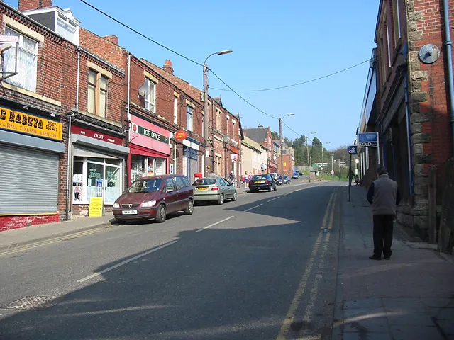
Chopwell is a village in the Gateshead district, in the county of Tyne and Wear, England, 3 miles (4.8 km) west of Rowlands Gill and 1 mile (1.6 km) north of Hamsterley. At the 2011 Census, it had a population of 9,395.
In 1150, Bishop Pudsey granted the Manor of Chopwell to the first Abbot of Newminster. NewminsterRead more
Abbey retained possession of the manor until the dissolution of the Monasteries in 1536.
Traditionally an area of coal mining, Chopwell was nicknamed "Little Moscow" because of the strong support for the Communist Party. Chopwell counts "Marx Terrace" (after Karl Marx) and "Lenin Terrace" (after Vladimir Lenin) among its street names, and during the 1926 General Strike the Union Flag at the council offices was taken down and replaced with the Soviet flag. Another notable street, site of the former Chopwell Junior School, "Fannybush Road", was renamed "Whittonstall Road" by the local authority in the 1990s after its street sign was repeatedly stolen.
Compare prices across Booking.com, Airbnb, Expedia, and more. Select your dates to see availability.
Pick your must-haves once: provider links open pre-filtered. Each filter lists which sites it applies to.
Compare before you book!
Prices can vary significantly between platforms. We recommend checking at least 2-3 sites to find the best deal for your stay in Chopwell.
Discover famous landmarks, scenic roads, and more near Chopwell.
Within an hour or so of Chopwell: Angel of the North (15 km), Durham Cathedral (22 km), Durham Cathedral Cloister (Hogwarts) (22 km), Chesters Roman Fort (24 km).
The nearest famous roads are B6318 Military Road (Hadrian's Wall), A689 Alston to Stanhope (Weardale) and Hartside Pass (A686).
Chopwell is in England, United Kingdom, about 5 km from Rowlands Gill.
Road trip
Add it as a stop and the planner works out the driving, the nights and what's worth seeing on the way.
Start planningSwipe through places to go
Places within a drive of Chopwell. Keep the ones you like and add them to your trip.
Essential numbers in United Kingdom
112 also works. NHS non-emergency medical advice: 111. National Highways breakdown assistance on motorways: 0300 123 5000.
Full driving guide for United Kingdom8 notable places within an hour's drive.
landmark
Striking 20-metre steel sculpture with a 54-metre wingspan standing on a hilltop in Gateshead, England.
15 km · about 30 min drive
cathedral
UNESCO-listed Romanesque masterpiece perched above the River Wear, widely regarded as the finest Norman building in England.
22 km · about 25 min drive
film location
The Norman cathedral's cloister garth is where Harry releases Hedwig in the snow, and its chapter house was Professor McGonagall's transfiguration classroom.
22 km · about 25 min drive
ancient ruins
The best-preserved Roman cavalry fort in Britain, on the North Tyne, with a remarkably complete military bath house.
24 km · about 25 min drive
ancient ruins
The 73-mile Roman frontier fortification stretching across northern England, built in 122 AD with forts, milecastles, and turrets marking the edge of the Roman Empire.
34 km · about 40 min drive
famous road
General Wade's arrow-straight road along Hadrian's Wall, rolling over the whin sill with Roman forts on either side.
34 km · about 40 min drive
ancient ruins
The most complete Roman fort in Britain, standing on the Whin Sill crags along Hadrian's Wall with barracks, hospital and communal latrines.
34 km · about 40 min drive
famous road
A remote high Pennine road over Killhope with wide moorland views and almost no traffic; England's highest market town at one end.
35 km · about 40 min drive
April to October
Other places to explore near Chopwell.
Your trip starts here
Pick the days, drop in the stops, and share it with whoever's coming.