

ancient ruins
Maiden Castle
One of the largest Iron Age hillforts in Europe, its multiple ramparts enclosing an area the size of 50 football pitches.
5 km · about 10 min drive
England, United Kingdom · Europe
Charminster works well as a base: 15 minutes from Puddletown, 17km from Durdle Door.
Charminster is in England, United Kingdom, with about 1,400 people. You drive on the left here. The nearest town is Puddletown, about 7 km away.
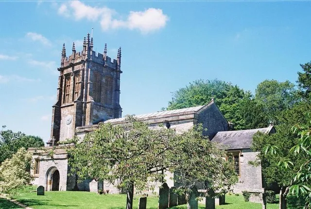
Charminster is a village and civil parish in west Dorset, England, situated on the River Cerne and A352 road 1 mile (1.6 km) north of the county town Dorchester. In the 2011 census the parish had a population of 2,940 and also contains the hamlet of Charlton Down.
The village name derives from the River Cerne and theRead more
small 'minster' church of St Mary, resulting in "Cerneminster" (recorded in 1223), which eventually evolved into Charminster. The village, which includes Wolfeton House, was the place of origin of Richard Norman and family, one of the Planters of the Massachusetts Bay Colony in America, who arrived there in ca. 1626. Scientist Margaret Bastock died in the village in 1982, aged 62.
Charminster was in the Charminster and Cerne Valley electoral ward, which stretches from the northern outskirts of Dorchester through Cerne Abbas to Minterne Magna. The total population of this ward at the 2011 census was 4,768.
After 2019 structural changes to local government in England, Charminster is part of the Charminster St Mary's ward for elections to Dorset Council.
Compare prices across Booking.com, Airbnb, Expedia, and more. Select your dates to see availability.
Pick your must-haves once: provider links open pre-filtered. Each filter lists which sites it applies to.
Compare before you book!
Prices can vary significantly between platforms. We recommend checking at least 2-3 sites to find the best deal for your stay in Charminster.
Discover famous landmarks, scenic roads, and more near Charminster.
Within an hour or so of Charminster: Maiden Castle (5 km), Cerne Abbas Giant (9 km), Chesil Beach (15 km), Durdle Door (17 km).
The nearest famous roads are Rhinefield Ornamental Drive, Cheddar Gorge Road (B3135) and Military Road, Isle of Wight.
Charminster is in England, United Kingdom, about 7 km from Puddletown.
Road trip
Add it as a stop and the planner works out the driving, the nights and what's worth seeing on the way.
Start planningSwipe through places to go
Places within a drive of Charminster. Keep the ones you like and add them to your trip.
Essential numbers in United Kingdom
112 also works. NHS non-emergency medical advice: 111. National Highways breakdown assistance on motorways: 0300 123 5000.
Full driving guide for United Kingdom8 notable places within an hour's drive.
ancient ruins
One of the largest Iron Age hillforts in Europe, its multiple ramparts enclosing an area the size of 50 football pitches.
5 km · about 10 min drive
landmark
A 55 m chalk hill figure of a club-wielding naked man above a Dorset village, now dated to the late Saxon period.
9 km · about 15 min drive
beach
An 18-mile shingle barrier beach enclosing the Fleet lagoon, its pebbles graded by size along its entire length.
15 km · about 30 min drive
natural wonder
Iconic natural limestone arch jutting into the sea on Dorset's Jurassic Coast, one of the most photographed landmarks in Britain.
17 km · about 20 min drive
natural wonder
A natural limestone arch and a near-perfect circular cove on the Jurassic Coast, linked by a clifftop path.
17 km · about 20 min drive
beach
A sheltered crescent of shingle immediately east of Durdle Door, enclosed by an offshore reef of eroded rock.
18 km · about 20 min drive
natural wonder
Almost perfectly circular cove formed by the sea eroding through Portland limestone, creating one of the world's finest examples of coastal geology.
19 km · about 20 min drive
natural wonder
A small collapsing cove beside Lulworth, showing the tightly folded Lulworth Crumple in its cliff face.
19 km · about 20 min drive
April to October
Other places to explore near Charminster.
Your trip starts here
Pick the days, drop in the stops, and share it with whoever's coming.