PYRTPlan Your Road Trips
Create TripCommunityMerchandise
PYRTPlan Your Road Trips
Create TripCommunityMerchandise
Điện Khuê Trung, Cẩm Lệ, Đà Nẵng
Ảnh chụp bên trong trường THCS - THPT Nguyễn Khuyến, Đà Nẵng. Khu vực giữa hai dãy phòng học.
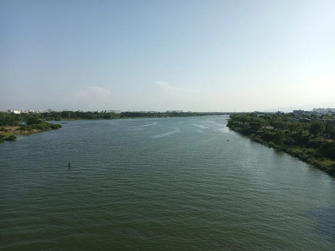
the Cầu Đỏ/Cẩm Lệ river seen from Nguyễn Tri Phương bridge
Photo by Linhcandng (thảo luận)
Destinations
Home›Destinations›Cẩm Lệ
AsiaVietnamDa Nang City

Cẩm Lệ

Da Nang City, Vietnam · Asia

About Cẩm Lệ

Cẩm Lệ works well as a base: 5 minutes from Hòa Cường, 7km from Marble Mountains.

Cẩm Lệ is in Da Nang City, Vietnam, with about 79,000 people. You drive on the right here. The nearest town is Hòa Cường, about 4 km away.

Cẩm Lệ is an urban district of Da Nang in the South Central Coast region of Vietnam.

Read more on Wikipedia

Where to Stay in Cẩm Lệ

Compare prices across Booking.com, Airbnb, Expedia, and more. Select your dates to see availability.

Filter presets

Pick your must-haves once: provider links open pre-filtered. Each filter lists which sites it applies to.

Booking.comExpediaTripAdvisorHotels.comAgodaAirbnb

Compare before you book!

Prices can vary significantly between platforms. We recommend checking at least 2-3 sites to find the best deal for your stay in Cẩm Lệ.

Explore the Area

Discover famous landmarks, scenic roads, and more near Cẩm Lệ.

Loading map...
Open in Google Maps

Frequently Asked Questions

What is there to see near Cẩm Lệ?

Within an hour or so of Cẩm Lệ: Dragon Bridge (Cau Rong) (5 km), My Khe Beach (6 km), Marble Mountains (7 km), Hai Van Pass (20 km).

Are there any good drives near Cẩm Lệ?

The nearest famous roads are Hai Van Pass.

Where is Cẩm Lệ?

Cẩm Lệ is in Da Nang City, Vietnam, about 4 km from Hòa Cường.

Road trip

Drive to Cẩm Lệ

Add it as a stop and the planner works out the driving, the nights and what's worth seeing on the way.

Start planning

What's nearby?

Swipe through places to go

Places within a drive of Cẩm Lệ. Keep the ones you like and add them to your trip.

Explore now

Quick Information

Population
78,837
Continent
Asia
Country
Vietnam
Region
Da Nang City
Timezone
Asia/Ho_Chi_Minh
Coordinates
16.0177, 108.2038

Emergency & Services

Essential numbers in Vietnam

Police
113
Ambulance
115
Fire
114
Driving side
right
Full driving guide for Vietnam

Tags

AsiaVietnamDa Nang CityTown

Worth the detour from Cẩm Lệ

8 notable places within an hour's drive.

bridge

Dragon Bridge (Cau Rong)

Da Nang's golden steel dragon arches 666 m across the Han River and breathes real fire and water on weekend nights: one of Vietnam's most theatrical drives.

5 km · about 10 min drive

beach

My Khe Beach

A long stretch of white sand along Da Nang's coastline, consistently ranked among Asia's most beautiful urban beaches.

6 km · about 10 min drive

natural wonder

Marble Mountains

Five limestone and marble hills south of Da Nang containing caves, tunnels, and Buddhist sanctuaries with panoramic coastal views.

7 km · about 10 min drive

famous road

Hai Van Pass

A stunning 21-kilometer mountain pass on Vietnam's central coast rising 500 meters above the South China Sea.

20 km · about 25 min drive

landmark

Hoi An Ancient Town

A beautifully preserved 15th-century trading port illuminated at night by hundreds of colorful silk lanterns along its atmospheric streets.

21 km · about 25 min drive

landmark

Golden Bridge (Cau Vang)

A pedestrian bridge held up by giant stone hands emerging from the mountainside above Da Nang, offering sweeping valley views.

22 km · about 25 min drive

bridge

Golden Bridge, Bà Nà Hills

150-metre pedestrian bridge held by two giant stone hands at 1,400 metres above Da Nang, reached by cable car.

22 km · about 25 min drive

tunnel

Hai Van Tunnel

At 6.28 km the longest road tunnel in Southeast Asia, burrowing beneath the Hai Van Pass to link Hue and Da Nang. Take it one way and drive the historic pass the other.

26 km · about 30 min drive

Driving roads near Cẩm Lệ

  • Right hereDragon Bridge (Cau Rong)Da Nang's golden steel dragon arches 666 m across the Han River and breathes real fire and water on weekend nights: one of Vietnam's most theatrical drives.
  • 20 kmHai Van PassA stunning 21-kilometer mountain pass on Vietnam's central coast rising 500 meters above the South China Sea.
  • 22 kmGolden Bridge, Bà Nà Hills150-metre pedestrian bridge held by two giant stone hands at 1,400 metres above Da Nang, reached by cable car.
  • 26 kmHai Van TunnelAt 6.28 km the longest road tunnel in Southeast Asia, burrowing beneath the Hai Van Pass to link Hue and Da Nang. Take it one way and drive the historic pass the other.

When to drive here

Year-round

Tropical latitude: plan around the wet season rather than temperature.

Nearby Destinations

Other places to explore near Cẩm Lệ.

Hòa Cường

🇻🇳 Vietnam

4 km awayPop. 119,363

Sơn Trà

🇻🇳 Vietnam

6 km awayPop. 86,890

Da Nang

🇻🇳 Vietnam

6 km awayPop. 1,276,000

Thanh Khê

🇻🇳 Vietnam

6 km awayPop. 201,240

An Hải

🇻🇳 Vietnam

6 km awayPop. 82,635

Hải Châu

🇻🇳 Vietnam

14 km awayPop. 131,427

Điện Bàn

🇻🇳 Vietnam

15 km awayPop. 226,564

Đại Lộc

🇻🇳 Vietnam

17 km awayPop. 16,215

Plan a trip around Cẩm Lệ

Asia road trip planner

Your trip starts here

Plan a road trip from Cẩm Lệ.

Pick the days, drop in the stops, and share it with whoever's coming.

Start planning
PYRT

The ultimate road trip planning platform. Discover 150,000+ destinations worldwide, plan scenic routes, and create unforgettable adventures.

Inspiration

  • Discover Trips
  • Travel Guides
  • Community

The Product

  • Calendar Planner
  • Integrations
  • How It Works
  • Collaboration Mode
  • Get the App
  • Merchandise: PYRT Supply Co.
  • Become a Creator
  • Trip Marketplace

Plan Your Trip

  • Road Trip Planner
  • Famous Routes
  • Drive Times & Distances
  • Planners by Country
  • Best Road Trip Planner App
  • Discover Road Trips
  • Events
  • Travel Guides
  • How It Works
  • My Trips
  • Community Groups

Company

  • Terms of Service
  • Privacy Policy
  • About PYRT
  • Support
  • Contact Us
  • Sign In
  • Create Account

© 2026 Plan Your Road Trips. All rights reserved.

•[email protected]
Data sources:GeoNames (CC BY 4.0)•Wikimedia Commons (CC BY-SA)•Mapbox•Photography: George Lawrence