PYRTPlan Your Road Trips
Create TripCommunityMerchandise
PYRTPlan Your Road Trips
Create TripCommunityMerchandise
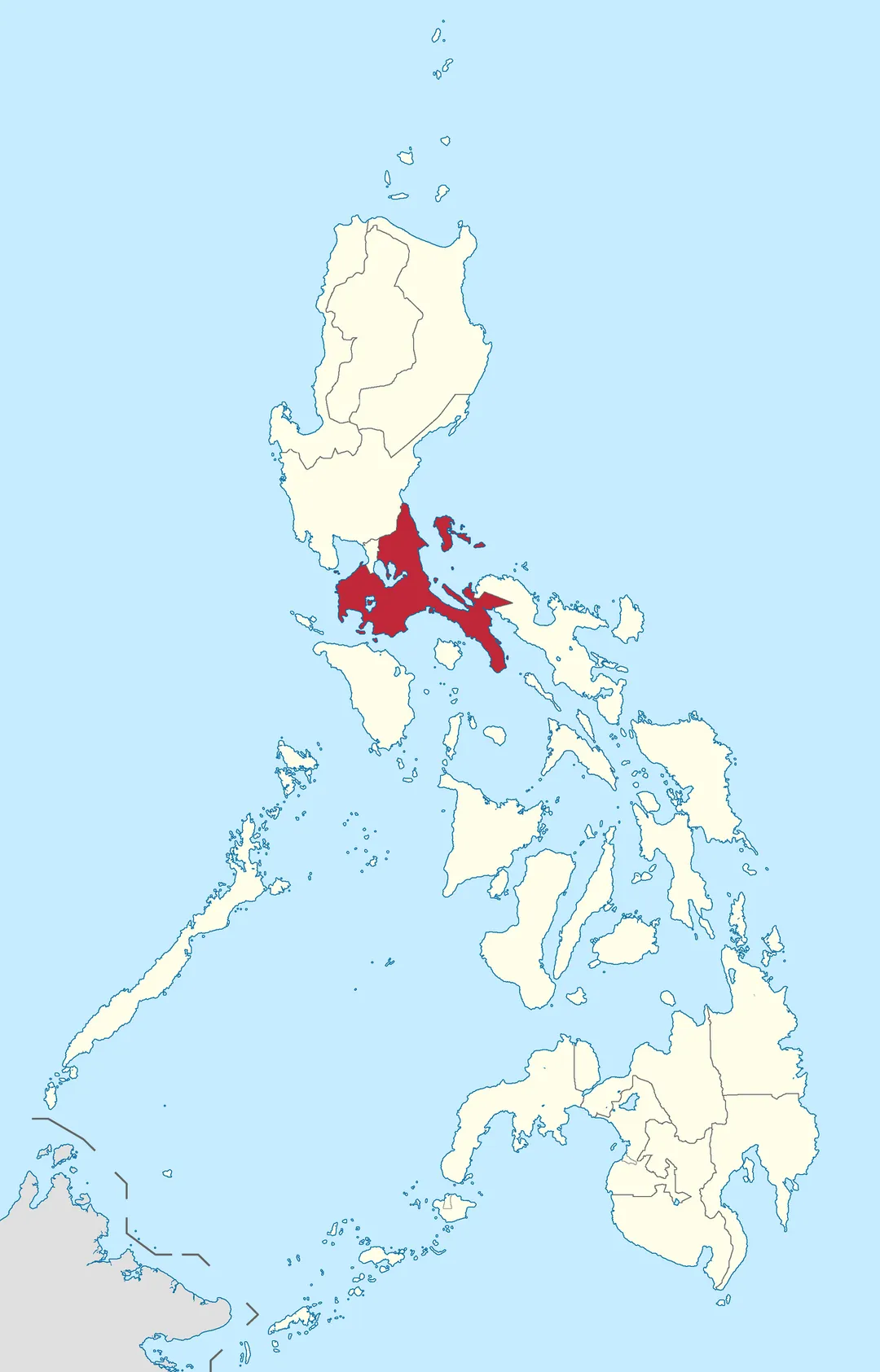
Location of CALABARZON in the Philippines.
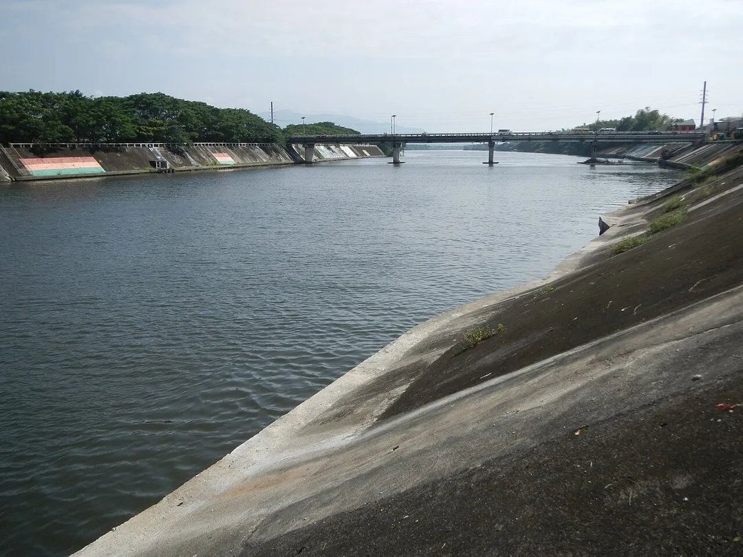
Upload Wizard -- (general description of landmarkds, town, church) -  of - Calumpang River[1] P. Herrera St., Rizal Avenue, Poblacion, [2] Batangas City[3] located in Brgy. Cuta, Malitam, and Wawa, Batangas City - View of the Calumpang River from the Calumpang Bridge.
Marcos Highway (Pugo, La Union section) Marcos Highway (Cares and Palina, Pugo, La Union section) Pugo (Cares) Central National High School Cares Bridge K0 251+422 Tapuakan River from Pugo (Cares-Poblacion-Duplas) Intersection (Pugo-Rosario Road & Agoo-Baguio City Road) of Marcos Highway K0250+556 P 11.548 Pugo-Bangalabang Provincial Road KM 286.380 - KM 291.630 5.25 kms. Category:Sitios and puroks of the Philippines Subdivisions of the Philippines List of barangays in La Union La Union province Barangays Cares, Pugo, La Union 16.3182, 120.4809 Palina, Pugo, La Union 16.3681, 120.4751 Pugo, La Union bounded by  Category:Sitios and puroks of the Philippines Subdivisions of the Philippines List of barangays in La Union Barangay Ambangonan, Rosario, La Union 16.2984, 120.4702 Rosario, La Union, La Union province bounded by Category:Sitios and puroks of the Philippines Subdivisions of the Philippines List of barangays in Benguet Barangay Tabaan Norte, Pugo, La Union 16.3254, 120.5202 Tuba, Benguet surrounded by Cordillera Central (Luzon) to Aspiras–Palispis Highway still referred to as Marcos Highway or Agoo–Baguio Road Cordillera Administrative Region served by Bued River Basin  Tapuacan River and Bued River River valleys to  Kennon Road roadway to  Pugo–Rosario Road to North Luzon Expressway MacArthur Highway (Rosario, La Union section) of the MacArthur Highway or Manila North Road) Philippine highway network (Note: Judge Florentino Floro, the owner, to repeat, Donor Florentino Floro of all these photos hereby donate gratuitously, freely and unconditionally Judge Floro all these photos to and for Wikimedia Commons, exclusively, for public use of the public domain, and again without any condition whatsoever).
Photo by Roel Balingit
Destinations
Home›Destinations›Calumpang
AsiaPhilippinesNational Capital Region

Calumpang

National Capital Region, Philippines · Asia

About Calumpang

Calumpang is worth a stop: 5 minutes from Antipolo, 25km from Masungi Georeserve.

Calumpang is in National Capital Region, Philippines, with about 16,000 people. You drive on the right here. The nearest town is Antipolo, about 4 km away.

Where to Stay in Calumpang

Compare prices across Booking.com, Airbnb, Expedia, and more. Select your dates to see availability.

Filter presets

Pick your must-haves once: provider links open pre-filtered. Each filter lists which sites it applies to.

Booking.comExpediaTripAdvisorHotels.comAgodaAirbnb

Compare before you book!

Prices can vary significantly between platforms. We recommend checking at least 2-3 sites to find the best deal for your stay in Calumpang.

Explore the Area

Discover famous landmarks, scenic roads, and more near Calumpang.

Loading map...
Open in Google Maps

Frequently Asked Questions

What is there to see near Calumpang?

Within an hour or so of Calumpang: National Museum of the Philippines (13 km), Intramuros (Manila) (13 km), Masungi Georeserve (25 km), Enchanted Kingdom (38 km).

Where is Calumpang?

Calumpang is in National Capital Region, Philippines, about 4 km from Antipolo.

Road trip

Drive to Calumpang

Add it as a stop and the planner works out the driving, the nights and what's worth seeing on the way.

Start planning

What's nearby?

Swipe through places to go

Places within a drive of Calumpang. Keep the ones you like and add them to your trip.

Explore now

Quick Information

Population
15,602
Continent
Asia
Country
Philippines
Region
National Capital Region
Timezone
Asia/Manila
Coordinates
14.6228, 121.0897

Emergency & Services

Essential numbers in Philippines

Police
911
Ambulance
911
Fire
911
Driving side
right
Full driving guide for Philippines

Tags

AsiaPhilippinesNational Capital RegionTown

Worth the detour from Calumpang

5 notable places within an hour's drive.

museum

National Museum of the Philippines

Houses the Philippines' most important cultural treasures including the Spoliarium and pre-colonial gold artifacts.

13 km · about 25 min drive

landmark

Intramuros (Manila)

The historic walled city of Manila built during the Spanish colonial period, containing Fort Santiago and San Agustin Church.

13 km · about 25 min drive

natural wonder

Masungi Georeserve

A conservation area in the Rizal karst where rope courses, hanging bridges and a steel spiderweb platform thread between 60-million-year-old limestone spires. Entry is by booked guided trail only.

25 km · about 30 min drive

landmark

Enchanted Kingdom

The Philippines' first and only world-class theme park in Santa Rosa, Laguna with seven themed zones.

38 km · about 45 min drive

natural wonder

Tinipak River

A river below Mount Daraitan running over bone-white marble boulders into deep blue pools, a few hours from Manila by road then a short trek from Daraitan village. Registration is at the barangay hall.

38 km · about 45 min drive

When to drive here

Year-round

Tropical latitude: plan around the wet season rather than temperature.

Nearby Destinations

Other places to explore near Calumpang.

Antipolo

🇵🇭 Philippines

4 km awayPop. 913,712

Marikina City

🇵🇭 Philippines

4 km awayPop. 471,323

Pasig City

🇵🇭 Philippines

5 km awayPop. 853,050

Quezon City

🇵🇭 Philippines

5 km awayPop. 3,084,270

Mariana

🇵🇭 Philippines

6 km awayPop. 11,967

Cainta

🇵🇭 Philippines

6 km awayPop. 283,172

San Juan

🇵🇭 Philippines

7 km awayPop. 134,312

Project 6

🇵🇭 Philippines

7 km awayPop. 12,595

Plan a trip around Calumpang

Asia road trip planner

Your trip starts here

Plan a road trip from Calumpang.

Pick the days, drop in the stops, and share it with whoever's coming.

Start planning
PYRT

The ultimate road trip planning platform. Discover 150,000+ destinations worldwide, plan scenic routes, and create unforgettable adventures.

Inspiration

  • Discover Trips
  • Travel Guides
  • Community

The Product

  • Calendar Planner
  • Integrations
  • How It Works
  • Collaboration Mode
  • Get the App
  • Merchandise: PYRT Supply Co.
  • Become a Creator
  • Trip Marketplace

Plan Your Trip

  • Road Trip Planner
  • Famous Routes
  • Drive Times & Distances
  • Planners by Country
  • Best Road Trip Planner App
  • Discover Road Trips
  • Events
  • Travel Guides
  • How It Works
  • My Trips
  • Community Groups

Company

  • Terms of Service
  • Privacy Policy
  • About PYRT
  • Support
  • Contact Us
  • Sign In
  • Create Account

© 2026 Plan Your Road Trips. All rights reserved.

•[email protected]
Data sources:GeoNames (CC BY 4.0)•Wikimedia Commons (CC BY-SA)•Mapbox•Photography: George Lawrence