beach
Newborough Warren and Llanddwyn Beach
A vast dune forest and beach on Anglesey with a red squirrel population and the finest view of Snowdonia across the strait.
8 km · about 15 min drive
Wales, United Kingdom · Europe
Caernarfon works well as a base: 10 minutes from Llanwnda, 10km from Llyn Padarn.
Caernarfon is in Wales, United Kingdom, with about 9,700 people. You drive on the left here. The nearest town is Llanwnda, about 4 km away.
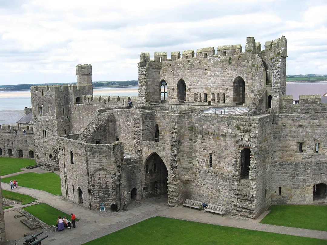
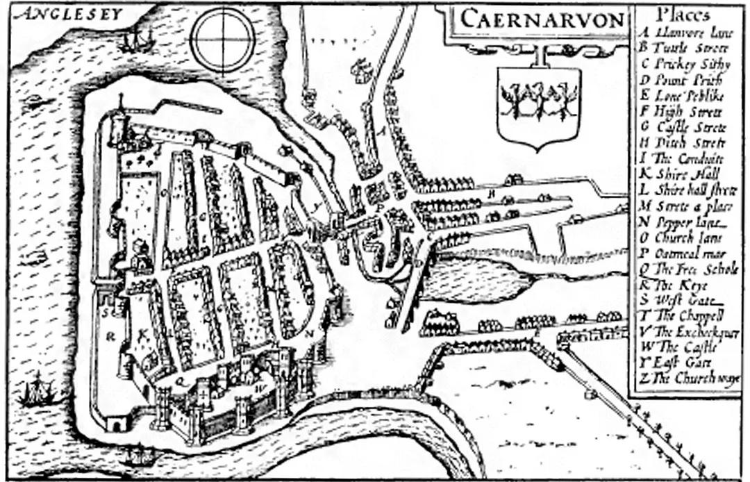
Caernarfon ( ; Welsh: [kaɨrˈnarvɔn] ) is a royal town, community and port, in Gwynedd, Wales. The community (which includes Caeathro) has a population of 9,852. It lies along the A4871 road, on the eastern shore of the Menai Strait, opposite the island of Anglesey. Bangor is 9 miles (14 km) to the north-east,Read more
Porthmadog is 20 miles (32 km) southeast and Holyhead is 29 miles (47 km) northwest, via the Britannia Bridge. Snowdonia (Eryri) is located to the east and south-east of the town. The town is the historic county town of Caernarfonshire.
Abundant natural resources in and around the Menai Strait enabled human habitation in prehistoric Britain. The Ordovices, a Celtic tribe, lived in the region during the period known as Roman Britain. The Roman fort Segontium was established around AD 80 to subjugate the Ordovices during the Roman conquest of Britain. The Romans occupied the region until the end of Roman rule in Britain in 382, after which Caernarfon became part of the Kingdom of Gwynedd. In the late 11th century, William the Conqueror ordered the construction of a motte-and-bailey castle at Caernarfon as part of the Norman invasion of Wales. He was unsuccessful, and Wales remained independent until around 1283.
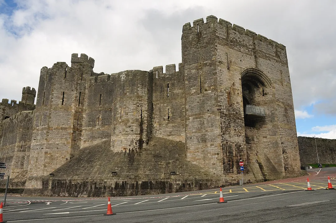
In the 13th century, Llywelyn ap Gruffudd, ruler of Gwynedd, refused to pay homage to Edward I of England, prompting the English conquest of Gwynedd. This was followed by the construction of Caernarfon Castle, one of the largest and most imposing fortifications built by the English in Wales. In 1284, the English-style county of Caernarfonshire was established by the Statute of Rhuddlan; the same year, Caernarfon was made a borough, a county and market town, and the seat of English government in north Wales.
The ascent of the Welsh House of Tudor to the throne of England eased hostilities with the English and resulted in Caernarfon Castle falling into a state of disrepair. The town has flourished, leading to its status as a major tourist centre and seat of Gwynedd Council, with a thriving harbour and marina. Caernarfon has expanded beyond its medieval walls and experienced heavy suburbanisation. The community of Caernarfon's population includes the highest percentage of Welsh-speaking citizens anywhere in Wales. The status of Royal Borough was granted by Queen Elizabeth II in 1963 and amended to Royal Town in 1974. The castle and town walls are part of a World Heritage Site described as the Castles and Town Walls of King Edward in Gwynedd.
Compare prices across Booking.com, Airbnb, Expedia, and more. Select your dates to see availability.
Pick your must-haves once: provider links open pre-filtered. Each filter lists which sites it applies to.
Compare before you book!
Prices can vary significantly between platforms. We recommend checking at least 2-3 sites to find the best deal for your stay in Caernarfon.
Discover famous landmarks, scenic roads, and more near Caernarfon.
Within an hour or so of Caernarfon: Newborough Warren and Llanddwyn Beach (8 km), Ynys Llanddwyn (10 km), Llyn Padarn (10 km), Anglesey (11 km).
The nearest famous roads are A4085 Beddgelert to Caernarfon, Llanberis Pass and A5 Betws-y-Coed to Bangor (Telford's Holyhead Road).
Caernarfon is in Wales, United Kingdom, about 4 km from Llanwnda.
Road trip
Add it as a stop and the planner works out the driving, the nights and what's worth seeing on the way.
Start planningSwipe through places to go
Places within a drive of Caernarfon. Keep the ones you like and add them to your trip.
Essential numbers in United Kingdom
112 also works. NHS non-emergency medical advice: 111. National Highways breakdown assistance on motorways: 0300 123 5000.
Full driving guide for United Kingdom8 notable places within an hour's drive.
beach
A vast dune forest and beach on Anglesey with a red squirrel population and the finest view of Snowdonia across the strait.
8 km · about 15 min drive
photogenic
Tidal island off Anglesey with the whitewashed Tŵr Mawr lighthouse, ruined chapel of the Welsh patron saint of lovers, and Snowdonia filling the horizon across the strait. Walk from Newborough beach car park.
10 km · about 20 min drive
natural wonder
A two-mile glacial lake at Llanberis beneath Snowdon, with the Lon Las Peris path, the lone tree at Elidir and the Llanberis Lake Railway along its shore.
10 km · about 20 min drive
landmark
Island off northwest Wales connected by two bridges, rich in Neolithic sites, dramatic coastal paths and the famous long-named village of Llanfairpwll.
11 km · about 20 min drive
museum
Fascinating museum in a former quarry workshop at the foot of Snowdon, telling the story of the Welsh slate industry that roofed the world.
11 km · about 20 min drive
bridge
Thomas Telford's pioneering 1826 suspension bridge over the swirling Menai Strait, the historic road gateway to Anglesey and one of the world's first great suspension bridges.
11 km · about 20 min drive
famous road
A flowing Snowdonia road past Llyn Cwellyn beneath Mynydd Mawr, quieter than the Llanberis Pass and just as scenic.
11 km · about 20 min drive
natural wonder
The smaller of the two Llanberis lakes, a reservoir for the Dinorwig pumped-storage power station, framed by the terraced slate quarries above.
11 km · about 20 min drive
8 named roads, passes and coastal drives within 60km.
April to October
Other places to explore near Caernarfon.
Your trip starts here
Pick the days, drop in the stops, and share it with whoever's coming.